


![Request for Information – Potential [Placeholder for Prize]](https://assets.science.nasa.gov/dynamicimage/assets/science/psd/solar/2023/09/s/solarsystem_0.jpg?w=1024)


- April 21, 2006 (5.77 MB)
- March 27, 2006 (5.15 MB)
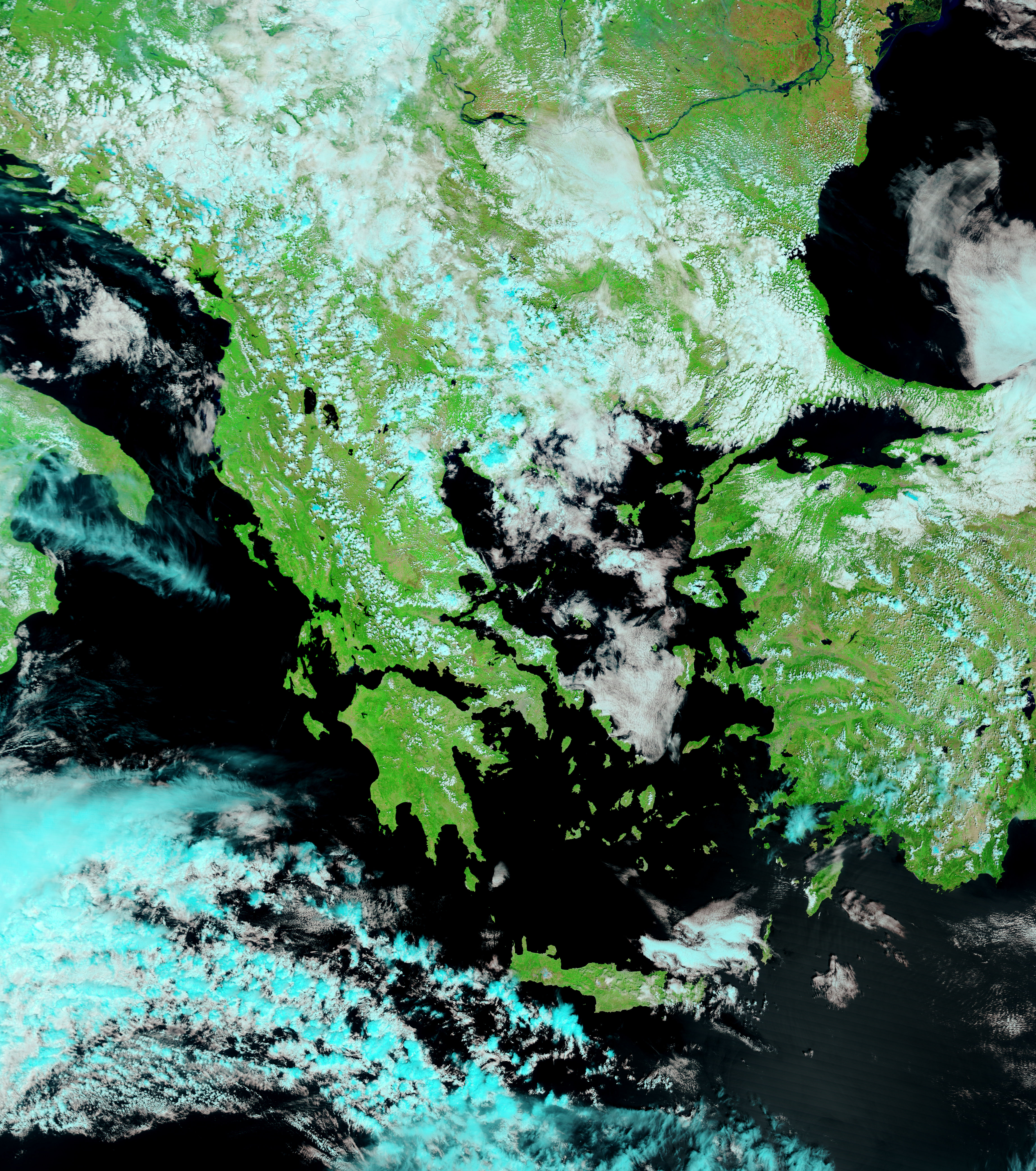
Southwestern Romania was one of the regions hardest hit when the Danube River burst its banks in the spring of 2006. Heavy rain and melting snow pushed the river to record-high levels in many regions. By April 21, approximately 4,000 people had still not been able to return to their homes in Rast, reported Reuters. The Romanian village was evacuated on April 17 when water surging through a broken dike threatened the region. The resulting flood was still clearly visible when the Moderate Resolution Imaging Spectroradiometer (MODIS) on NASA’s Terra satellite captured this image on the morning of April 21, 2006. Water, black in this false-color image, covers a kilometers-wide region along the Danube’s northern bank. Rast is located along the northern edge of the flooded region.
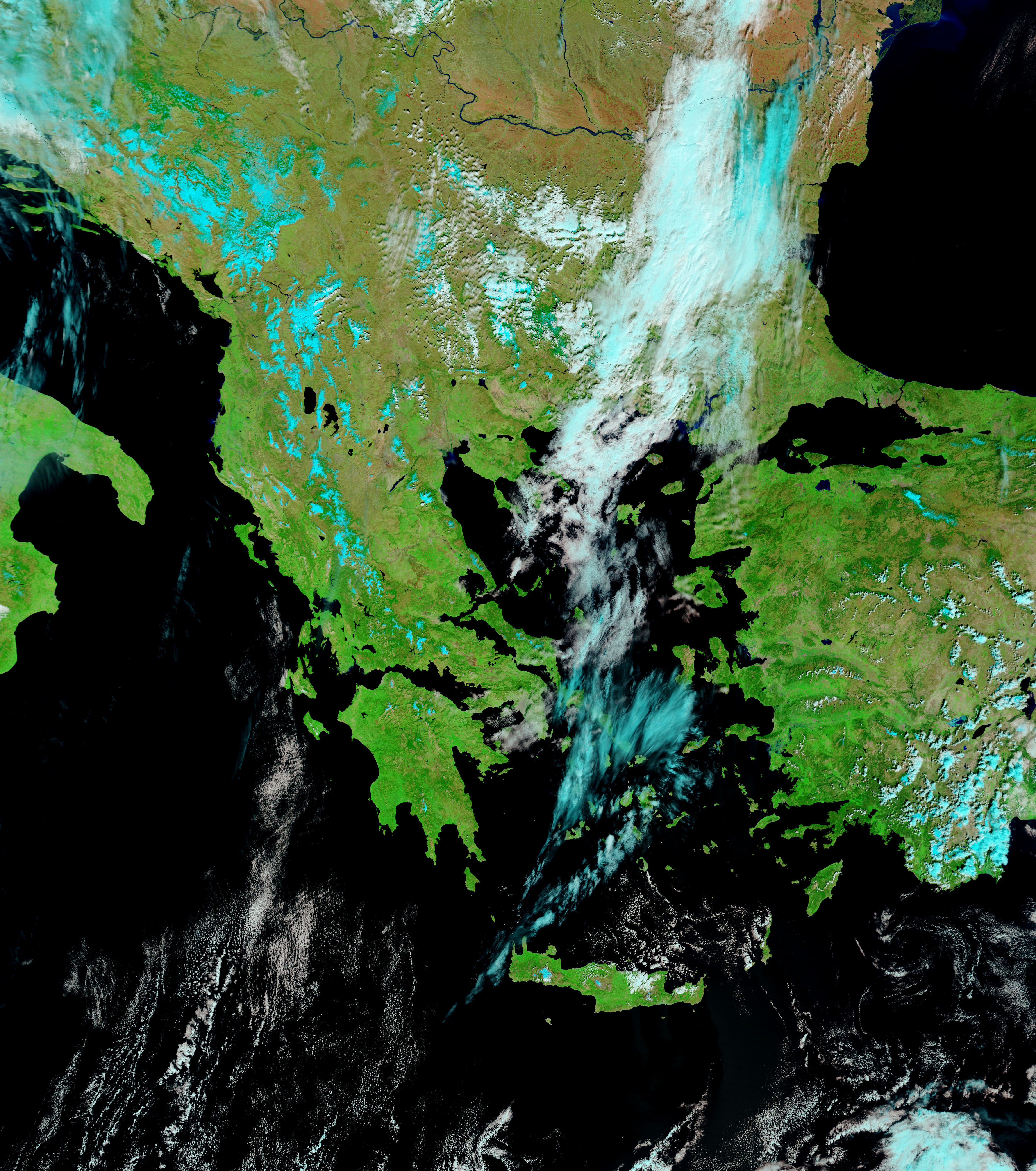
The lower image, taken on March 27, shows the river under normal conditions. In both images, clouds are pale blue and white, vegetation is green, and bare earth is pink and tan. Fires have been outlined in red. Both images are shown at 250 meters per pixel, MODIS’ maximum resolution. Daily images of the floods are available from the MODIS Rapid Response Team in a variety of resolutions.
References & Resources
NASA images courtesy the MODIS Rapid Response Team at NASA GSFC.


