

May 10, 2012
Floods in Kenya
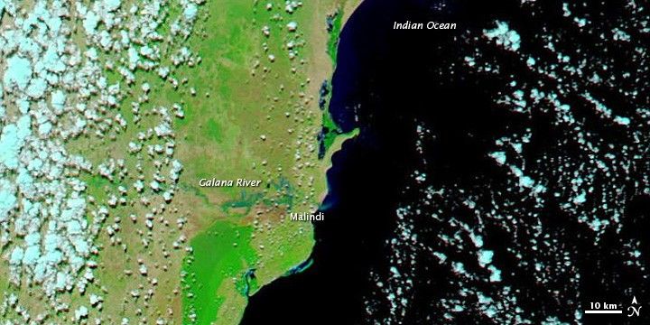
Floods isolated schools and villages in southeastern Kenya in early May 2012. The Galana River (or Sabaki River) broke its banks and changed course, news reports said. Roughly 2,000 students were cut off from their schools, and more than 3,000 families were affected by the flooding in the region around Malindi.
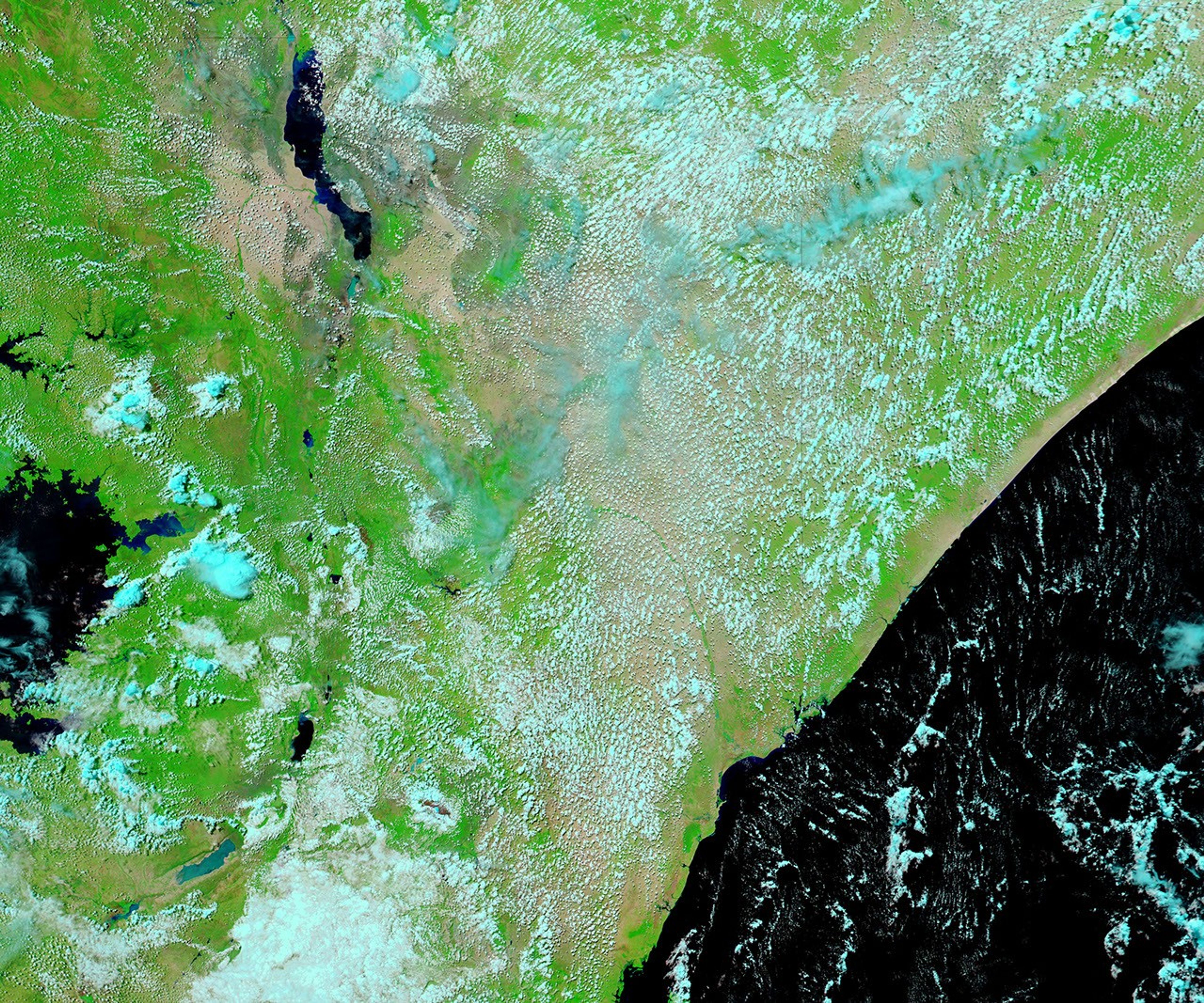
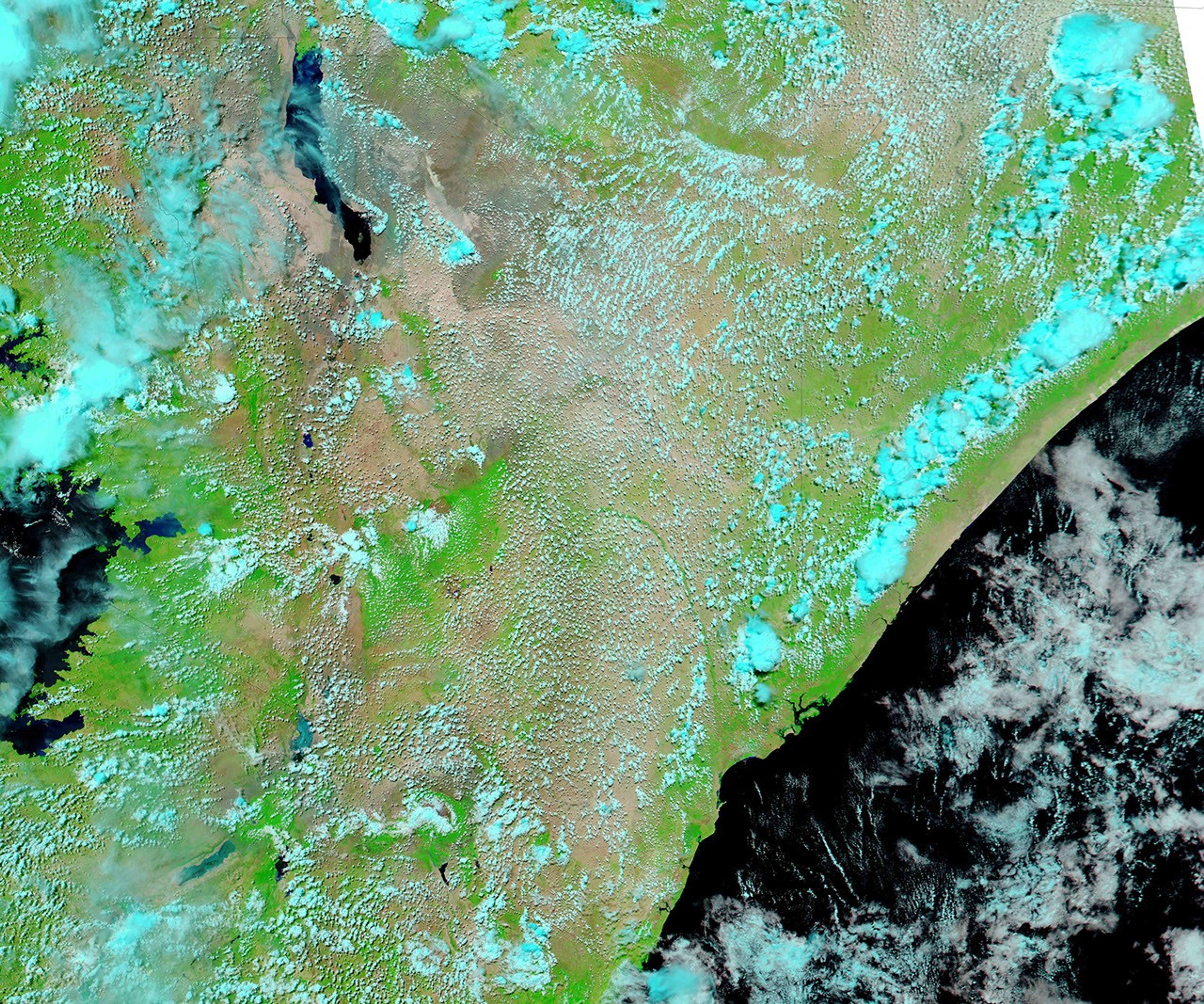
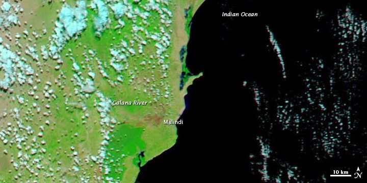
The Moderate Resolution Imaging Spectroradiometer (MODIS) on NASA’s Aqua satellite captured the top image on May 10, 2012. For comparison, the bottom image shows the same region on May 9, 2009. These images use a combination of visible and infrared light to better distinguish between water and land. Water varies from electric blue to navy. Vegetation is bright green and bare ground is earth-toned. Clouds are pale blue-green and cast shadows.
Emptying into the Indian Ocean just north of Malindi, the Galana River appears electric blue in the image from 2012. In places, water spans kilometers. The same river is not discernible in the image from 2009.
A Nairobi-based newspaper, The Star, reported severe flooding elsewhere in Kenya. In Murang’a, northeast of Nairobi, heavy rains forced evacuations and destroyed crops.
References & Resources
- Chao, S. (2012, May 9) Boy saves villagers from killer floods. Daily Nation. Accessed May 10, 2012.
- Gari A. (2012, May 9) Kenya: Magarini floods lock out 2,000 pupils from school.The Star. Accessed May 10, 2012.
- Mwangi, J. (2012, May 9) Kenya: Murang’a farmers lose as floods sweep crops. The Star. Accessed May 10, 2012.
NASA images courtesy LANCE MODIS Rapid Response Team at NASA GSFC. Caption by Michon Scott.