Suggested Searches

2 min read

Floods in Northwestern Tunisia

Instruments:
February 28, 2012
February 19, 2012
Images from February 19 and February 28 document rising water levels in northwestern Tunisia and northeastern Algeria.
NASA image courtesy LANCE/EOSDIS MODIS Rapid Response Team at NASA GSFC. Caption by Michon Scott.
Images from February 19 and February 28 document rising water levels in northwestern Tunisia and northeastern Algeria.
NASA image courtesy LANCE/EOSDIS MODIS Rapid Response Team at NASA GSFC. Caption by Michon Scott.
Images from February 19 and February 28 document rising water levels in northwestern Tunisia and northeastern Algeria.
NASA image courtesy LANCE/EOSDIS MODIS Rapid Response Team at NASA GSFC. Caption by Michon Scott.
Images from February 19 and February 28 document rising water levels in northwestern Tunisia and northeastern Algeria.
NASA image courtesy LANCE/EOSDIS MODIS Rapid Response Team at NASA GSFC. Caption by Michon Scott.
February 28, 2012
February 19, 2012

February 28, 2012

Floods in Northwestern Tunisia

Images from February 19 and February 28 document rising water levels in northwestern Tunisia and northeastern Algeria.
Floods in Northwestern Tunisia
Images from February 19 and February 28 document rising water levels in northwestern Tunisia and northeastern Algeria.
NASA image courtesy LANCE/EOSDIS MODIS Rapid Response Team at NASA GSFC. Caption by Michon Scott.
Floods in Northwestern Tunisia
Images from February 19 and February 28 document rising water levels in northwestern Tunisia and northeastern Algeria.
NASA image courtesy LANCE/EOSDIS MODIS Rapid Response Team at NASA GSFC. Caption by Michon Scott.

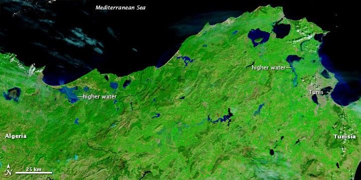
A combination of melting snow, overflowing rivers, and heavy rains flooded parts of northwestern Tunisia in late February 2012. The Tunisian Army evacuated residents of multiple towns in the region of Tunis, according to Tunisia Live. Flood waters reached rooftops in some areas, and at least one vehicle was swept away by fast-moving water. As of February 23, at least two people were confirmed dead, and one person had been reported missing.

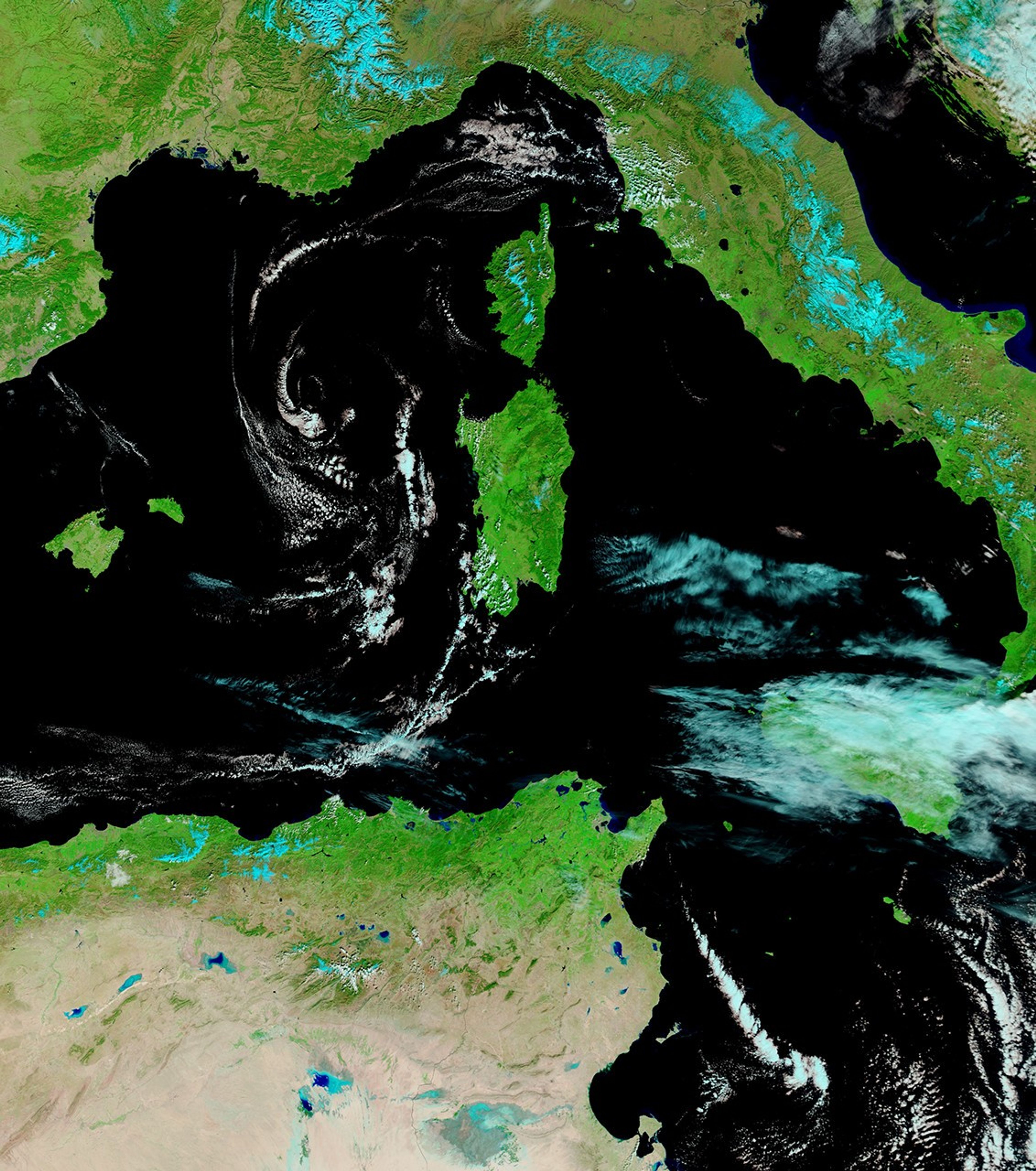
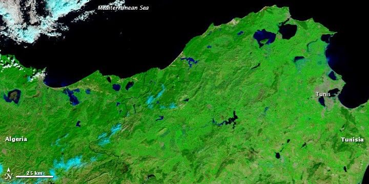
The Moderate Resolution Imaging Spectroradiometer (MODIS) on NASA’s Terra satellite captured the top image on February 28, 2012. For comparison, the bottom image shows the same region on February 19, 2012. Both images use a combination of visible and infrared light to better distinguish between water and land. Water is blue. Vegetation is bright green. Bare ground and urban areas are earth-toned. Clouds are pale blue-green.

These images show the coastal region of northwestern Tunisia and northeastern Algeria. Multiple water bodies appear enlarged on February 28, and two lakes—one near the city of Tunis and the other west of the Tunisia-Algeria border—are clearly higher. The electric blue of the Algerian lake suggests the presence of sediment, perhaps carried there by flood waters.

References & Resources

NASA image courtesy LANCE/EOSDIS MODIS Rapid Response Team at NASA GSFC. Caption by Michon Scott.

You may also be interested in:

Stay up-to-date with the latest content from NASA as we explore the universe and discover more about our home planet.

Iraq Reservoirs Plunge to Low Levels
5 min read

A multi-year drought has put extra strain on farmers and water managers in the Middle Eastern country.

Article
Reservoirs Dwindle in South Texas
3 min read

Drought in the Nueces River basin is reducing reservoir levels, leaving residents and industry in the Corpus Christi area facing…

Article
Cooper Creek Replenishes Lake Eyre
3 min read

Another major tributary reached the Australian outback lake in 2025, extending the months-long flood of the vast, ephemeral inland sea.

Article