


- January 23, 2007 (2.1 MB)
- January 16, 2007 (3.1 MB)
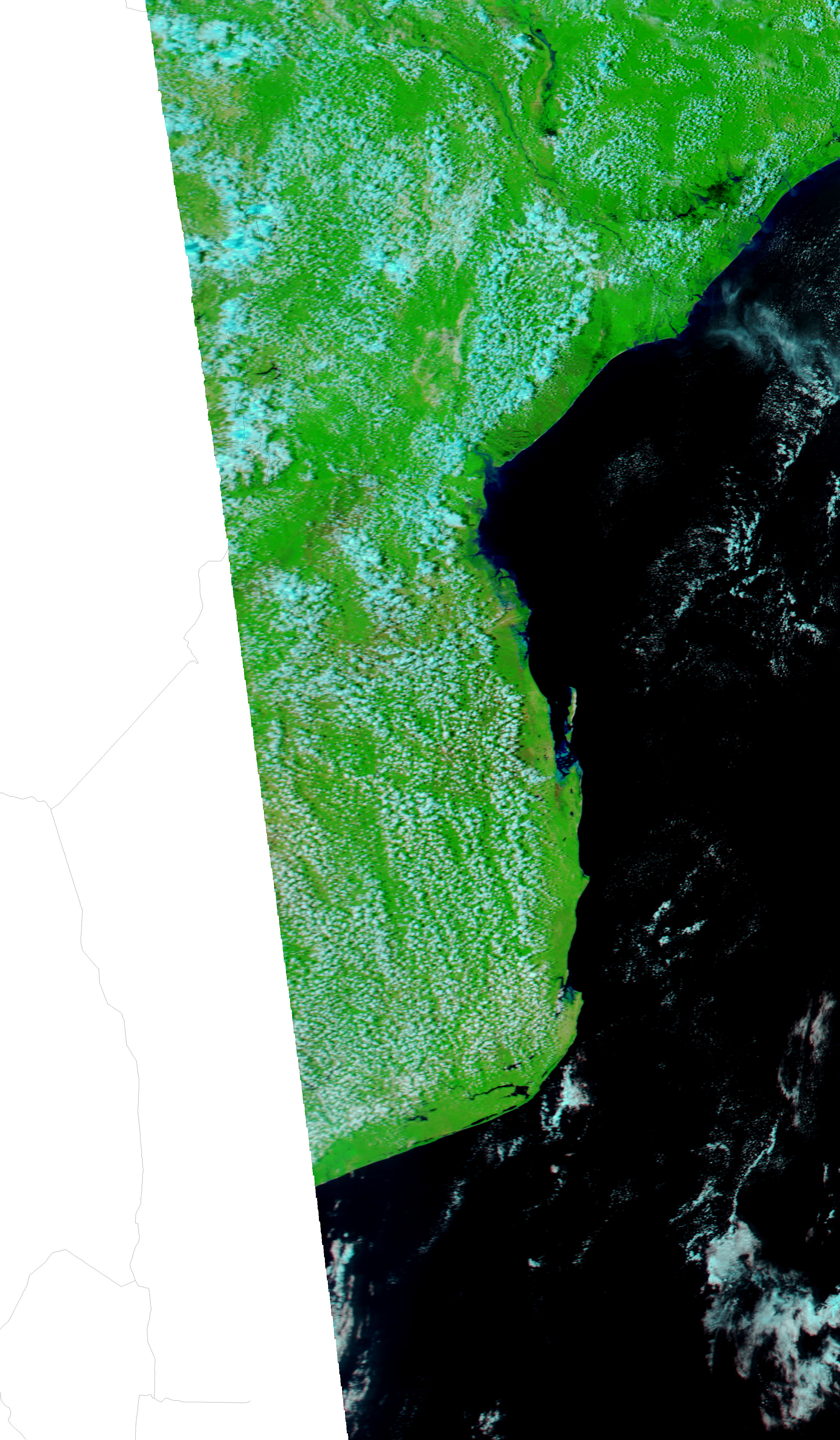
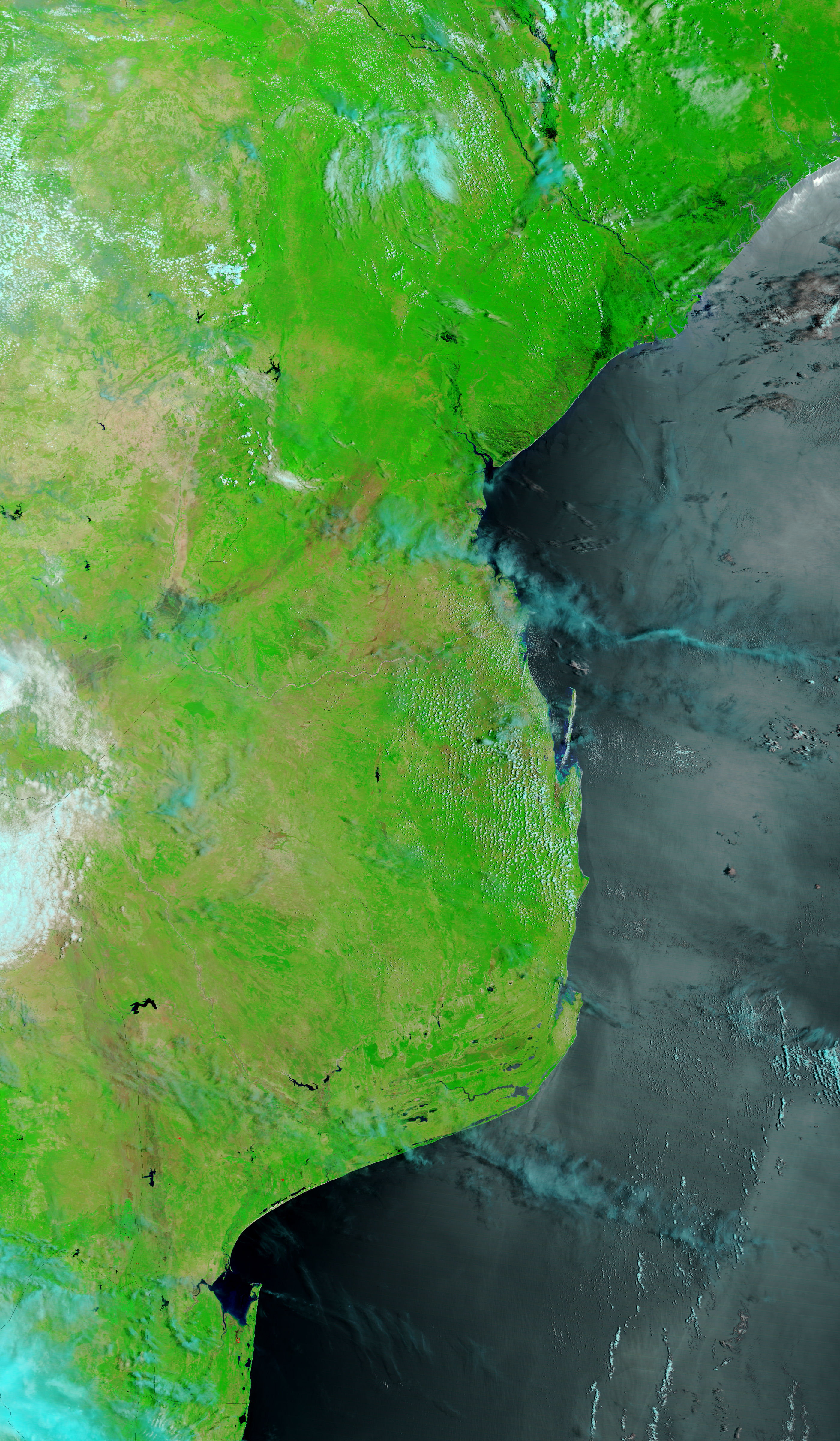
Widespread floods were evident in central Mozambique when the Moderate Resolution Imaging Spectroradiometer (MODIS) on NASA’s Aqua satellite captured the top image on January 23, 2007. Water, black against the bright green vegetation in these infrared-enhanced images, spreads in a wide line parallel to the coast. A week earlier, when MODIS on the Terra satellite acquired the lower image, the water was isolated to the wetlands around the river.
According to local news reports, parts of the provincial capital, Quelimane, were under water after 339.2 millimeters of rain fell in 24 hours on January 21, more rain than the region typically receives during the entire month of January. The floods forced at least 400 families from their homes in the city. Though Quelimane was visible on January 16 as a pale brown-gray patch on the north bank of the river, it was covered by clouds on January 23. The clouds are pale blue and white in these false-color images. The silvery color of the Indian Ocean in the lower image is caused by sunlight reflecting off the water’s surface. Daily images of Mozambique are available from the MODIS Rapid Response System.
References & Resources
NASA image courtesy the MODIS Rapid Response Team at NASA GSFC.


