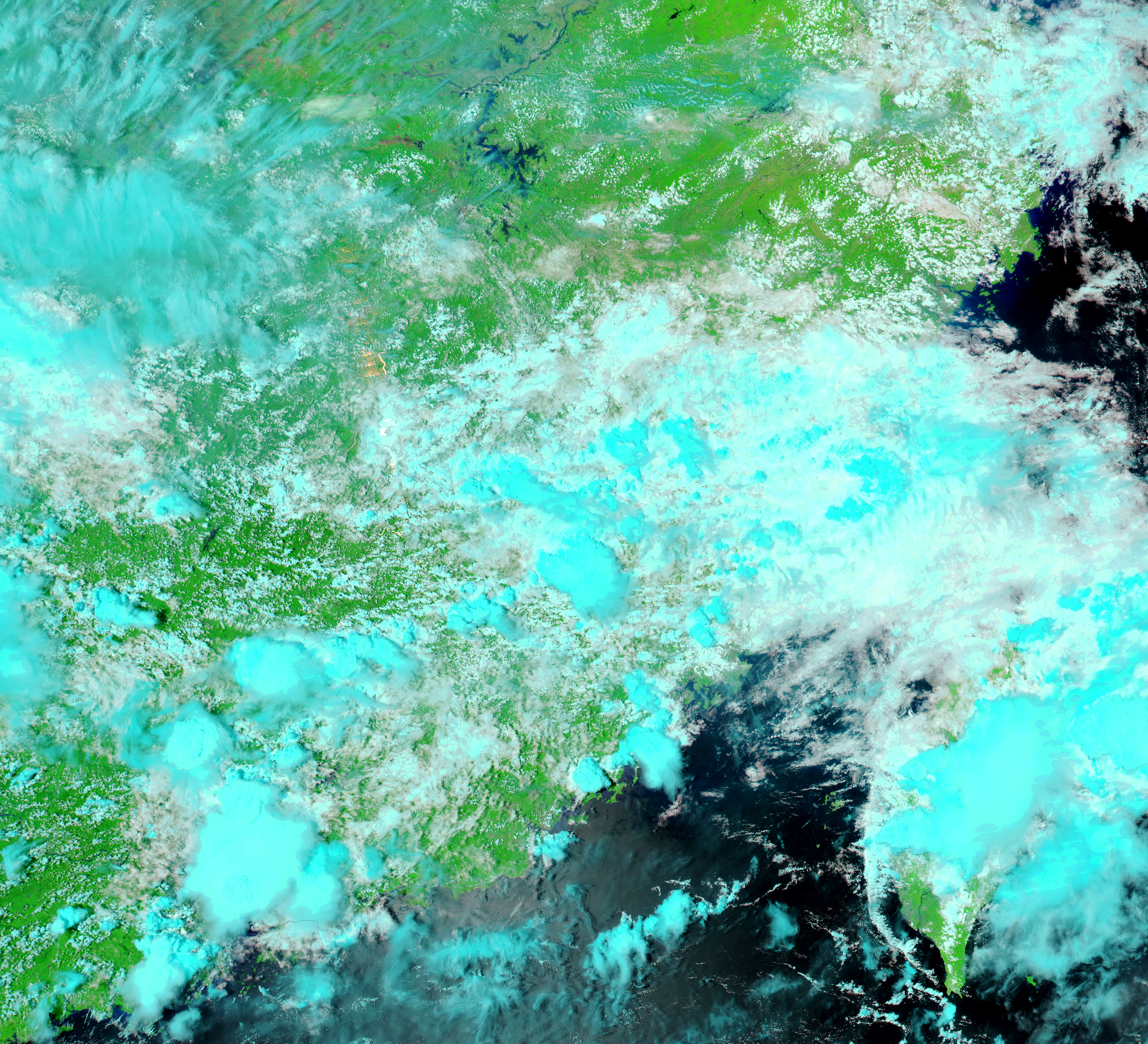



























- June 6, 2007 (4.4 MB JPG)
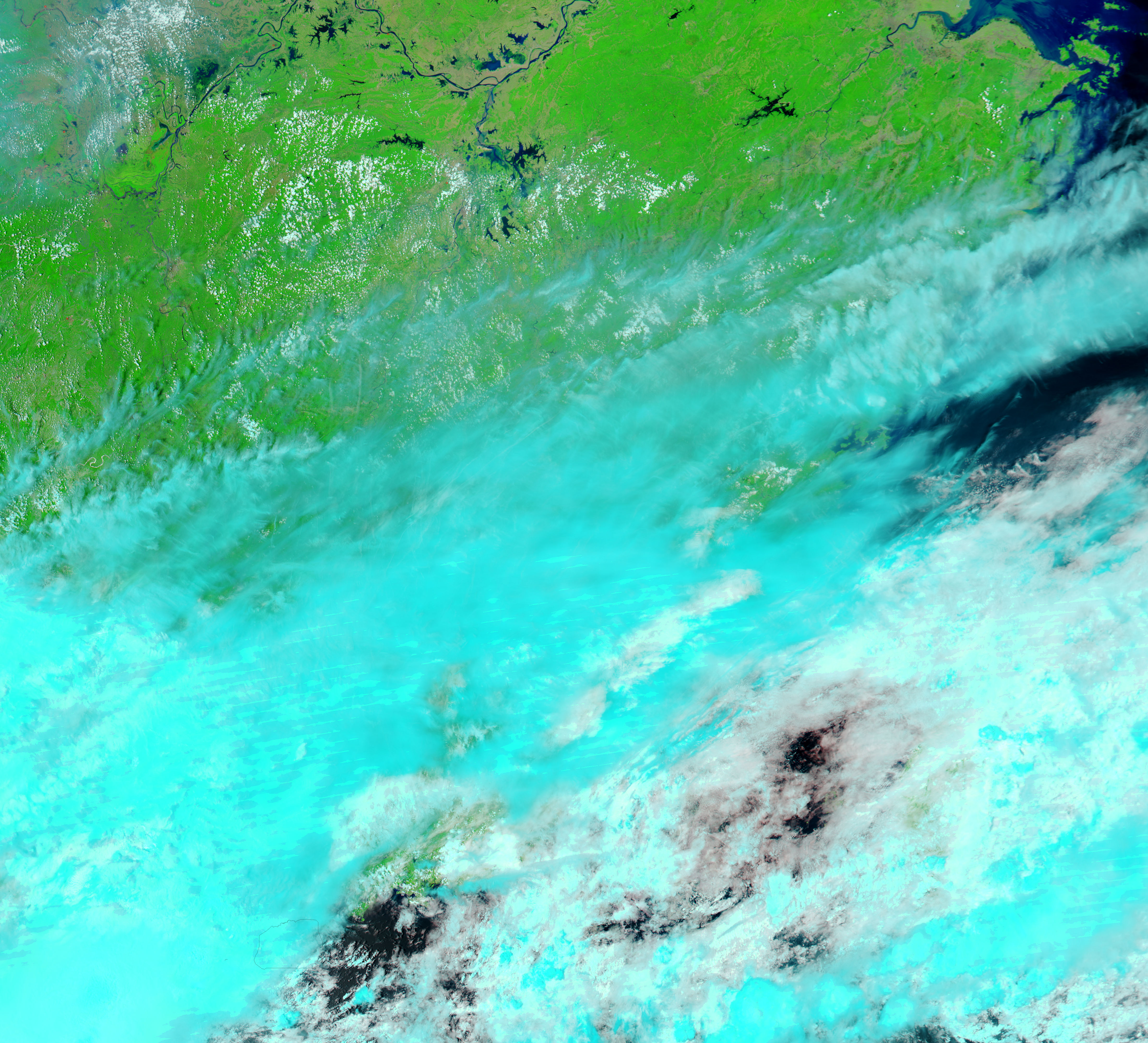
- May 19, 2007 (3.2 MB JPG)
Three days of heavy rain caused widespread flooding across China’s Jiangxi Province in early June 2007. The floods destroyed about 2,000 houses, and caused an economic loss of approximately $13 million, reported Reuters. The Moderate Resolution Imaging Spectroradiometer (MODIS) on NASA’s Aqua satellite captured the top image of flooding around Poyang Lake, a reservoir in northern Jiangxi, on June 6, 2007. Compared to conditions a few weeks earlier, on May 19 (lower image), the reservoir is swollen, and its shores have been pushed out by several kilometres. Both images were made with a combination of infrared and visible light, which makes water appear black or dark blue. Plant-covered land is bright green, bare earth is tan, and clouds are light blue and white. Similar images as well as photo-like images of southeast China are available from the MODIS Rapid Response System on a daily basis.
References & Resources
NASA image courtesy the MODIS Rapid Response Team at NASA GSFC.