


















- September 25, 2006 (1.48 MB)
- September 20, 2006 (1.01 MB)
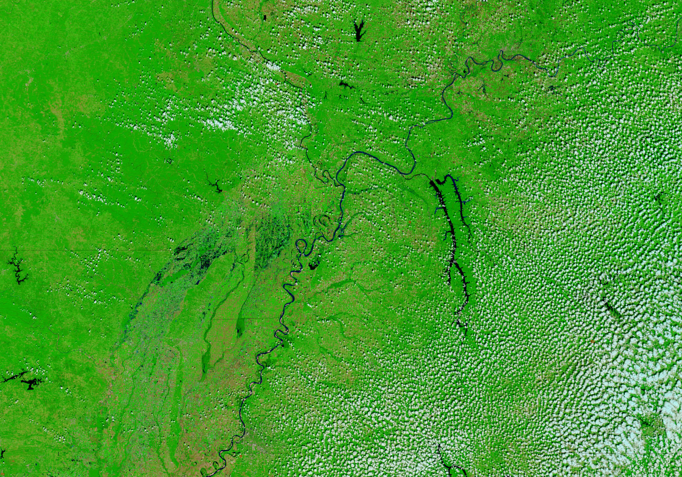
Weekend storms dumped heavy rain over Arkansas, Missouri, Kentucky, and Tennessee on September 23 and 24, 2006. More than 10 inches of rain fell over parts of the region, giving rise to flash floods that killed 12 people, reported the Associated Press. By September 25, the clouds had cleared, providing the Moderate Resolution Imaging Spectroradiometer (MODIS) on NASA’s Terra satellite this view of the floods. In the top image, large portions of northeast Arkansas and southeast Missouri are dotted with dark pools of standing water. The rivers flowing into the Mississippi River in Kentucky are swollen, as are rivers in Arkansas. At the time this image was collected, a flood advisory remained in effect for the Black River, which flows north-south along the left edge of the image.
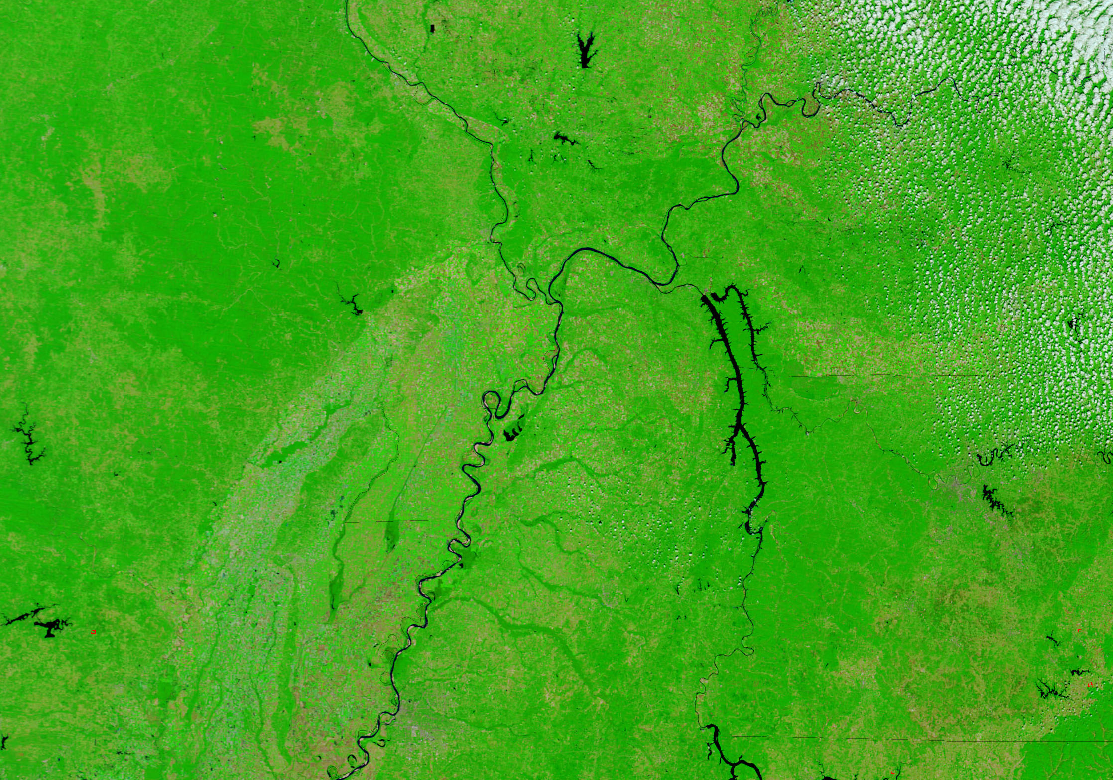
The lower image shows the four states on September 20, a few days before the storms. In this image, it is clear that much of the land that was flooded was agricultural land. Cultivated land on both sides of the Mississippi River forms a grid of tan and green squares. Primarily natural or non-cultivated vegetation, by contrast, is solid green. The floods on the west side of the Mississippi have a checker-board appearance, indicating that water covers low-lying, rectangular farm fields.
The large images provided above are at MODIS’ maximum resolution of 250 meters per pixel. Daily images of the southeastern United States are available from the MODIS Rapid Response Team in a variety of resolutions.
References & Resources
NASA images courtesy the MODIS Rapid Response Team at NASA GSFC.