


- September 14, 2007 (6.29 MB JPG)
- May 25, 2007 (4.87 MB JPG)
Sandwiched between the vast Sahara Desert of northern Africa and the equatorial forest of central Africa is the semi-arid, but fertile Sahel grassland. One of Africa’s most significant crop areas, the Sahel swings between frequent drought and frequent floods. In September 2007, floods dominated. Unusually heavy and persistent rains hammered much of the Sahel, swelling rivers from Senegal on the Atlantic coast to Kenya on the Indian Ocean coast. As many as 17 countries across the Sahel were flooded, affecting more than a million people, reported BBC News on September 17.
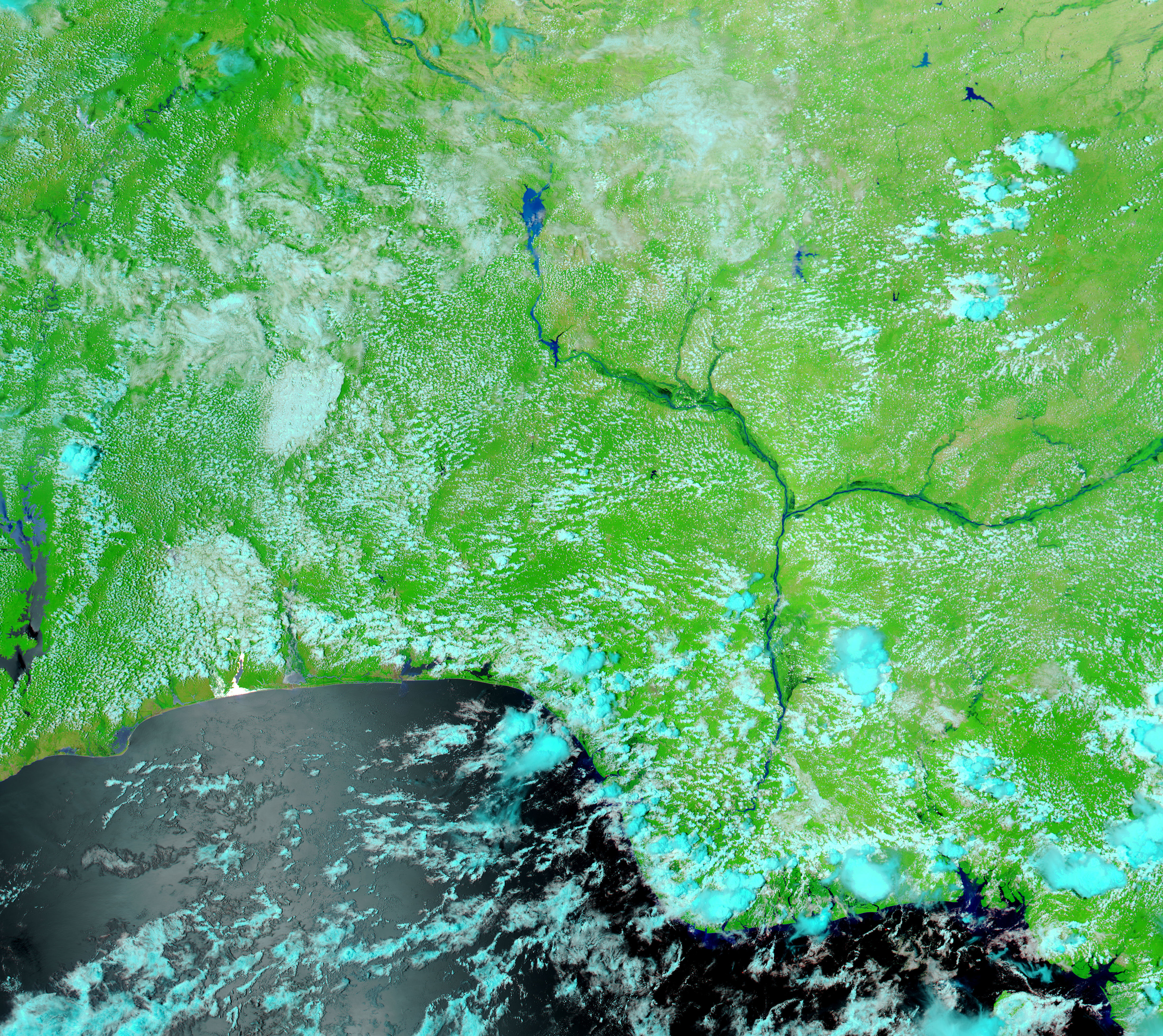
The Moderate Resolution Imaging Spectroradiometer (MODIS) flying on NASA’s Aqua satellite captured the top image of floods in Nigeria on September 14, 2007. The lower image, taken by Aqua MODIS on May 25, 2007, shows the region under normal conditions and is provided here for reference. On September 14, both the Niger River and its tributary, the Benue River, were running over their banks. Pools of water, dark blue to black in this false-color image, line the swollen rivers. The large image reveals that the floods extend along the full length of both rivers. Smaller tributaries are also notably flooded in the large image.
The combination of infrared and visible light used in this image gives clouds a pale blue tint. Plant-covered land is bright green, and bare earth is tan. A photo-like, true-color version of the image is available from the MODIS Rapid Response System, which provides daily images of Nigeria.
The floods took a heavy toll on Nigeria. As of September 14, 41 people had died in floods in northern and central Nigeria, reported Agence France-Presse.
References & Resources
NASA images courtesy the MODIS Rapid Response Team at NASA GSFC.


