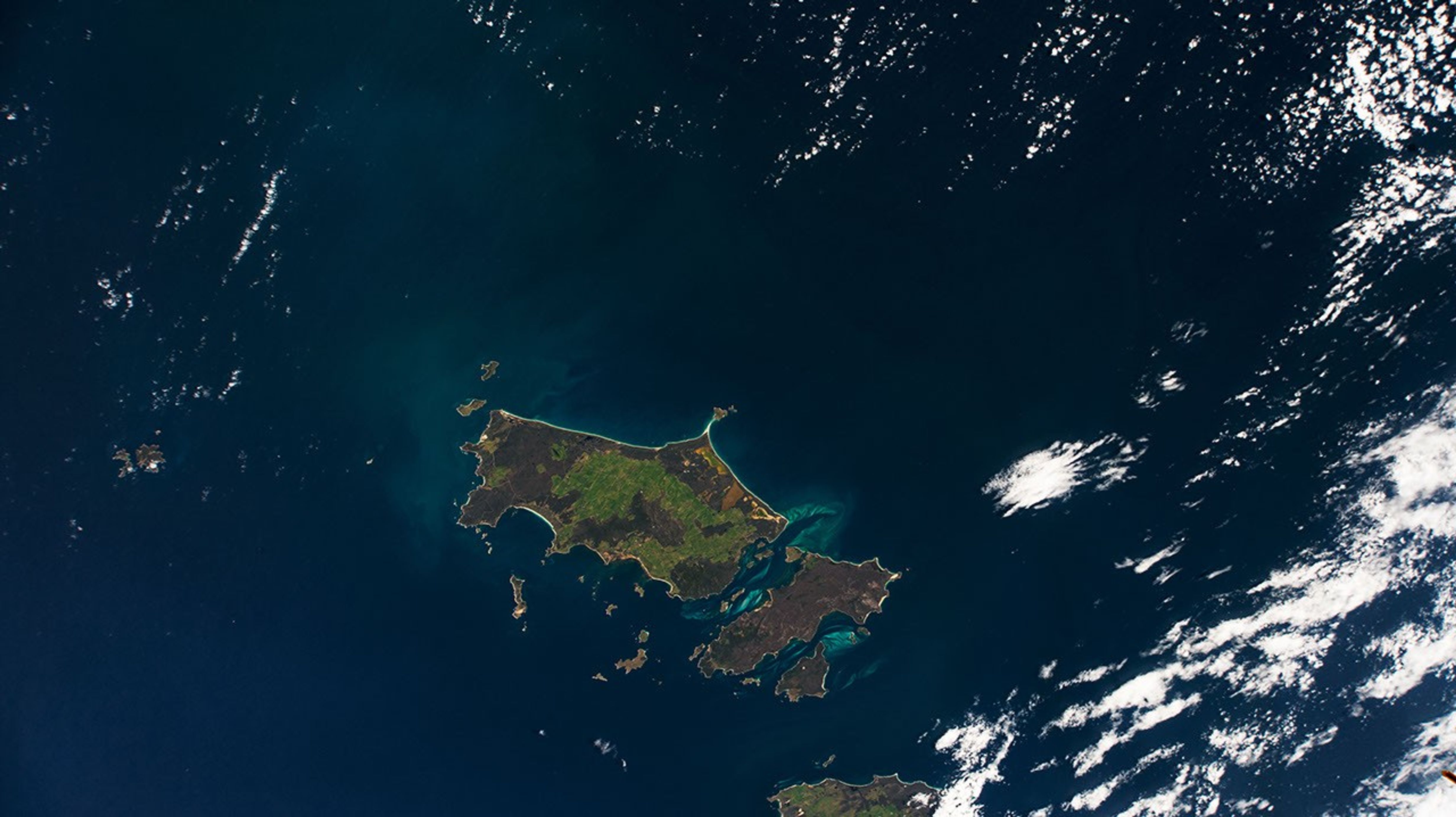


As the International Space Station (ISS) passed through the southernmost part of its cyclical orbit path, the Furneaux Islands (also known as the Furneaux Group) crossed into the field of view of a camera dedicated to Earth observation. The ISS External High-Definition Camera captured this view of the major islands of the eastern Bass Strait, which separates mainland Australia from Tasmania.
Named after British navigator Tobias Furneaux, the islands were first sighted by Europeans (but not visited) in 1773. Flinders, Cape Barren, and Clarke islands are the largest of more than 100 islands in the group.
The sparsely populated Flinders Island appears mostly two-toned from 400 kilometers (250 miles) above. Dark brownish scrub areas contrast with mottled green vegetated woodland and agricultural areas. Bright beaches outline the islands, and tidal sand banks are visible between them.
The Furneaux Group once formed the backbone of a land bridge between Tasmania and Victoria, Australia. That land bridge was submerged by rising sea levels at the end of the Earth’s most recent ice age, with the topographic high points becoming islands.
References & Resources
ISS External High-Definition Camera (EHDC) photograph ISS066-E-77622 was acquired on November 10, 2021, with a D4 electronic still camera using a focal length of 72 millimeters. It is provided by the ISS Crew Earth Observations Facility and the Earth Science and Remote Sensing Unit, Johnson Space Center. The image was taken by an externally-mounted camera on the ISS during Expedition 66. The image has been cropped and enhanced to improve contrast, and lens artifacts have been removed. The International Space Station Program supports the laboratory as part of the ISS National Lab to help astronauts take pictures of Earth that will be of the greatest value to scientists and the public, and to make those images freely available on the Internet. Additional images taken by astronauts and cosmonauts can be viewed at the NASA/JSC Gateway to Astronaut Photography of Earth. Caption by Alex Stoken, Jacobs, JETS Contract at NASA-JSC.