Using a combination of NASA satellite images and laser data, scientists have produced a first-of-its-kind map that details the height of the world’s forests. The map may help scientists build an inventory of how much of the carbon dioxide people release by burning fossil fuels gets stored by trees around the world.
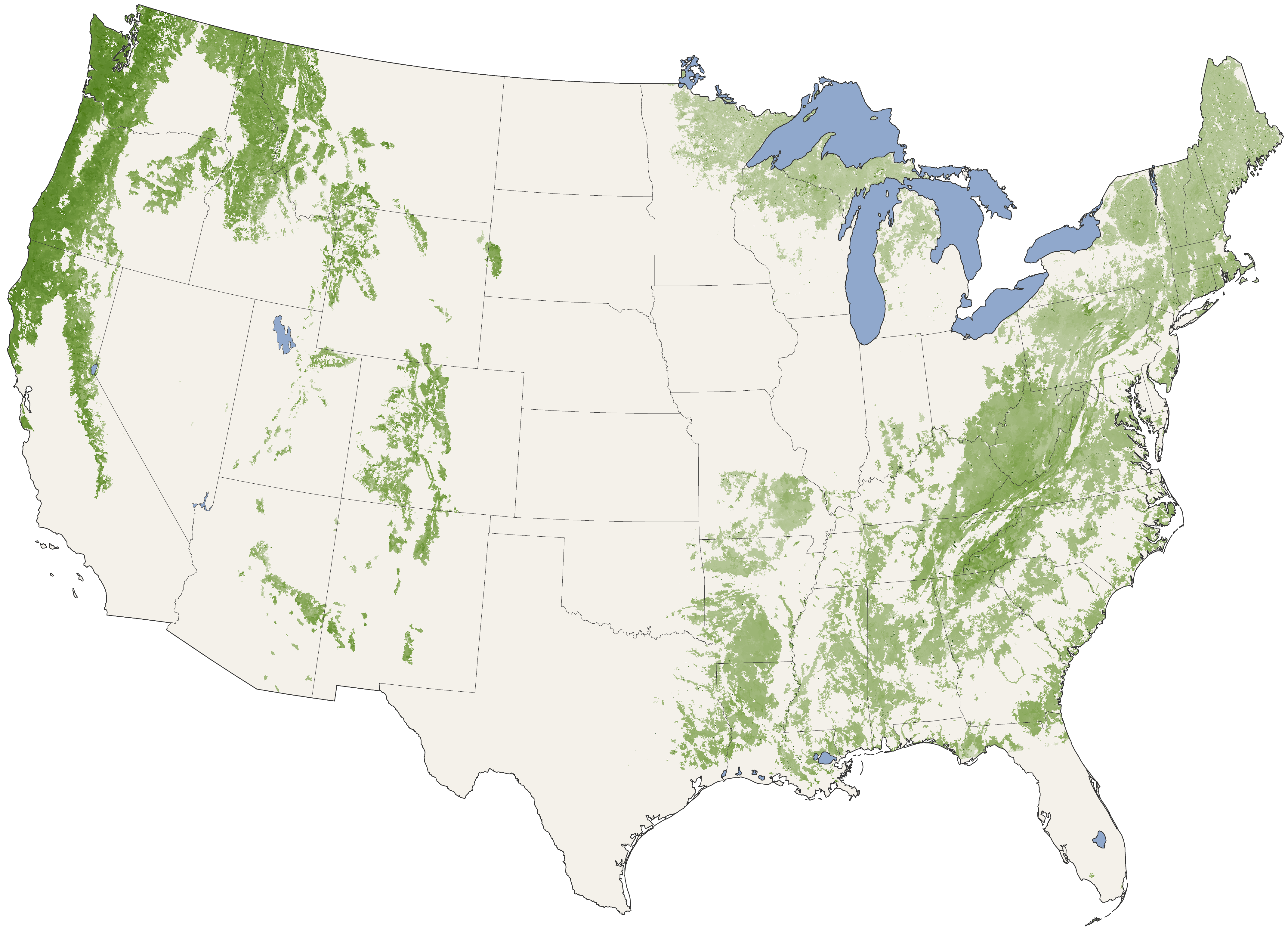
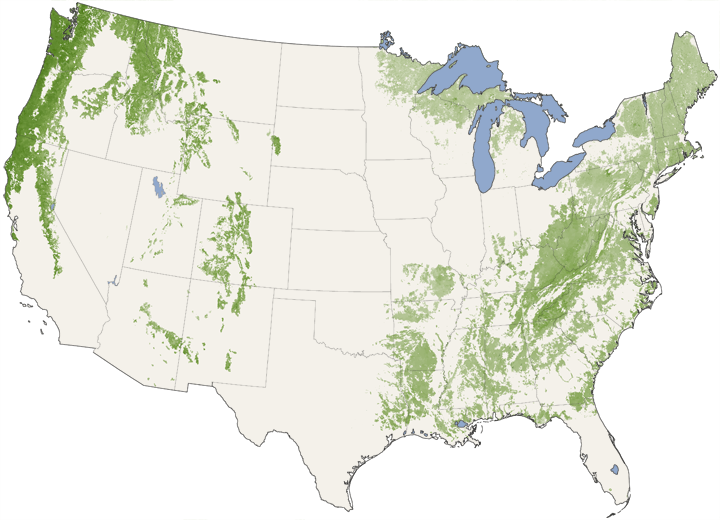
The map above shows forest canopy height for the United States in shades of green. Non-forested areas are pale beige. Not surprisingly (to anyone who has ever marveled at a coast redwood or a giant sequoia), the country’s tallest forest canopies are found in the Pacific Northwest and California. In the East, canopy heights generally decrease along a gradient from the Southern Appalachians (including the forests of the Great Smoky Mountains) to Maine (far northeast corner of the country).
For decades, scientists have been mapping the location and area of the Earth’s forests with satellite images. Forest area maps are useful for answering plenty of scientific questions, such as whether deforestation is slowing down or picking up. But for other questions—such as which forests are absorbing the most carbon dioxide from fossil fuel emissions—scientists need information on biomass, which means they need data on area and height.
The trouble is, most satellite images don’t provide any more information about the height of things on the ground than a photo from your digital camera would if you could snap a picture from space. To come up with the canopy height map, Michael Lefsky of Colorado State University used images from the Moderate Resolution Imaging Spectroradiometer (MODIS) on NASA’s Terra satellite to identify forest patches and then combined the images with laser scans of the forests’ vertical structure made by the Geoscience Laser Altimeter System, which flew on NASA’s Icesat satellite until the mission ended in 2009.
A sensor like MODIS passively records light reflected from the forest canopy, capturing a single image as the satellite passes overhead. A laser like GLAS emits short, rapid-fire pulses of light and records the strength and speed of the return signals—the “echos” that ricochet from multiple levels of the forest, including treetops, lower branches, and the ground.
In addition to carbon research, forest height is useful for studies of biodiversity as well as for studies into how forested landscapes affect winds and weather. For more information, please read First-of-its-Kind Map Depicts Global Forest Heights.
Further Reading
- Mystery of the Missing Carbon
- Tree Canopy Height from 1650 to 1992
- Deep Freeze and Sea Breeze: Changing Land and Weather in Florida
- NASA’s Newest Map of the World
References & Resources
NASA Earth Observatory image created by Jesse Allen, using data provided by Michael Lefsky (Colorado State University). Caption by Rebecca Lindsey and Adam Voiland.