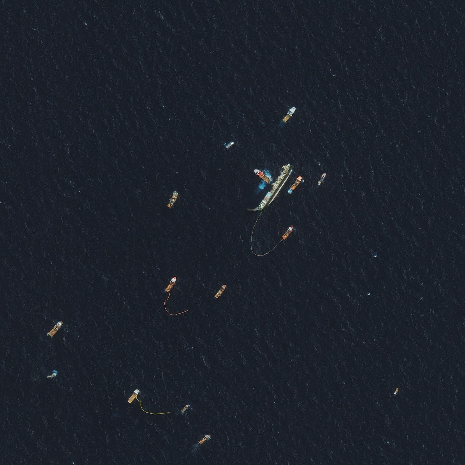
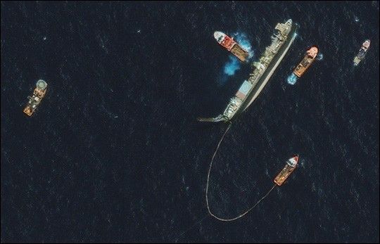
This high-resolution satellite image shows the rescue efforts underway to salvage afloundering Brazilian oil platform located 50 miles (80 kms) off the coastof Rio de Janeiro, Brazil. The image was taken on Oct. 15, 2002, atapproximately 11 a.m. local time by Space Imaging's IKONOS satellite.According to reports, salvage ships worked to repair the listing offshore oilrig. The $200 million offshore rig, known as P-34, heeled over after an electrical failure caused the oil stored aboard to flow to oneside. The rig began to right itself Tuesday, Oct. 15, 2002, after workerspumped sea water into empty tanks to restore its balance.
The 1600-pound IKONOS satellite travels 423 miles above the Earth’s surfaceat a speed of 17,500 miles per hour. It’s the world’s first commercialhigh-resolution remote sensing satellite and can see objects on the groundas small as one-meter square. IKONOS has collected more than 900,000 imagesof the Earth’s surface representing imagery over every continent.
References & Resources
© All Rights Reserved: Use of IKONOS, GeoEye, QuickBird and WorldView imagery must be coordinated with Maxar.
Image copyright DigitalGlobe © All Rights Reserved: Use of IKONOS, GeoEye, QuickBird, WorldView, and Digital Globe imagery must be coordinated with Maxar .