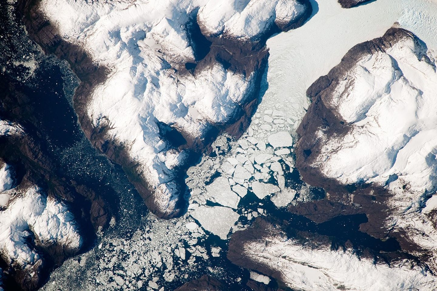
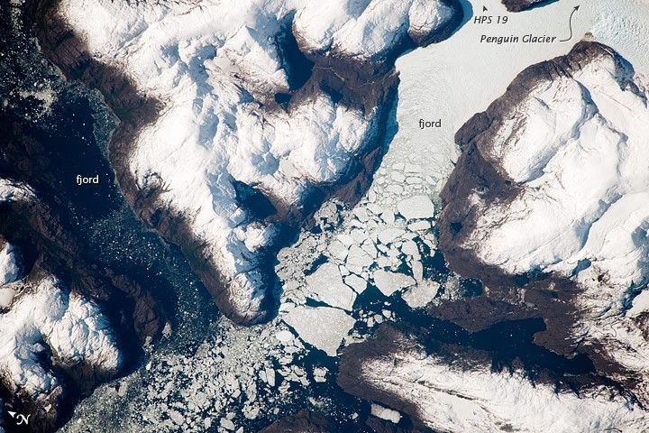
The Southern Patagonian Ice Field of Chile and Argentina hosts a spectacular array of glaciers and associated glacial features within the southern Andes Mountains. Glaciers flowing downhill on the eastern side of the mountains have outlets into several large freshwater lakes. On the western side of the mountains, glaciers release ice into the Pacific Ocean via an intricate network of fjords. Fjords are steep, inundated valleys originally cut by glaciers during periods of lower sea level. As glaciers flow into the fjord, ice at the front of the glacier begins to break off and form icebergs that can float out to sea—a process known as calving.
This detailed astronaut photograph shows the merged outlet of Penguin Glacier and HPS 19 into a fjord carved into the snow-covered mountains of the southern Andes. The designation HPS stands for Hielo Patagónico Sur (Southern Patagonian Icefield); the numbering system is used to identify glaciers that have no other geographic name. Ice flowing into the fjord begins to break up at image center, forming numerous icebergs. The largest visible in this image is approximately 2 kilometers in width. The large ice masses visible at image center have a coarse granular appearance due to variable snow cover and mixing and refreezing of ice fragments prior to floating free.
References & Resources
Astronaut photograph ISS020-E-39083 was acquired on September 6, 2009, with a Nikon D3 digital camera fitted with an 800 mm lens, and is provided by the ISS Crew Earth Observations experiment and Image Science & Analysis Laboratory, Johnson Space Center. The image was taken by the Expedition 20 crew. The image in this article has been cropped and enhanced to improve contrast. Lens artifacts have been removed. The International Space Station Program supports the laboratory to help astronauts take pictures of Earth that will be of the greatest value to scientists and the public and to make those images freely available on the Internet. Additional images taken by astronauts and cosmonauts can be viewed at the NASA/JSC Gateway to Astronaut Photography of Earth. Caption by William L. Stefanov, NASA-JSC.