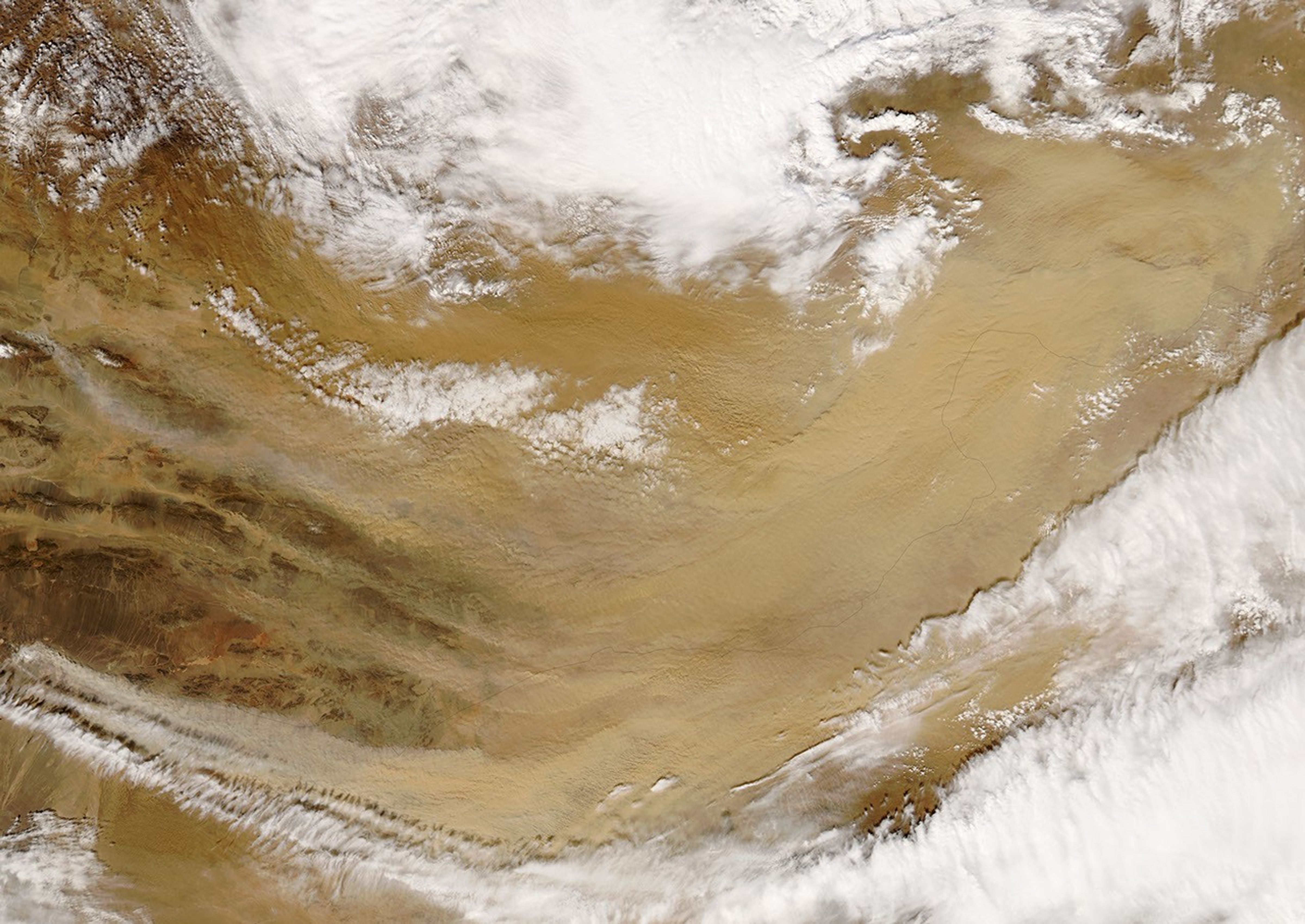
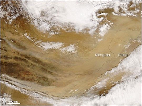
A dust storm blew across the Gobi Desert on March 30, 2007. The same day, the Moderate Resolution Imaging Spectroradiometer (MODIS) on NASA’s Aqua satellite captured this image of the storm. This picture shows the storm’s source points in Mongolia: the start of a very pale plume in the north, and the beginnings of thicker, slightly darker plumes in the south. All the plumes flare out as they sweep across the Gobi in a counter-clockwise direction toward China. Just south of the dust plumes, opaque white clouds follow a similar path.
According to the University Corporation for Atmospheric Research’s Meteorology Education and Training program, the Gobi Desert ranks among the world’s leading sources of dust storms, along with the Sahara, the Middle East, and Southwest Asia.
References & Resources
NASA image by Jeff Schmaltz, MODIS Rapid Response Team, Goddard Space Flight Center.