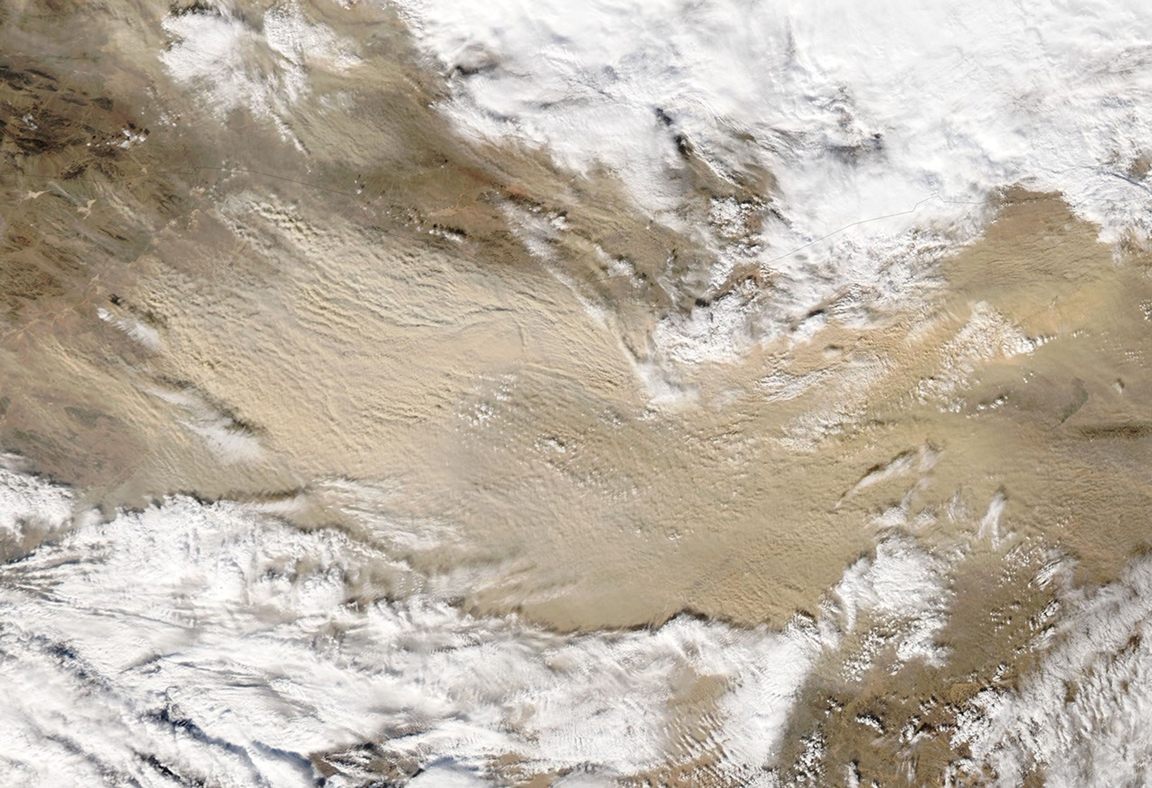
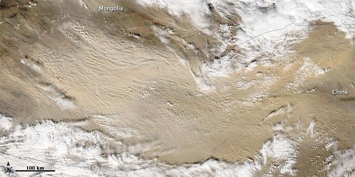
A dust storm that blew through Asia's Gobi Desert on November 10, 2010, quickly intensified as the day wore on. When the Moderate Resolution Imaging Spectroradiometer (MODIS) on NASA’s Aqua satellite captured this image at 1:50 p.m. Beijing time (5:50 UTC), the dust plumes were considerably thicker than they had been just two hours earlier. Smaller dust plumes also appeared north of the Mongolia-China border.
The dust forms an arc that curves to the southeast and then northeast and occupies an area of clear sky between two cloudbanks. The clouds could be related to the weather system that stirred the dust.
A sand sea in north-central China provides plentiful material for dust storms. Although the Gobi has long ranked as one of the world’s top dust-producing regions, its dust storms have historically occurred most often in March and April, according to the University Corporation for Atmospheric Research.
References & Resources
- Encyclopedia Britannica. (2010). Gobi. Accessed November 10, 2010.
- University Corporation for Atmospheric Research. (2003). Forecasting Dust Storms. Accessed November 10, 2010.
NASA image by Jeff Schmaltz, MODIS Rapid Response Team at NASA GSFC. Caption by Michon Scott.