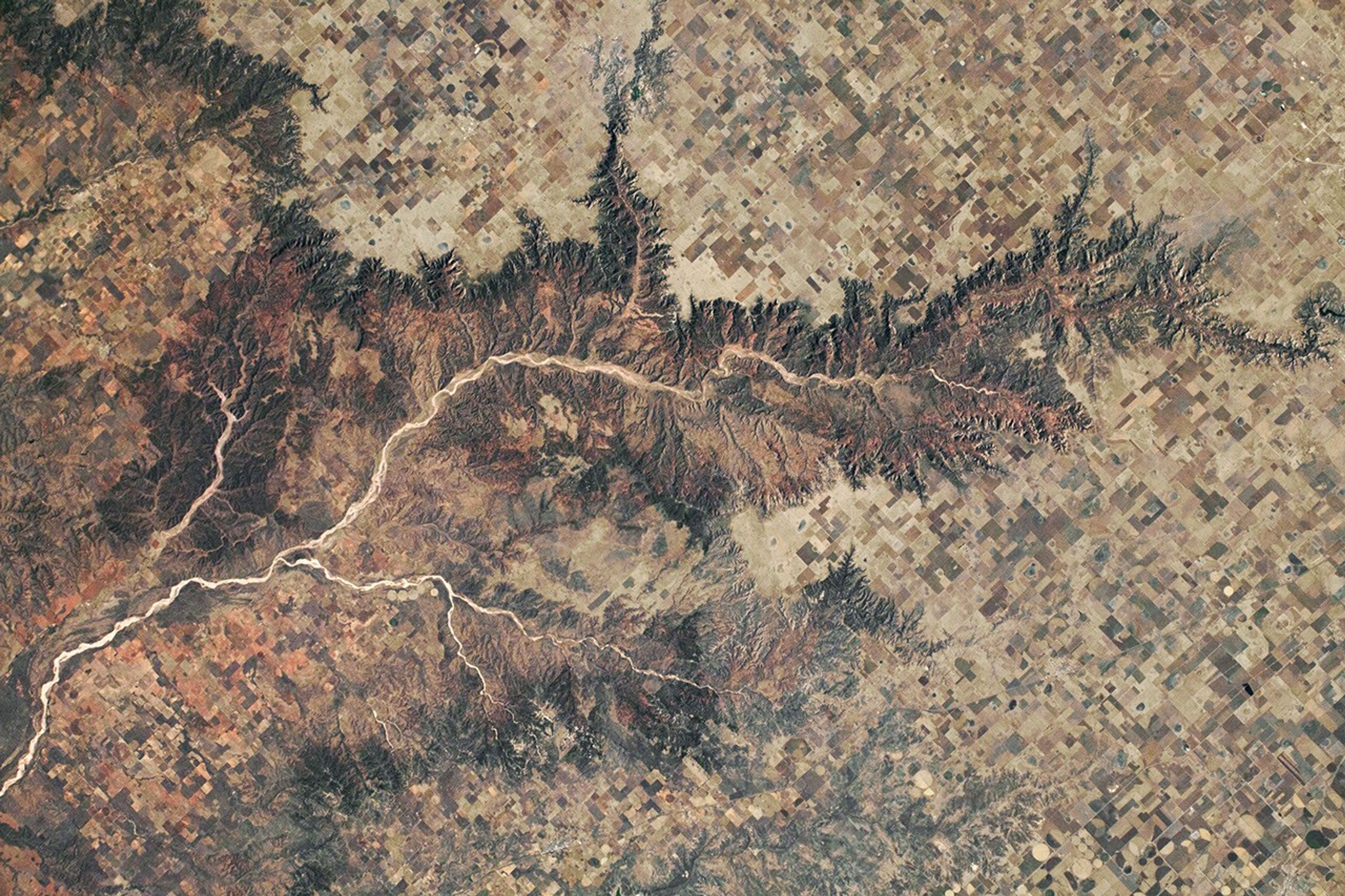


While in orbit over the Texas Panhandle, an astronaut on the International Space Station (ISS) photographed Palo Duro and Caprock Canyons, areas that provide insight into Texas geologic and human history.
Dark, intricate canyon edges branch out into the High Plains, where agricultural fields and ranches tile the landscape. A fork of the Red River, named the Prairie Dog Town Fork Red River, runs through the canyons. (Note that the photo has been oriented with north toward the bottom in order to prevent relief inversion by the shadows.)
Almost one million years ago, the headwaters of the Prairie Dog Town Fork Red River began carving their way through the Palo Duro area. The canyon is now about 800 feet (240 meters) deep and about 20 miles (30 kilometers) across, making it the second largest canyon in the United States behind Arizona’s Grand Canyon. Comprised of sedimentary rock layers, the oldest exposed rocks in Palo Duro were deposited more than 250 million years ago, during the Permian Period.
The first known humans in the area are thought to have hunted bison and mammoths here, with fossils of extinct animals embedded in the sedimentary rocks. Human artifacts, such as stone tools and rock art, have been found throughout the canyons and date back thousands of years. Today agriculture and ranching spread across the surrounding landscape, though the Palo Duro and Caprock Canyon systems are both reserved as Texas state parks.
References & Resources
Astronaut photograph ISS066-E-138096 was acquired on February 7, 2022, with a Nikon D5 digital camera using a focal length of 140 millimeters. It is provided by the ISS Crew Earth Observations Facility and the Earth Science and Remote Sensing Unit, Johnson Space Center. The image was taken by a member of the Expedition 66 crew. The image has been cropped and enhanced to improve contrast, and lens artifacts have been removed. The International Space Station Program supports the laboratory as part of the ISS National Lab to help astronauts take pictures of Earth that will be of the greatest value to scientists and the public, and to make those images freely available on the Internet. Additional images taken by astronauts and cosmonauts can be viewed at the NASA/JSC Gateway to Astronaut Photography of Earth. Caption by Sara Schmidt, GeoControl Systems, JETS Contract at NASA-JSC.