


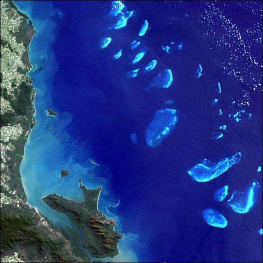
Stretching more than 2,000 km (1,200 miles) along the Queensland coast, the Great Barrier Reef, wasinscribed on the World Heritage List in October 1981. One of Australia’s greatest assets is themagnificent reef which runs along virtually the entire coast of Queensland. Considered one of theworld’s natural wonders, it is the most extensive reef system and the biggest structure made byliving organisms on Earth. In the north, the reef is virtually continuous and is located only 50 km(30 miles) from the shore. In the south, individual reefs are more common, and in some places up to300 km (190 miles) offshore. The Landsat 7 image shown here depicts southern parts of the reef system.Hundreds of islands dot the reef area. About twenty of them have resort facilities, but it is possibleto camp on many others.
This image was acquired byLandsat 7’s Enhanced Thematic Mapper plus(ETM+) sensor on August 14, 1999. This is a natural color composite image made using red, green,and blue wavelengths (ETM+ bands 3, 2, & 1).
References & Resources
Image provided by NASA Goddard Space Flight Center’s Landsat Team using data courtesy the Australian ground receiving station teams


