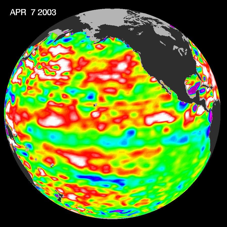
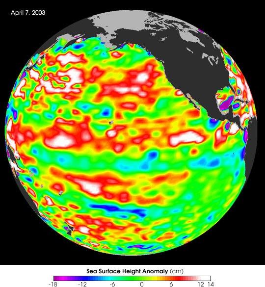
The latest image from NASA’s Jason oceanography satellite, taken during a 10-day collection cycle ending April 7, 2003, shows that the warm, high sea level El Niño pool of the pastwinter is history. The equatiorial Pacific sea surface temperatures and sea levels havereturned to near-normal conditions. The image shows red areas in the north and southsubtropical Pacific, (10°N(S) to 20°N(S), remnants of the disappearing El Niño, that areabout 10 centimeters (4 inches) above normal; white areas indicate sea surface heightsbetween 14 and 32 centimeters (6 to 13 inches) above normal. In the western tropicalPacific, sea levels (red and white areas) are beginning to rise as strong trade winds aresweeping the warm El Nino waters westward.
Elsewhere, the influence of the 20- to 30-year larger than El Niño/La Niña pattern called the Pacific Decadal Oscillation continues to create warm, higher-than-normal sea-surfaceheights in the north Pacific that are connected in a warm horseshoe pattern with thewestern and southern Pacific.ÿ
Looking ahead, oceanographers will be carefully monitoring Pacific sea levels to seewhether the tropical Pacific returns to normal or switches to La Nina conditions as it did in1998, after the huge El Niño of 1997-1998.
Sea-surface heights are a measure of how much heat is stored in the ocean below. Thisheat influences both present weather and future planetary climate events.
References & Resources
Image courtesy NASA/JPL Ocean Surface Topography Science Team