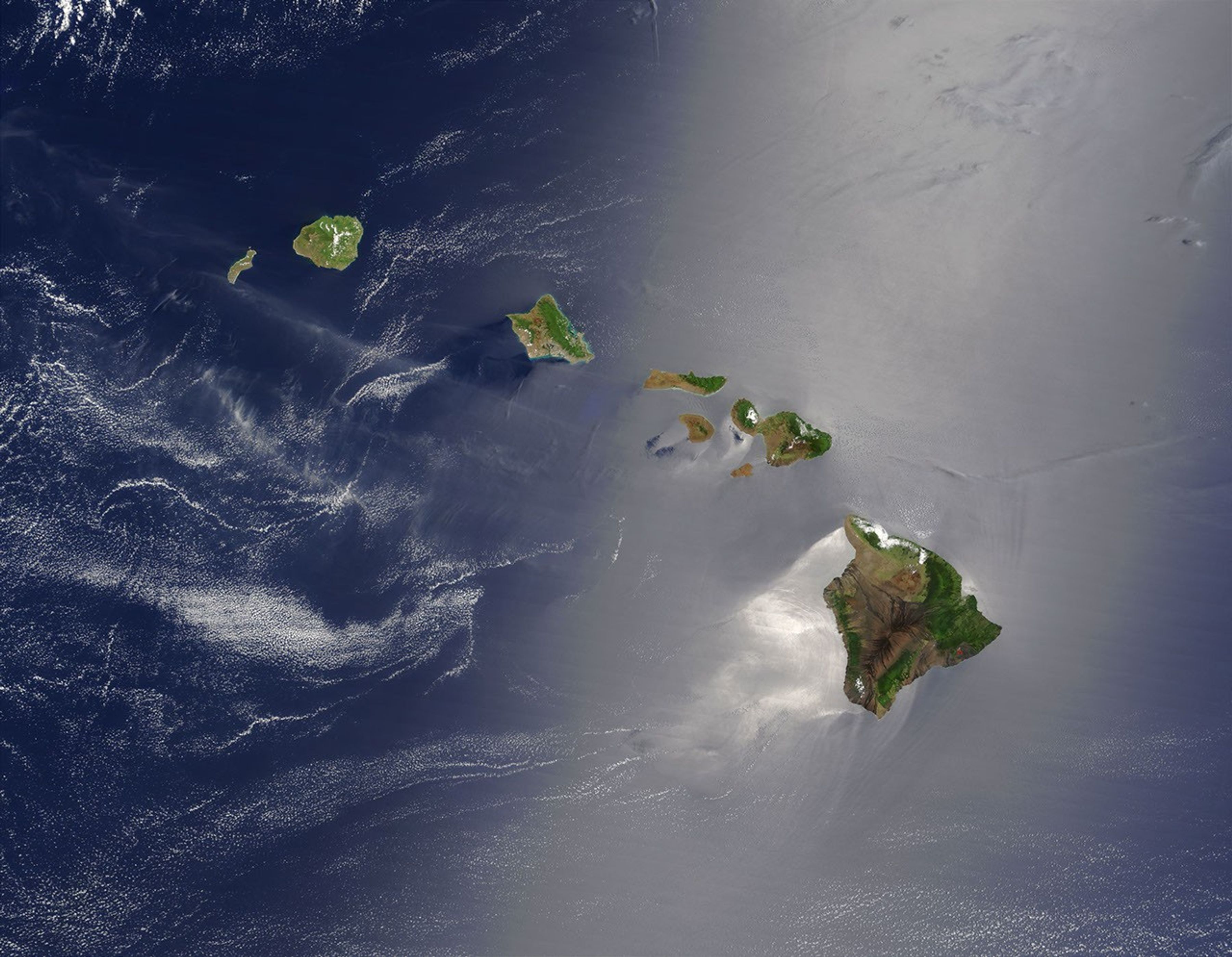
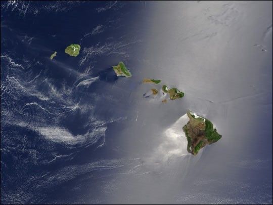
A silver swath of sunglint surrounds half of the Hawaiian islands in thistrue-color Terra MODIS image acquired on May 27, 2003. Sunglint revealsturbulence in the surface waters of the Pacific Ocean. If the surface ofthe water was as smooth as a perfect mirror, we would see the circle ofthe Sun as a perfect reflection. But because the surface of the water isruffled with waves, each wave acts like a mirror and the Sun’s reflection getssoftened into a broader silver swath, called the sunglint region.
In this scene, the winds ruffling the water surface around the HawaiianIslands create varying patterns, leaving some areas calmer than others.Southwest of Hawaii and Maui, on their leeward sides, calmer waters are indicated by brightersilver coloration. Conversely, notice how most of the vegetation on the Hawaiian Islands grows on their northeastern, or windward, sides.
From lower right to upper left, the “Big Island”(Hawaii), Maui, Kahoolawe, Lanai, Molokai, Oahu, Kauai, and Niihauislands all make up the state of Hawaii, which lies more than 2,000 miles fromany other part of the United States. The small red dot on the BigIsland’s southeastern side marks a hot spot on Kilauea Volcano’ssouthern flank. Kilauea has been erupting almost continuously sinceJanuary 1983, and is one of the world’s best studied volcanoes.
References & Resources
Image courtesy Jacques Descloitres, MODIS Land Rapid Response Team at NASA GSFC