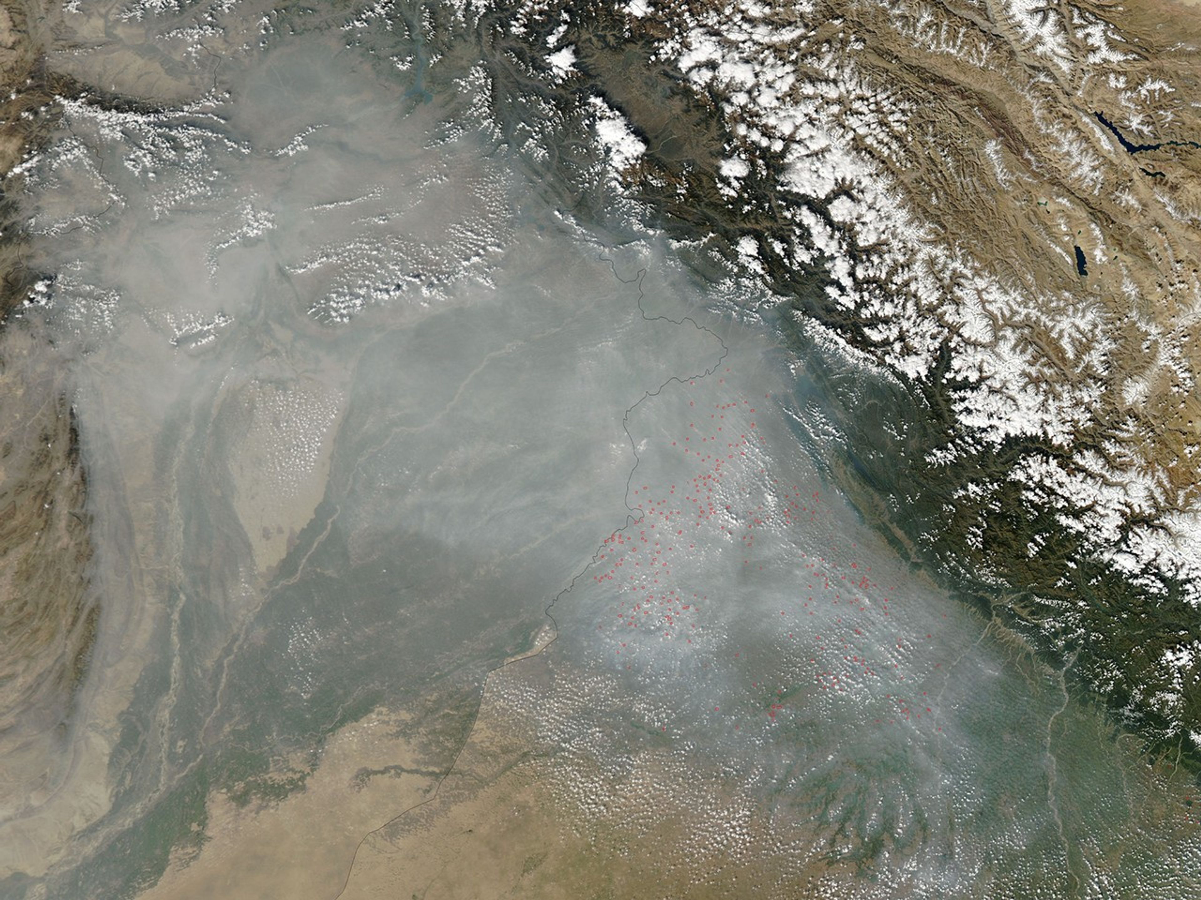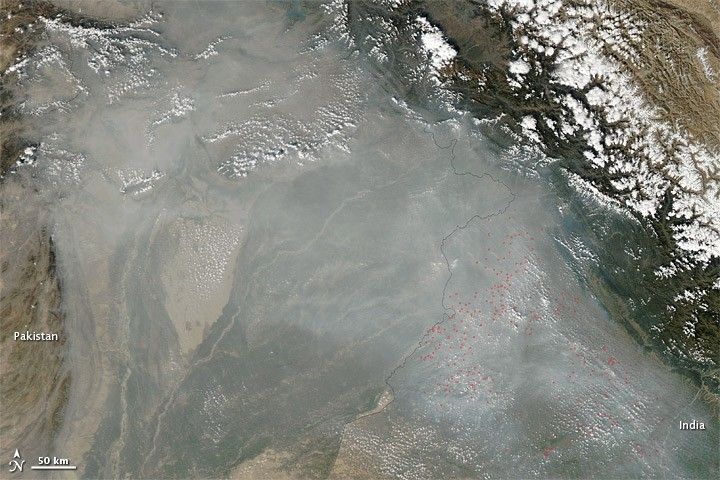
Haze hugged the southern slopes of the Himalaya in late October 2010. Straddling the border between Pakistan and India, the haze stretched over hundreds of kilometers.
The Moderate Resolution Imaging Spectroradiometer (MODIS) on NASA’s Aqua satellite captured this natural-color image on October 19, 2010. Haze forms a translucent veil over most of the scene, and concentrates in the southeast. The spray of red dots in India is a multitude of hotspots—areas where MODIS has detected unusually high surface temperatures. The hotspots are most likely agricultural fires. Although the fires undoubtedly contribute to the haze in the region, they may not account for all of it. The haze might also result partly from industrial pollution.
References & Resources
NASA image courtesy of the MODIS Rapid Response Team at NASA GSFC. The Rapid Response Team offers daily images of this region. Caption by Michon Scott.