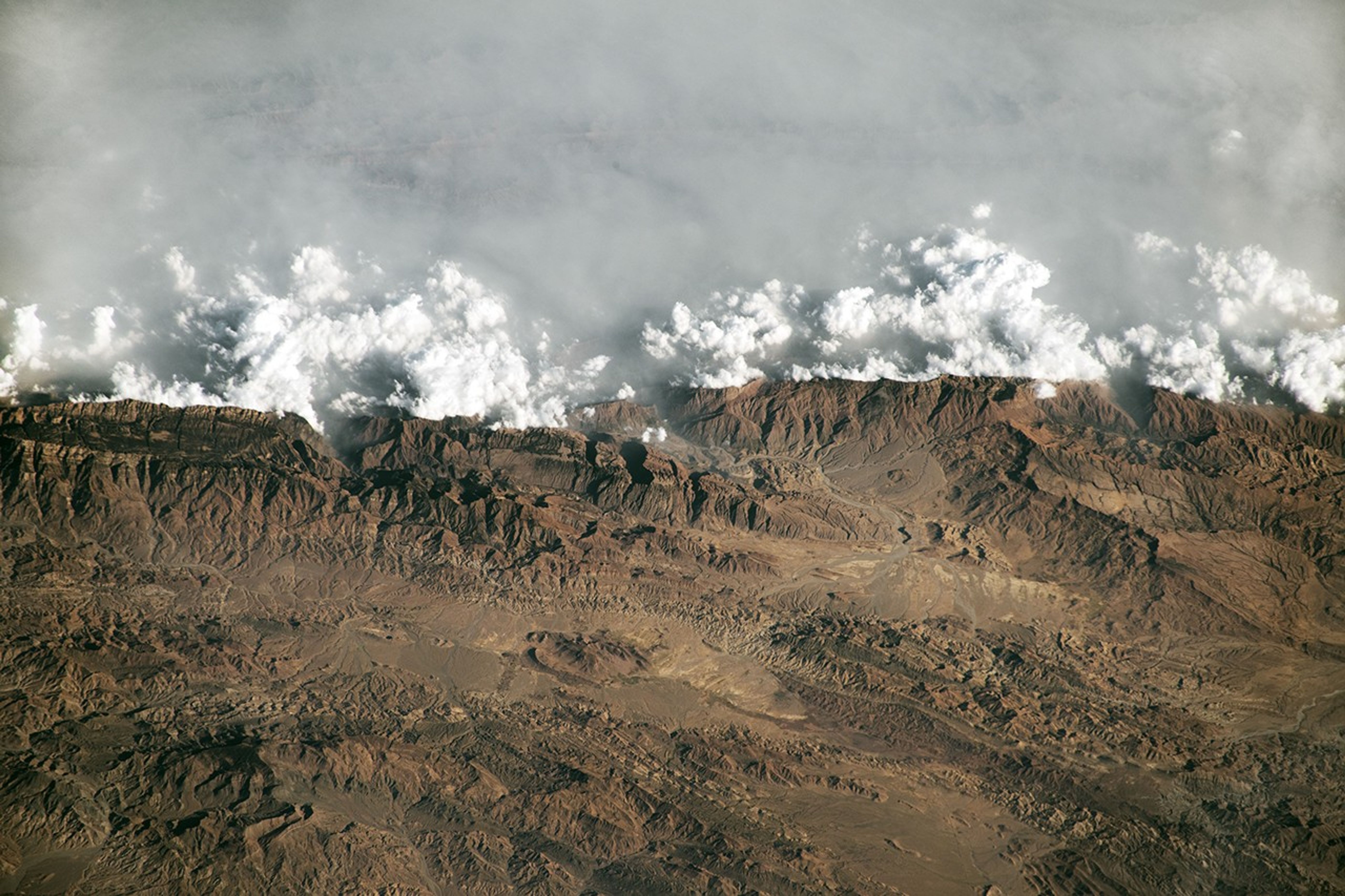


An astronaut aboard the International Space Station took this oblique photograph of the Sulaiman Mountains in central Pakistan. The range resulted from the slow-motion collision of the Indian and Eurasian tectonic plates that began about 60 million years ago. Peaks rise to more than 3,000 meters (10,000 feet) above sea level in the northern portion of the mountain range, shown in this photograph.
The Sulaiman Mountains form a natural barrier between the plateaus to the west and the Indus River Valley to the east. Winds blowing from the Indian Ocean and Indus floodplain carry moisture and particulates inland, causing a combination of haze, mist, and clouds to form on the windward side of the mountain range.
Clouds and haze are unable to pass over the high-elevation terrain of the mountains. Terrain-forced flow instead channels air around the range. However, a small stream of vapor is visible passing through gaps in the barrier near the town of Dhana Sar, where a gorge cuts through the mountains.
A unique attribute of astronaut photography of Earth is the crew member’s ability to highlight features of the landscape by taking photos from perspectives other than straight-down (nadir). This photo leverages an oblique view to highlight the ruggedness of the Sulaiman Mountains by accentuating shadows created by the topography.
References & Resources
Astronaut photograph ISS070-E-42565 was acquired on December 17, 2023, with a Nikon D5 digital camera using a focal length of 460 millimeters. It is provided by the ISS Crew Earth Observations Facility and the Earth Science and Remote Sensing Unit, Johnson Space Center. The image was taken by a member of the Expedition 70 crew . The image has been cropped and enhanced to improve contrast, and lens artifacts have been removed. The International Space Station Program supports the laboratory as part of the ISS National Lab to help astronauts take pictures of Earth that will be of the greatest value to scientists and the public, and to make those images freely available on the Internet. Additional images taken by astronauts and cosmonauts can be viewed at the NASA/JSC Gateway to Astronaut Photography of Earth . Caption by Cadan Cummings, Jacobs, JETS II Contract at NASA-JSC.