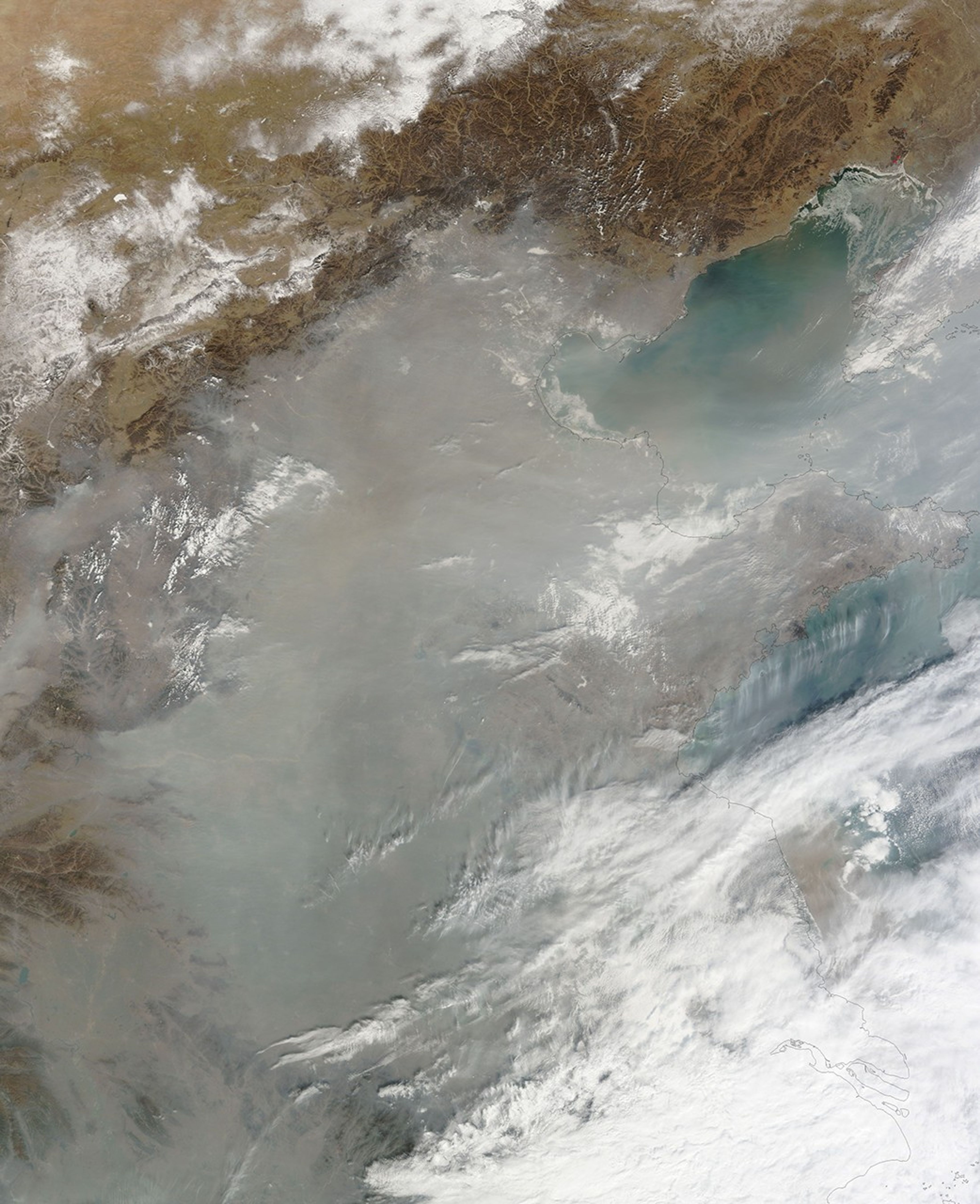
























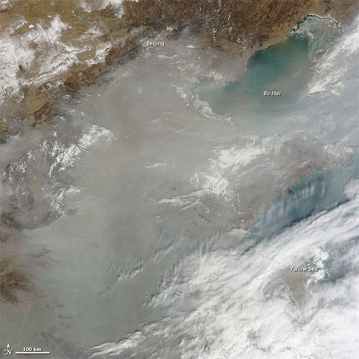
Haze hovered over eastern China in mid-February 2011, obscuring the coastlines of Bo Hai and the Yellow Sea. The Moderate Resolution Imaging Spectroradiometer (MODIS) on NASA’s Terra satellite captured this natural-color image on February 17, 2011.
Gray-beige haze blankets the coastal plain and nearby ocean waters. The haze likely results from pollution held in place by a temperature inversion. Air high in the atmosphere is usually cooler than the air near the ground. As warm air rises through the atmosphere, it disperses its pollutants, but when cold air is trapped under a layer of warm air, it cannot rise.
Winter temperature inversions are not uncommon in this region, and residents rely on coal for electricity and heat. This combination leads to frequent buildups of haze. Dust from farther inland might also be mixed with the haze in this image.
References & Resources
NASA image courtesy MODIS Rapid Response Team at NASA GSFC. Caption by Michon Scott.