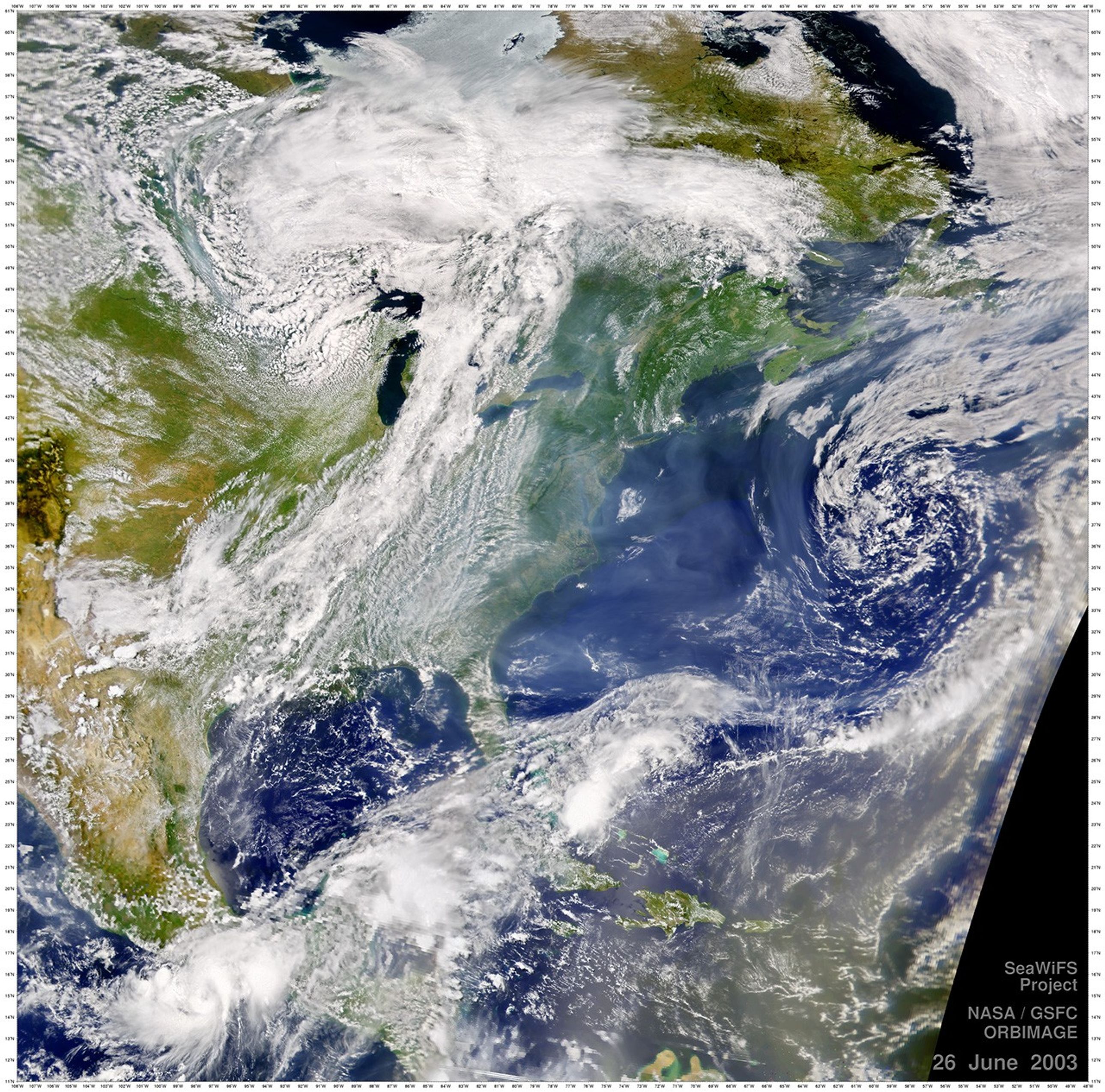


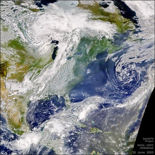
The Sea-viewing Wide Field-of-view Sensor (SeaWiFS) capture this view of Code Red Air over much of eastern North America on June 26, 2003.The lower atmosphere exhibits thick, grayish haze all along the East Coast and out over the Atlantic Ocean—probably a combination of smokeand pollution from points to the north and west on the continent.
A large low-pressure system still sits over the Gulf Stream, due east of the mid-Atlantic states. On the other side of the cloud band runningacross the lower right quadrant of the imagethe haze has more of a brownish tint. Thisis dust that has blown across the Atlantic Oceanfrom North Africa.
Tropical Storm Carlos can be seen spinning just off the southern coast of Mexico, near the bottom leftcorner of the image.
References & Resources
Image courtesy the SeaWiFS Project, NASA/Goddard Space Flight Center, and ORBIMAGE