


![Request for Information – Potential [Placeholder for Prize]](https://assets.science.nasa.gov/dynamicimage/assets/science/psd/solar/2023/09/s/solarsystem_0.jpg?w=1024)


- Large images
- April 1, 2008 (3.2 MB JPEG)
- February 1, 2008 (2.9 MB JPEG)
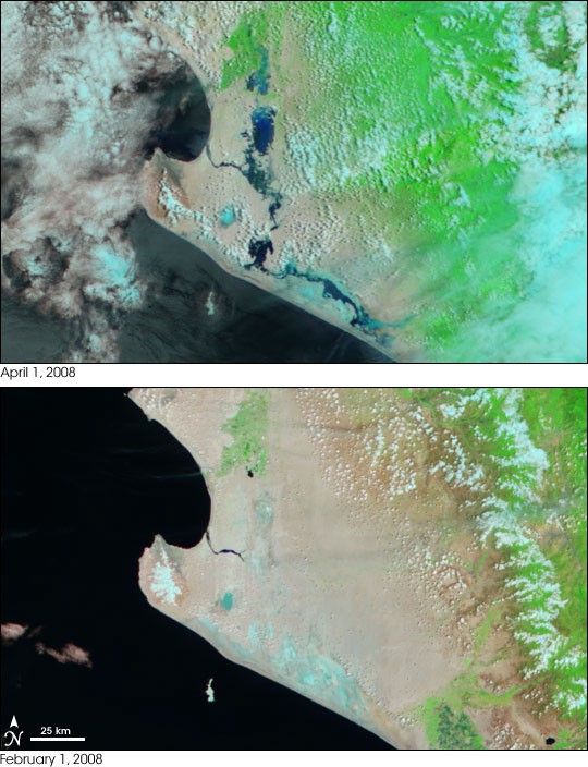
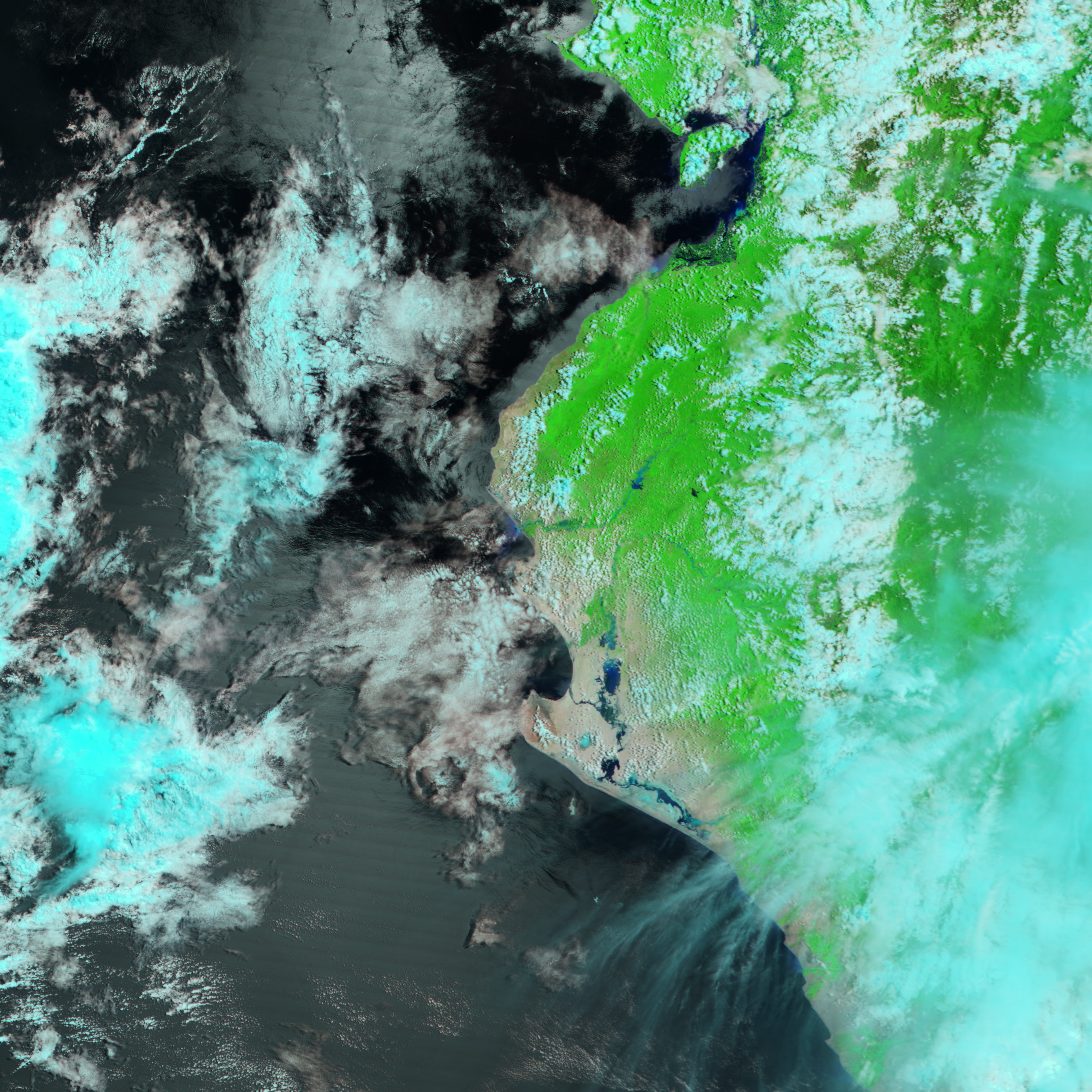
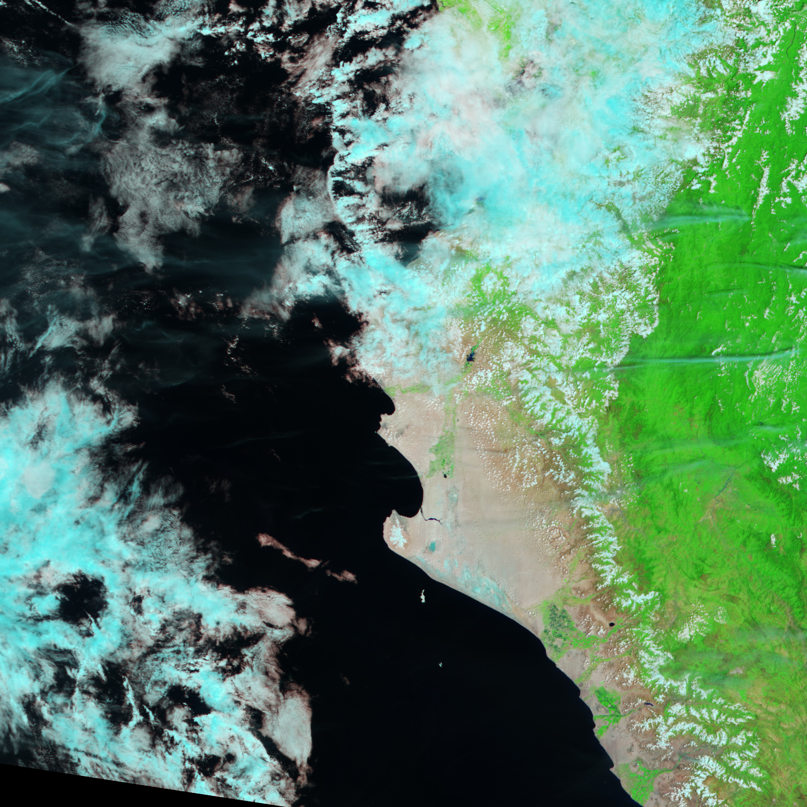
Two months after intense rains began to pound much of South America, rivers along the northwest coast of Peru remained flooded. The Moderate Resolution Imaging Spectroradiometer (MODIS) on NASA’s Terra satellite captured the top image of the flooded river systems on April 1, 2008. Streams and pools of dark blue water dominate what was a tan-pink desert in early February, immediately before the rains began.
The images show the Sechura Desert in northwestern Peru near the border with Ecuador. The large image shows additional flooding extending north into Ecuador. To increase the contrast between muddy water and land, which often look the same in photo-like images, the image was made with both visible and infrared light. This false-color combination colors water black and dark blue and bare or sparsely vegetated earth tan. Plant-covered land is green, and clouds are turquoise and white.
Floods throughout Peru damaged farmland, homes, and transportation networks, reported the United Nations Office for the Coordination of Humanitarian Affairs. On February 28, the government of Peru declared a state of emergency in Piura and Lambayeque, the regions included in this image, and in Tumbes, the region immediately north of the area shown, and in Ucayali, a region in central Peru along the Brazilian border. More than 450,000 people were affected by flooding throughout Peru as of March 12, said the United Nations.
- References
- United Nations Office for the Coordination of Humanitarian Affairs. (2008, March 12). Peru: Floods (as of 05 March 2008) location map. Published on ReliefWeb. Accessed April 3, 2008.
You can download a 250-meter-resolution KMZ file of the flooding suitable for use with Google Earth.
References & Resources
- References
- United Nations Office for the Coordination of Humanitarian Affairs. (2008, March 12). Peru: Floods (as of 05 March 2008) location map. Published on ReliefWeb. Accessed April 3, 2008.
NASA image created by Jesse Allen, using data provided courtesy of the MODIS Rapid Response team. Caption by Holli Riebeek.


