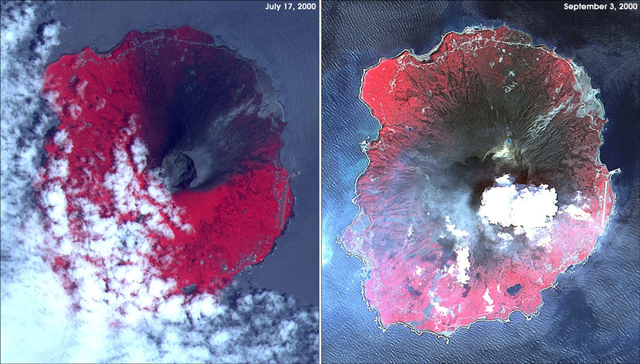

Eruptions of Mount Oyama progressively covered the volcano's slopes withmore and more ash over the last half of 2000. This pair of images fromthe Advanced Spaceborne Thermal Emission and Reflection Radiometer(ASTER) shows the volcano on July 17, 2000 (left) and September 3, 2000(right). The false-color images combine infrared, red, and green lightas red, blue, and green colors, respectively. Ash is dark gray,vegetation appears red, and water is blue-gray. In the image fromSeptember 3, steam is being vented from the volcano's caldera.
The volcano has again been venting steam, ash, and large amounts ofsulfur dioxide (an estimated 20 to 50 kilotons per day) in February2001. (See this previous SeaWiFS image of Miyakajima.) Scientistsbelieve most of the emitted sulfur dioxide is from degassing magmawithin the volcano.
The 8-km-wide (5-mile) island is actually a low-angle stratovolcanorising some 818 meters (2,686 feet) up out of the Pacific Ocean, about240 km (150 miles) south of Okinawa and 320 km (200 miles) east ofTaiwan. Many now refer to the island as Miyakejima, and the volcano'ssummit as Mount Oyama.
References & Resources
Image courtesy NASA/GSFC/MITI/ERSDAC/JAROS, and U.S./Japan ASTER Science Team