Suggested Searches

1 min read

How On Earth Was This Image Made?

Instruments:
 

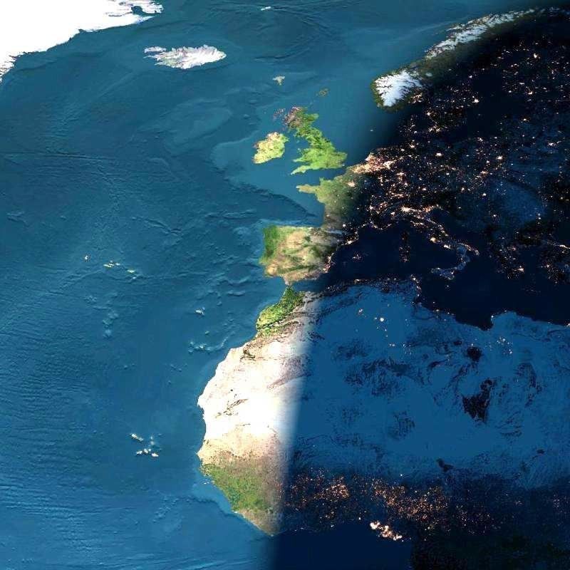
This image presents a remarkable view of the North Atlantic Ocean, stretching from the equator and western Africa northward to Iceland and Greenland, with sunset occurring over (north to south) Scandinavia, France, Spain, Algeria, Mali, and the Ivory Coast.

Here is an opportunity for you to play image detective. How on Earth was this image made? Is it a painting, or a map? Is it a photograph? If so, was it taken from a high-flying aircraft, or from outer space? Is it a satellite image, or possibly even something else? Click to read the feature article when you’re ready to check your answer.

References & Resources

Image courtesy The Living Earth

You may also be interested in:

Stay up-to-date with the latest content from NASA as we explore the universe and discover more about our home planet.

A Northwest Night Awash in Light
3 min read

The glow of city lights, the aurora, and a rising Moon illuminate the night along the northwest coast of North…

Article
The Galaxy Next Door
3 min read

The Large Magellanic Cloud—one of our closest neighboring galaxies—is a hotbed of star formation that is visible to both astronauts…

Article
Five Minutes in Orbit
3 min read

An astronaut captured a moonrise—and much more—in a series of photos taken from the International Space Station.

Article