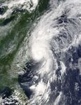

Hurricane Alex skims the North Carolina shoreline in this image, taken by the Moderate Resolution Imaging Spectroradiometer (MODIS) on NASA’s Terra satellite on August 3, 2004, at 12 p.m. U.S. Eastern time. At that time, Alex was a Category Two hurricane with maximum sustained winds of 100 miles per hour and stronger gusts. Storm surges of 2-4 feet, heavy surf, and rip currents are expected to affect the entire Atlantic shoreline. According to the Tropical Prediction Center, Alex is moving towards the northeast at 15 mph and is expected to maintain that course over the next 24 hours. For more information, please visit the National Hurricane Center.
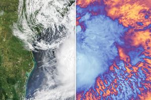
The first named storm of the Atlantic hurricane season, Hurricane Alex formed as a tropical depression on July 31, and developed into a tropical storm on August 2. It reached hurricane status on August 3 as it neared the North Carolina coast. Both MODIS and the Tropical Rainfall Measuring Mission (TRMM) tracked the development of the storm on August 2 and August 3. The large image shows the storm at MODIS’ maximum resolution of 250 meters per pixel. The image is available in multiple resolutions.
References & Resources
NASA image courtesy Jacques Descloitres, MODIS Rapid Response Team at NASA GSFC