


























Suggested Searches

1 min read

Hurricane Charley

Instruments:
2004-08-10 00:00:00
August 10, 2004

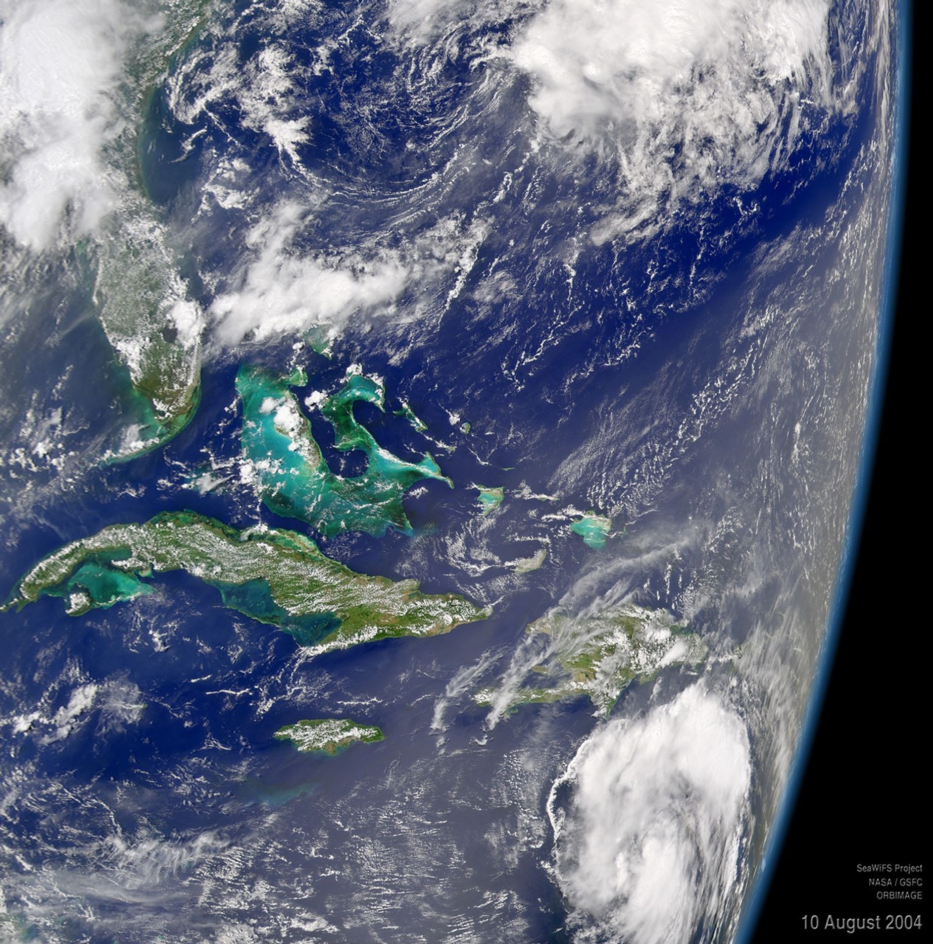
The SeaWiFS sensor onboard the OrbView-2 satellite captured this true-color image of Tropical Storm Charley on August 10 at 1:30 PM EDT. In this oblique view, Charley is located in the bottom right corner of the image.

At the time this image was taken, Charley has maximum sustained winds of 45 mph with a minimum central pressure of 1005 mb. Charley was moving towards the west-northwest at a rapid 24 mph.

References & Resources

Image provided by the SeaWiFS Project, NASA/Goddard Space Flight Center, and ORBIMAGE.
You may also be interested in:

Stay up-to-date with the latest content from NASA as we explore the universe and discover more about our home planet.

Tropical Storm Arthur
2 min read

The first named storm of the 2026 Atlantic hurricane season brought intense rainfall and the threat of flash flooding to…

Article
Typhoon Jangmi
2 min read

The sprawling storm promised to deliver torrential rain across a wide swath of southern Japan.

Article
Tropical Cyclone Narelle Crosses Australia
3 min read

The powerful storm lashed the northern edge of the continent with damaging winds and drenching rain as it made landfall…

Article





