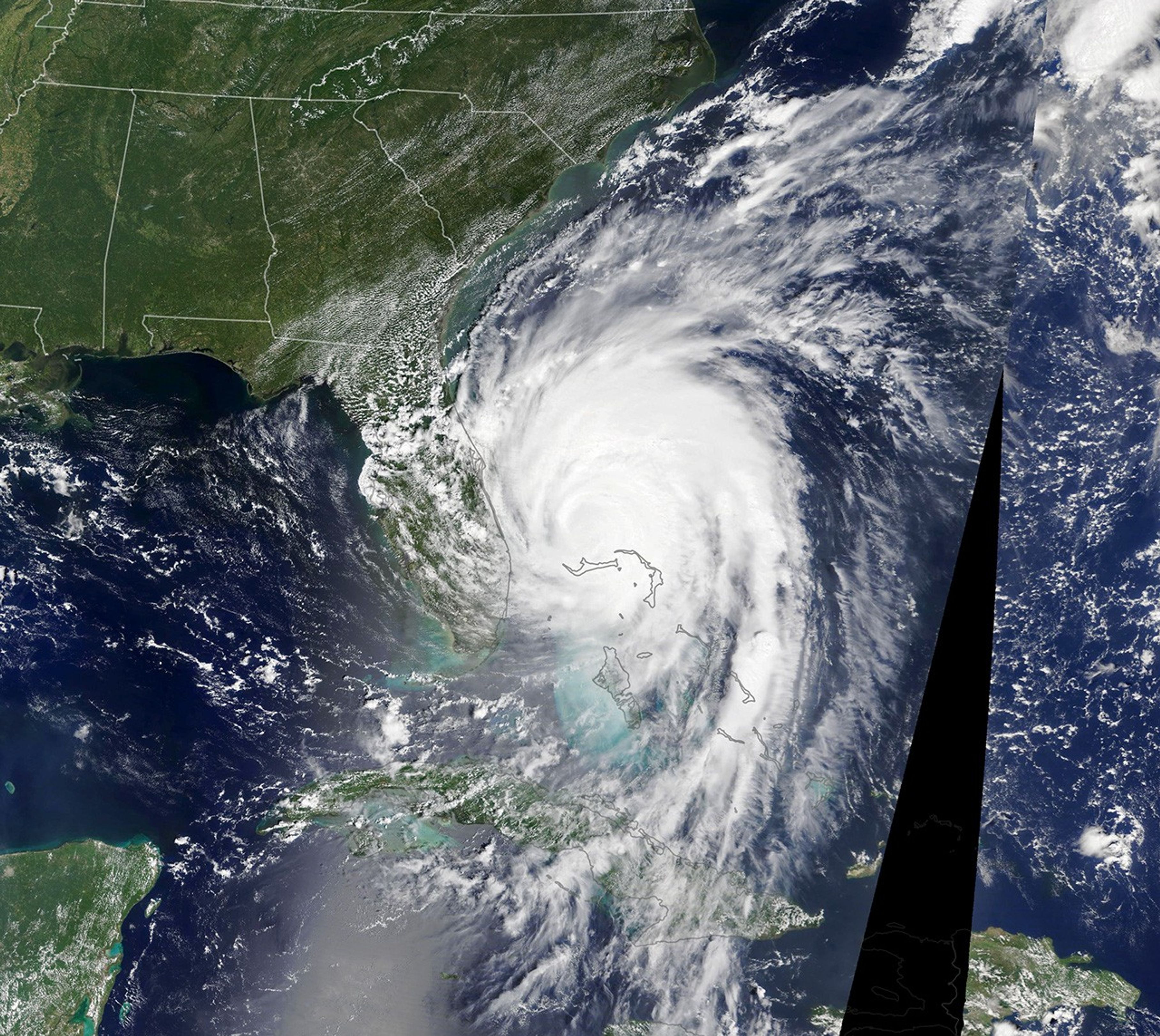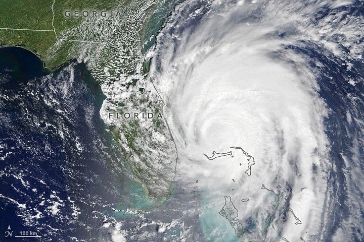
After pummeling parts of the Bahamas for several days, Hurricane Dorian has started moving north-northwest toward the United States.
The Moderate Resolution Imaging Spectroradiometer (MODIS) on NASA’s Terra satellite captured this natural-color image of the storm at 12:15 p.m. Eastern Daylight Time (16:15 Universal Time) on September 3, 2019. The eye was just north of Grand Bahama Island, the northernmost of the Bahama islands. It was moving northwest at 3 miles (5 kilometers) per hour. Though Dorian had weakened some, the storm was still causing a destructive storm surge and had maximum sustained winds of 110 miles (175 kilometers) per hour around the time the image was acquired.
National Hurricane Center forecasters are warning that the storm will move dangerously close to the coasts of Florida, Georgia, South Carolina, and North Carolina in the coming days.
References & Resources
- Bahama Press (2019, September 3) Dorian Affects New Providence with Mass Flooding in Many Communities. Accessed September 3, 2019.
- Forbes (2019, September 3) Why Hurricane Dorian Has Stalled Over the Bahamas. Accessed September 3, 2019.
- National Hurricane Center (2019, September 3) Dorian. Accessed September 3, 2019.
- NASA Hurricane and Typhoon Updates (2019, September 3) Dorian. Accessed September 3, 2019.
- NASA Disasters Program (2019, September 3) Hurricane Dorian 2019. Accessed September 3, 2019.
- NASA Earth Observatory (2019, September 3) Hurricane Dorian. Accessed September 3, 2019.
NASA Earth Observatory image by Lauren Dauphin, using MODIS data from NASA EOSDIS/LANCE and GIBS/Worldview. Caption by Adam Voiland.