Suggested Searches

1 min read

Hurricane Frances

Instruments:
2004-09-03 00:00:00
September 3, 2004

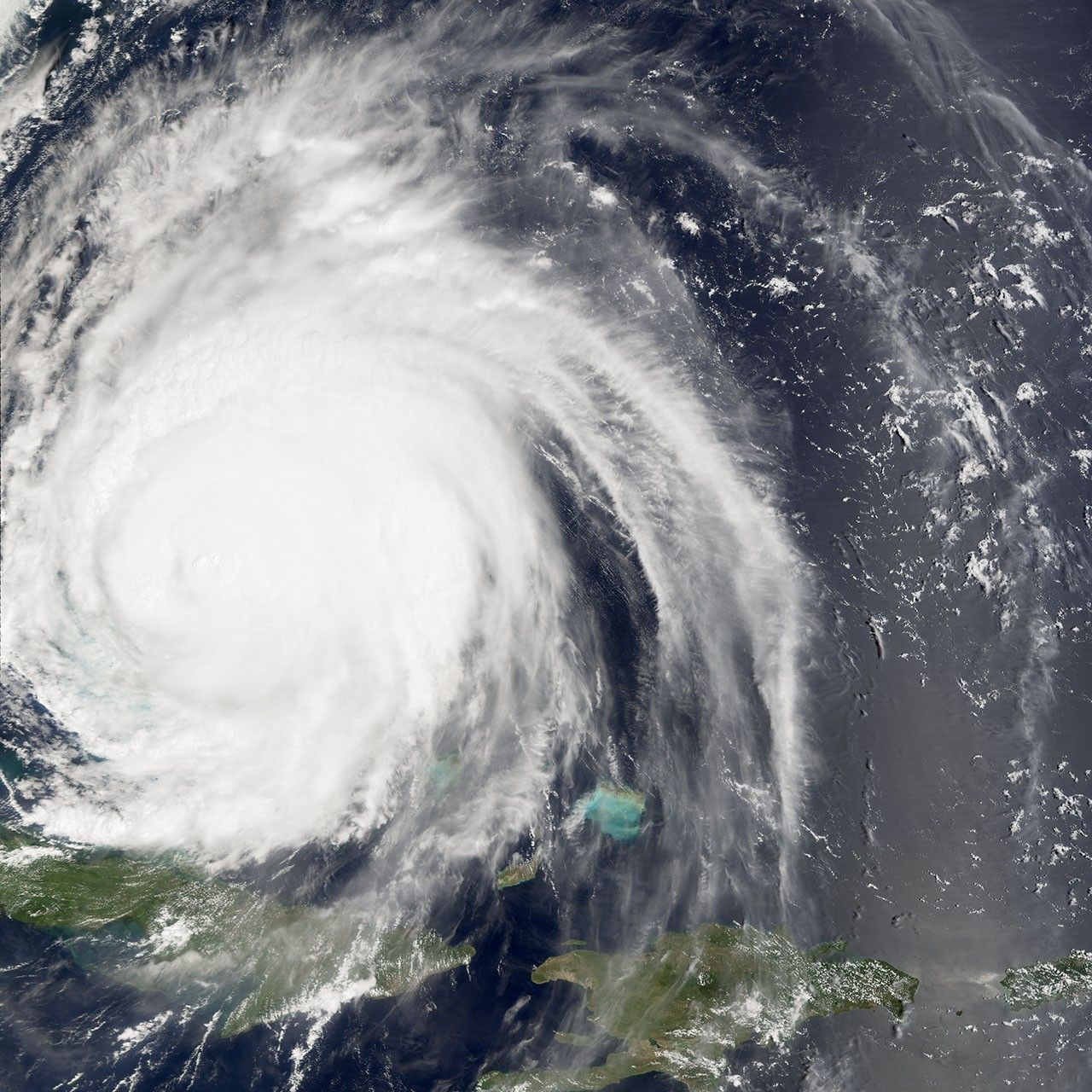
The MODIS instrument aboard NASA's Terra satellite captured this true-color image of Hurricane Frances on September 3, 2004 at 15:15 UTC (11:15 AM EDT). At the time this image was taken, Frances was located approximately 65 km (40 miles) northwest of Eleuthera Island in the Bahamas. Maximum sustained winds had decreased to 185 km/hr (115 mph) and the minimum central pressure had risen to 957 millibars. Frances was moving towards the northwest at 9 mph.

References & Resources

NASA image courtesy Jesse Allen, NASA's Earth Observatory.

You may also be interested in:

Stay up-to-date with the latest content from NASA as we explore the universe and discover more about our home planet.

Hurricane Kiko Nears Hawaii
2 min read

The storm became a major hurricane while traversing the eastern Pacific but weakened as it approached the islands.

Article
Hurricane Erin Roils in the Atlantic
3 min read

The major hurricane steered clear of land but delivered tropical storm conditions to coastal areas along its path.

Article
Imelda and Humberto Crowd the Atlantic
3 min read

The tropical cyclones are close enough in proximity that they may influence one another.

Article