


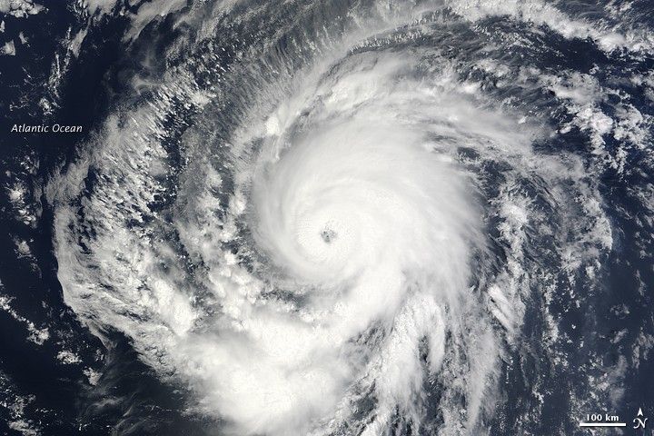
According to a bulletin released by the U.S. National Hurricane Center at 5 p.m. Atlantic Standard Time on September 9, 2009, the eye of Hurricane Fred hovered over the Atlantic Ocean some 955 kilometers (595 miles) west of the southernmost Cape Verde Islands. With maximum sustained wind speeds of 185 kilometers (115 miles) per hour, Fred was a Category 3 hurricane. The National Hurricane Center reported, however, that the storm had weakened slightly over the previous several hours, and was expected to continue weakening over the subsequent 48 hours.
The Moderate Resolution Imaging Spectroradiometer (MODIS) on NASA’s Terra satellite captured this true-color image of Hurricane Fred at 8:55 a.m. Atlantic Standard Time (12:55 UTC) on September 9, 2009. Spanning hundreds of kilometers, Fred was traveling northwestward over the Atlantic Ocean.
The high-resolution image provided above is at MODIS’ full spatial resolution (level of detail) of 250 meters per pixel. The MODIS Rapid Response System provides this image at additional resolutions.
References & Resources
NASA image by Jeff Schmaltz, MODIS Rapid Response Team, Goddard Space Flight Center. Caption by Michon Scott.


