For the first time in a decade, a hurricane is poised to strike Florida.
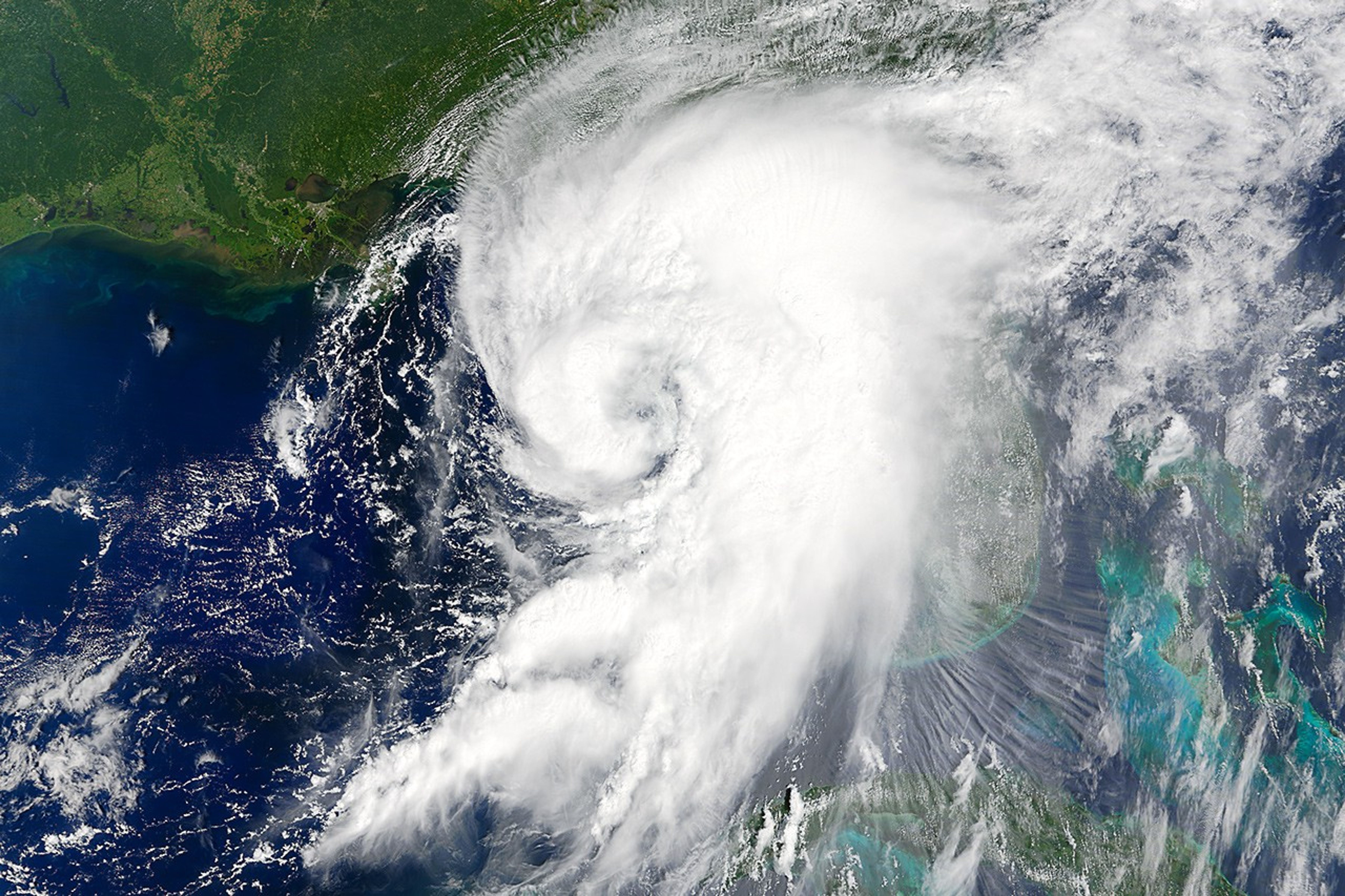
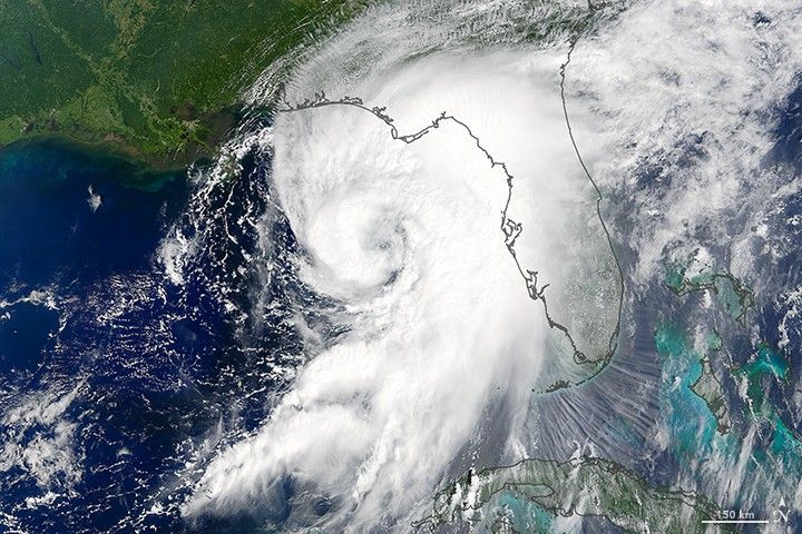
At 12:25 p.m. local time (16:25 Universal Time) on September 1, 2016, the Moderate Resolution Imaging Spectroradiometer (MODIS) on NASA’s Terra satellite captured this image of Hurricane Hermine churning toward Florida’s Gulf Coast. A few hours after the image was acquired, the National Hurricane Center announced that the storm’s maximum sustained winds had increased to 75 miles (120 kilometers) per hour—enough to make Hermine a category 1 hurricane.
Forecasters expect the storm to make landfall near the Big Bend region of Florida’s Gulf Coast late on Thursday. After that, Hermine will push northeast through southeastern Georgia and eastern South Carolina.
References & Resources
- National Hurricane Center (2016, September 1) Hurricane Hermine Advisor Archive. Accessed September 1, 2016.
- The Washington Post (2016, September 1) A hurricane hasn’t made Florida landfall in over 10 years. Hermine is set to end that streak. Accessed September 1, 2016.
- UniSys Weather (2016, September 1) Tropical Storm Hermine. Accessed September 1, 2016.
- Weather Underground (2016, September 1) Intensifying Tropical Storm Hermine Beginning to Close off an Eye.
NASA image by Jeff Schmaltz, LANCE/EOSDIS Rapid Response. Caption by Adam Voiland.