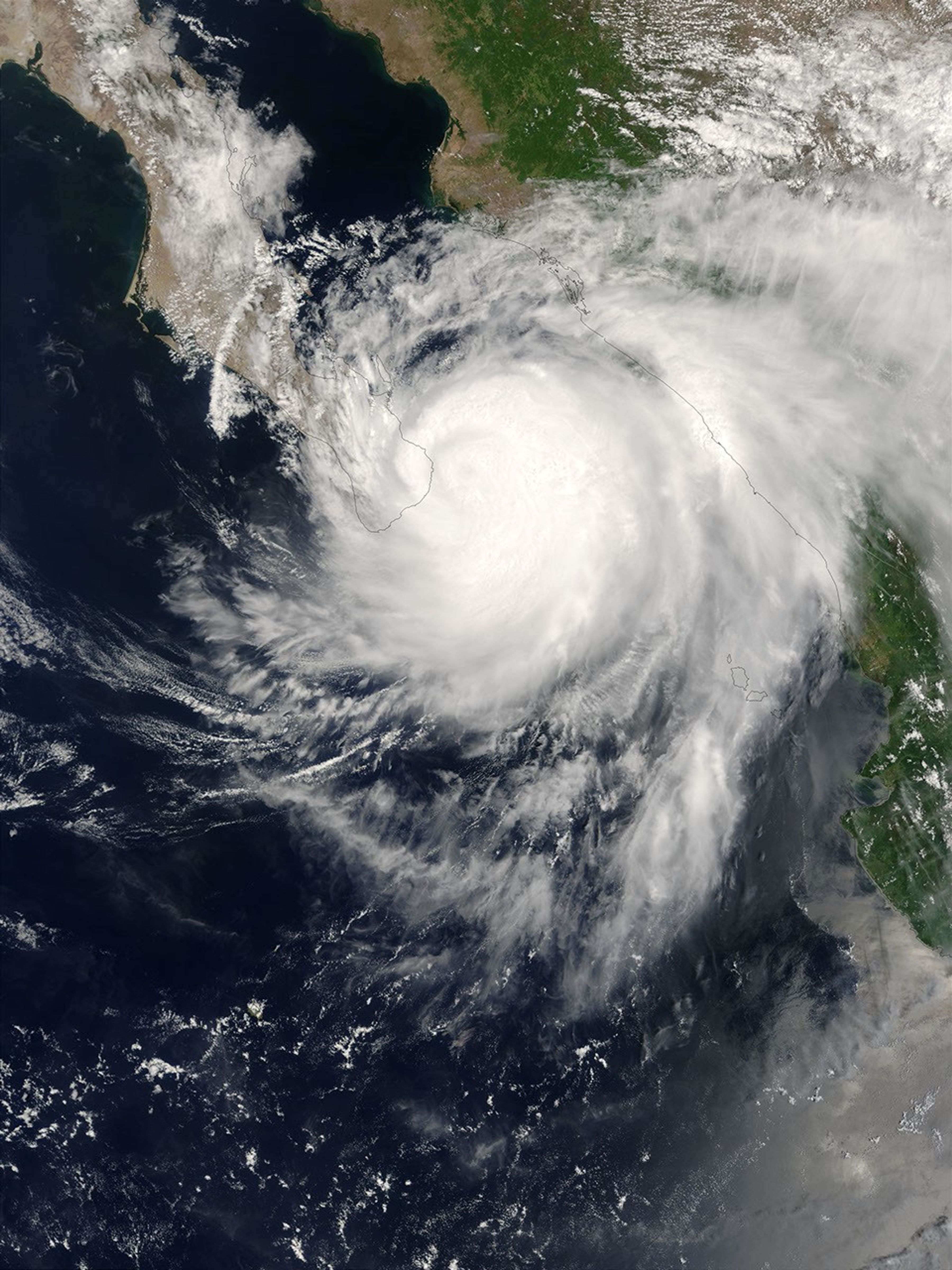

The MODIS instrument onboard NASA’s Terra spacecraft captured this true-color image of Hurricane Ignacio as it was bearing down on the southern tip of Baja.
At the time this image was taken, Ignacio was packing winds near 105 mph, making it a Category 2 storm on the Saffir-Simpson scale. On Monday, Aug. 25, 2003, the National Hurricane center issued a warning that the storm could produce 20 inches or more of rain to fall in the southern baja region and said the rains could cause “life-threatening” flash floods and mudslides. However, the storm is expected to weaken significantly over the next 24 hours as its winds spiral across land.
References & Resources
Image courtesy Jeff Schmaltz, MODIS Land Rapid Response Team at NASA GSFC