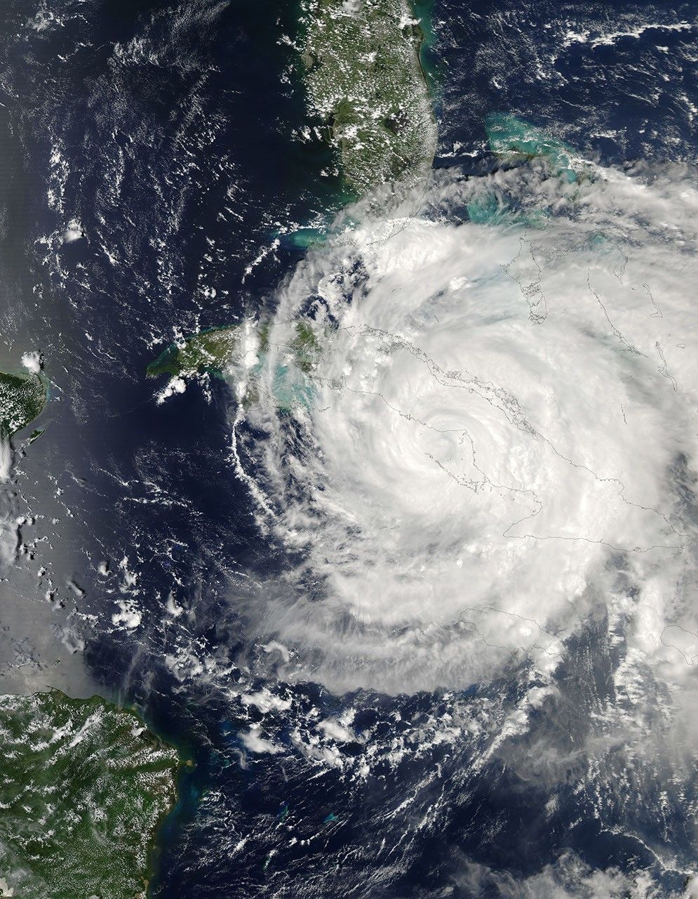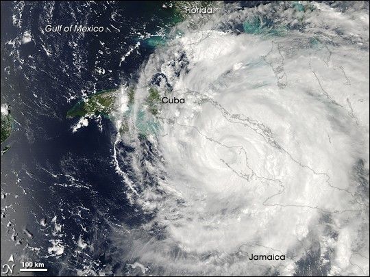
In the early morning hours of September 7, 2008, Hurricane Ike slammed into eastern Cuba as a Category 3 storm. The storm re-emerged over the southwestern coastline of the island on the afternoon of September 8 as a Category 2 storm. This image of Ike was captured by the Moderate Resolution Imaging Spectroradiometer (MODIS) on NASA’s Aqua satellite that afternoon. The closed eye of the storm was over water just offshore of the center of the western coast. Clouds span almost the entire island, cover the Bahamas (upper right), and graze the southern tip of Florida.
The high-resolution image provided above is at MODIS’ full spatial resolution (level of detail) of 250 meters per pixel. The MODIS Rapid Response System provides this image at additional resolutions.
References & Resources
NASA image by Jeff Schmaltz, MODIS Rapid Response Team, Goddard Space Flight Center. Caption by Rebecca Lindsey.