![Request for Information – Potential [Placeholder for Prize]](https://assets.science.nasa.gov/dynamicimage/assets/science/psd/solar/2023/09/s/solarsystem_0.jpg?w=1024)


September 9, 2004
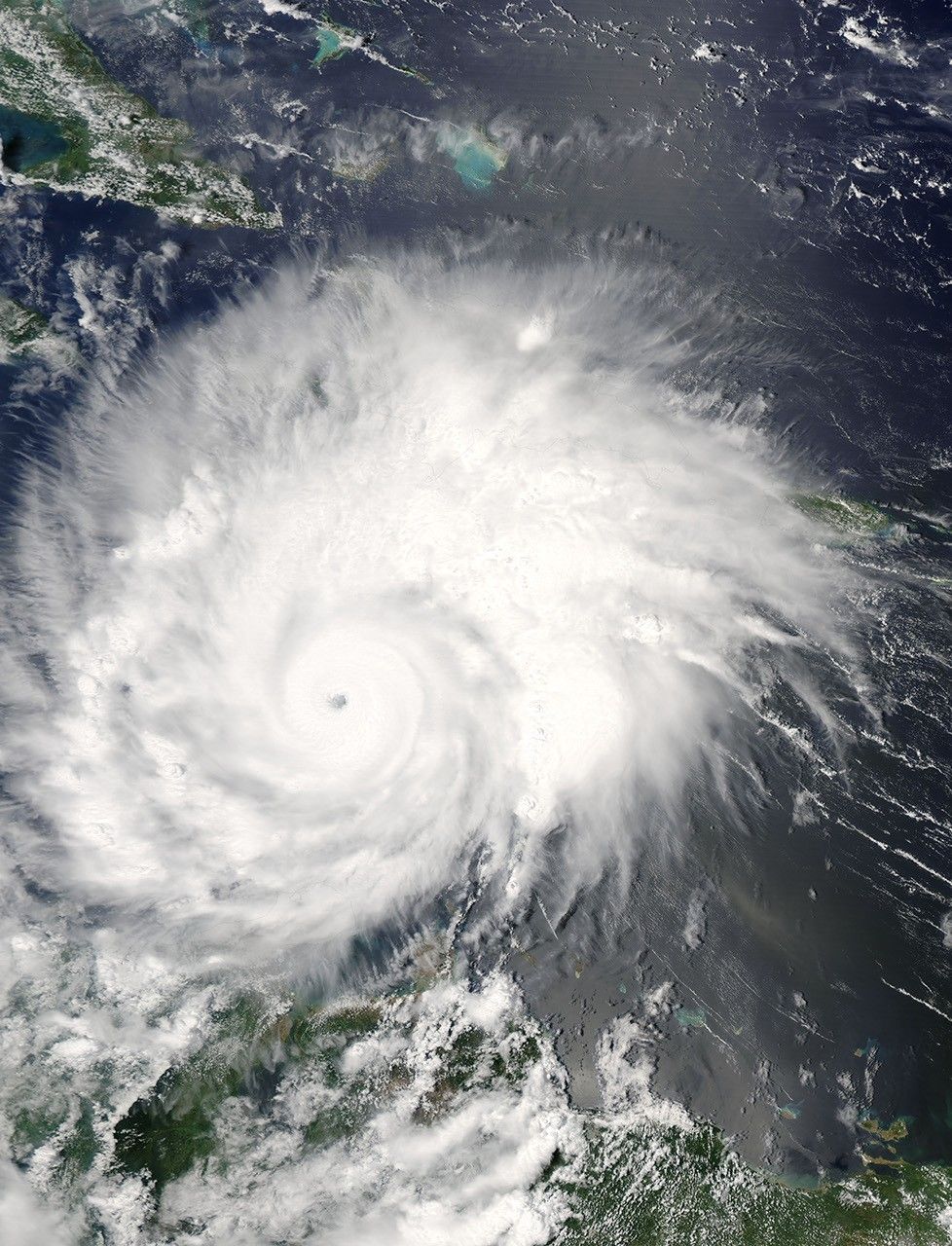
When the Moderate Resolution Imaging Spectroradiometer (MODIS) on NASA’s Aqua satellite captured this image at 1:45 p.m. Eastern Daylight Savings time on September 9, 2004, Hurricane Ivan had dropped from deadly Category 5 hurricane to a still dangerous Category 4 storm. The storm had winds of 240 kilometers per hour (150 mph) with stronger gusts. According to the National Hurricane Center, Ivan is on course for Jamaica, seen on the left edge of the image below Cuba.
References & Resources
NASA image courtesy Jacques Descloitres, MODIS Rapid Response Team at NASA GSFC