


![Request for Information – Potential [Placeholder for Prize]](https://assets.science.nasa.gov/dynamicimage/assets/science/psd/solar/2023/09/s/solarsystem_0.jpg?w=1024)


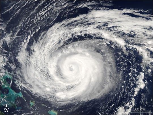
People in the northwestern Bahamas are bracing as Hurricane Jeanne approaches their shores. The storm is expected to blow over Abaco Island and Grand Bahama Island on Saturday, September 25, 2004. When the Moderate Resolution Imaging Spectroradiometer (MODIS) on NASA’s Aqua satellite captured this image of the storm at 12 p.m. on September 23, Jeanne was immediately north of the southeastern Bahamas and the Turks and Caicos Islands. At that time, the storm had sustained winds of 165 kilometers per hour (105 mph), making it a Category 2 hurricane. The National Hurricane Center expected the storm to make landfall in central Florida on Sunday, September 26.
The large image provided above has a resolution of 250 meters per pixel. It is available in additional resolutions and formats.
References & Resources
NASA image courtesy Jeff Schmaltz, MODIS Land Rapid Response Team at NASA GSFC


