Suggested Searches

1 min read

Hurricane Juan

Instruments:
2003-09-27 00:00:00
September 27, 2003

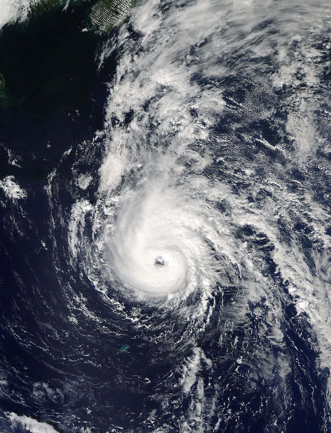
The MODIS instrument onboard NASA’s Aqua satellite captured this true-color image of Hurricane Juan approximately 645 miles south of Halifax, Nova Scotia. At the time this image was taken on September 27, 2003, Juan was packing sustained winds of 85 mph and was moving to the north-northwest at 7 mph.

References & Resources

Image courtesy Jacques Descloitres, MODIS Land Rapid Response Team at NASA GSFC.
You may also be interested in:

Stay up-to-date with the latest content from NASA as we explore the universe and discover more about our home planet.

Nebraska’s Wide, Rolling Domain
3 min read

The Nebraska Sandhills—the largest system of sand dunes in the Western Hemisphere—stretch across about one-quarter of the state.

Article
Tropical Storm Arthur
2 min read

The first named storm of the 2026 Atlantic hurricane season brought intense rainfall and the threat of flash flooding to…

Article
Wave of Dust Rolls Through Texas
3 min read

An advancing cold front kicked up a sharp line of sand and other small particles that swept over the high…

Article