


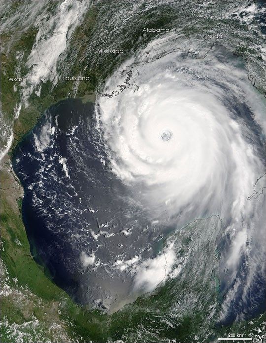
“Katrina is comparable in intensity to Hurricane Camille of 1969, only larger,”warned the National Hurricane Center on Sunday, August 28, 2005. By this time, Hurricane Katrina was set to become one of the most powerful storms to strike the United States, with winds of 257 kilometers per hour (160 miles per hour) and stronger gusts. The air pressure, another indicator of hurricane strength, at the center of this Category 5 storm measured 902 millibars, the fourth lowest air pressure on record for an Atlantic storm. The lower the air pressure, the more powerful the storm.
Two hours after the National Hurricane Center issued their warning, the Moderate Resolution Spectroradiometer (MODIS) captured this image from NASA’s Terra satellite at 1:00 p.m. Eastern Daylight Savings Time. The massive storm covers much of the Gulf of Mexico, spanning from the U.S. coast to the Yucatan Peninsula.
The large image provided above has a resolution of 500 meters per pixel. The image is available in additional resolutions from the MODIS Rapid Response Team.
References & Resources
NASA image courtesy the MODIS Rapid Response Team at Goddard Space Flight Center


