





















September 1, 2016
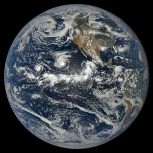
At 12:50 p.m. Hawaii Standard Time on September 1, 2016, the Moderate Resolution Imaging Spectroradiometer (MODIS) on NASA’s Aqua satellite captured this image of Hurricane Lester on approach to the island of Hawaii. At this time, Lester was located about 1,200 kilometers east of Hilo. It had developed a more well-defined eye and had sustained wind speeds of 110 miles (175 kilometers) per hour.
References & Resources
- Central Pacific Hurricane Center (2016, September 1) Hurricane Lester Forecast/Advisory Number 33. Accessed September 2, 2016.
- Central Pacific Hurricane Center (2016, September 1) Hurricane Lester Discussion Number 33. Accessed September 2, 2016.
- Unisys Weather (2016, September 2) Hurricane-4 Lester. Accessed September 2, 2016.
- NASA Earth Observatory (2016, August 31) Hurricanes Madeline and Lester.
NASA image by Jeff Schmaltz, LANCE/EOSDIS Rapid Response . Caption by Kathryn Hansen.