


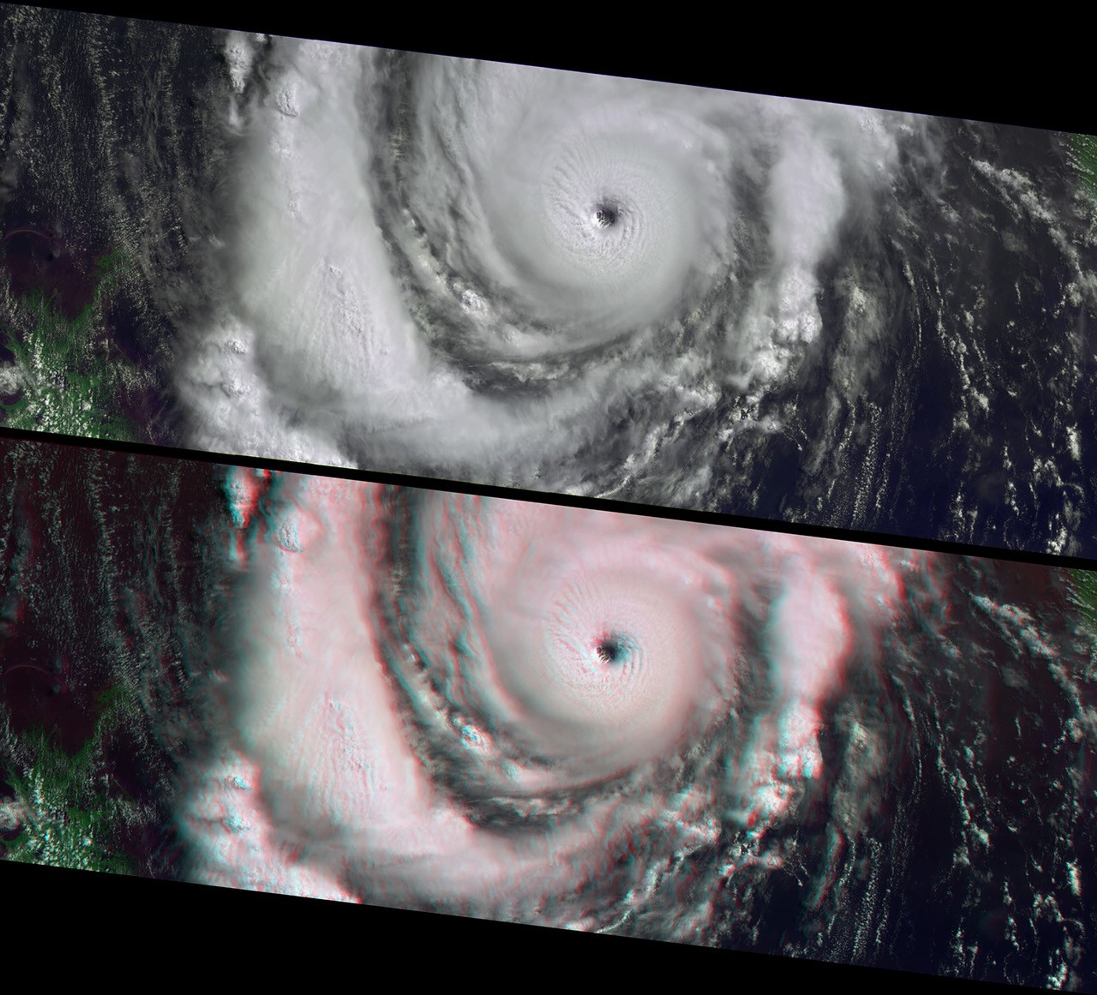
Characteristics of a strengthening Category 3 Hurricane Lili areapparent in these images from the Multi-angle Imaging SpectroRadiometer(MISR), including a well-developed clearing at the hurricane eye. Whenthese views were acquired on October 2, 2002, Lili was approaching theGulf coast of the United States and rapidly strengthening towardCategory 4 status. The storm's power reached its peak less than twelvehours later, and although it weakened overnight, this was still adangerous system as it blew across the Louisiana coast on the morning ofOctober 3. Lili was the first hurricane to make landfall in the UnitedStates since Hurricane Irene in 1999. Twenty-eight parishes in Louisianawere declared disaster areas, yet this hurricane fortunately caused muchless damage than what could have resulted from an event of thismagnitude.
The top panel uses data from MISR's vertical-viewing (nadir) cameraand data from the red, near-infrared, and blue spectral bands isdisplayed as red, green and blue to create a false-color view in whichland surfaces appear bright green. The nadir and stereo anaglyph viewsare identical in their band choices, except that the anaglyph uses datafrom the 26-degree forward-viewing camera for the red band. The imagesare oriented with north to the left. Observing the spectacularthree-dimensional structure of the hurricane eyewall and of convectivethunderclouds present in the storm's spiral arms requires the use ofred-blue glasses, with the red filter placed over your left eye.Information on ordering glasses can be found athttp://photojournal.jpl.nasa.gov/Help/VendorList.html#Glasses.
The Multi-angle Imaging SpectroRadiometer observes the daylit Earthcontinuously from pole to pole, and every 9 days views the entire globebetween 82 degrees north and 82 degrees south latitude. The MISR Browse Image Viewer provides access tolow-resolution true-color versions of these images. These dataproducts were generated from a portion of the imagery acquired duringTerra orbit 14844. The panels cover an area of about 380 kilometers x985 kilometers, and utilize data from blocks 67 to 73 within WorldReference System-2 path 21.
References & Resources
Image courtesy NASA/GSFC/LaRC/JPL, MISR Team.


