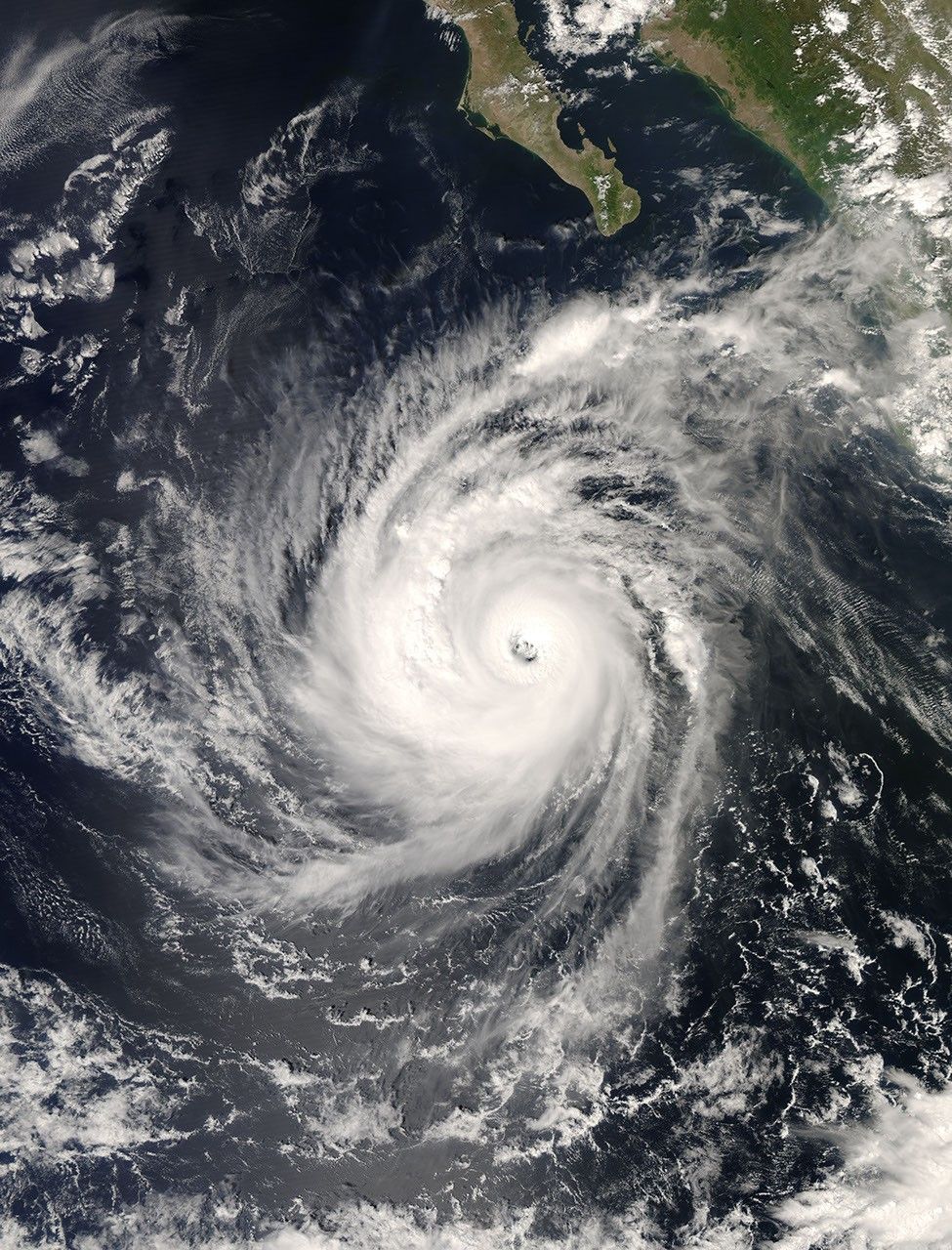

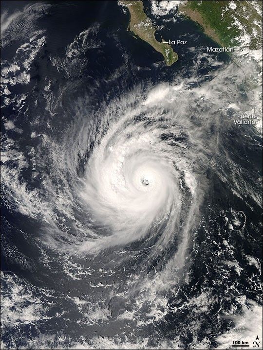
In the Eastern Pacific, in the early afternoon hours of October 8, 2008, Hurricane Norbert grew to a Category 4 hurricane. By October 12, the storm was expected to pass over the southern end of Baja California and reach inland in northern Mexico, according to the U.S. National Hurricane Center.
The Moderate Resolution Imaging Spectroradiometer (MODIS) on NASA’s Aqua satellite captured this image of the storm at 1:55 p.m. local time (20:55 UTC). According to the National Hurricane Center’s warning, issued within minutes of this image acquisition, the eye of the storm was located roughly 715 kilometers (445 miles) south of the southern tip of Baja Caifornia. Although the storm appears within striking distance of Baja California’s La Paz and mainland resort towns Mazatlán and Puerto Vallarta in this image, its path remained uncertain on October 8. According to the National Hurricane Center’s predictions, Norbert might veer slightly toward the northwest, sparing some towns that initially appeared to be within its path.
On October 8, 2008, Hurricane Norbert had maximum sustained winds speeds near 215 kilometers (135 miles) per hour, with higher gusts, and hurricane-force winds extended 55 kilometers (35 miles) outward from the storm’s center. By the following day, the storm had weakened somewhat but remained a major hurricane, now centered some 620 kilometers (385 miles) south-southwest of the southern tip of Baja California. Its maximum sustained winds, now reduced to 185 kilometers (115 miles) per hour, remained strong enough to meddle with cruise ship itineraries along the Pacific Coast of Mexico.
References & Resources
- National Hurricane Center. (2008, October 9). Hurricane Norbert. Accessed October 9, 2008.
- National Hurricane Center. (2008, October 9). Hurricane Norbert Public Advisory Archive. Accessed October 9, 2008.
- Sloan, G. (2008, October 9). Hurricane Norbert barrels toward cruise ships off Mexico. USA Today. Accessed October 9, 2008.
NASA images created by Jeff Schmaltz, MODIS Rapid Response, NASA Goddard Space Flight Center. Caption by Michon Scott.