


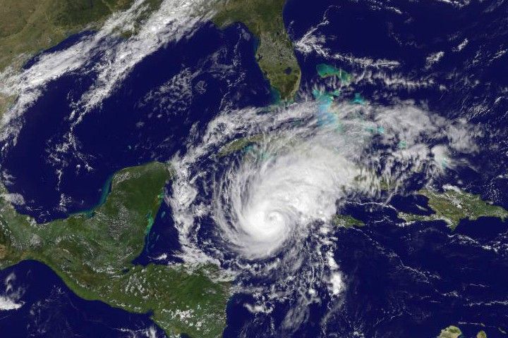
Hurricane Paloma was well-formed, with distinctive spirals and a cleareye on November 7, 2008, when the GOES satellite captured this image. Thestorm formed off the coast of Nicaragua on November 5, and became ahurricane the next day. When GOES captured this image, Paloma was movingsteadily north-northeast at 10 kilometers per hour (6 miles per hour) oncourse towards Cuba. As it moved over the warm waters of the Caribbean, itstrengthened. At 1:00 Eastern Standard time, about an hour before this imagewas taken, the storm had sustained winds near 150 km/hr (90 mph) withstronger gusts, said the National Hurricane Center. By 4:00, winds hadpicked up to 165 km/hr (105 mph), making Paloma a Category 2 storm. It wasat this strength that the storm barreled into the Cayman Islands a shorttime after this image was taken.
The National Hurricane Center forecast that Paloma would continue tointensify through November 7, possibly reaching Category 3 status beforeweakening on November 8. The storm was forecast to come ashore over Cuba onNovember 8 and 9. The Cuban government has issued a hurricane warning tofour provinces, said the National Hurricane Center.
References & Resources
- National Hurricane Center. (2008, November 7). Hurricane Paloma Advisory Archive. NOAA. Accessed November 7, 2008.
NASA image created by Marit Jentoft-Nilsen, NASA GOES Project Science Office. Caption by Holli Riebeek.


