


![Request for Information – Potential [Placeholder for Prize]](https://assets.science.nasa.gov/dynamicimage/assets/science/psd/solar/2023/09/s/solarsystem_0.jpg?w=1024)


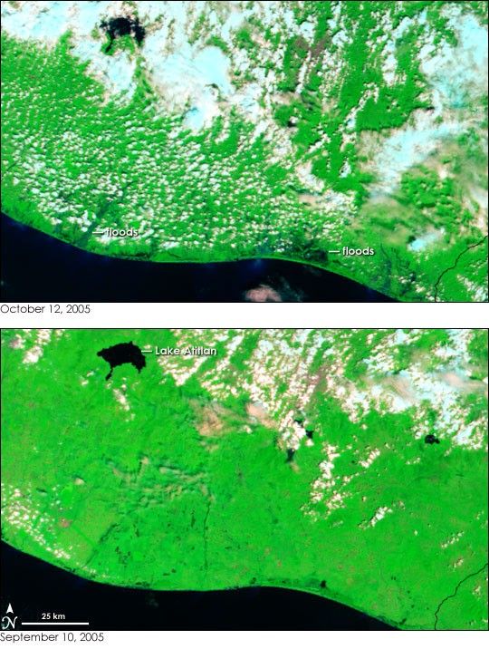
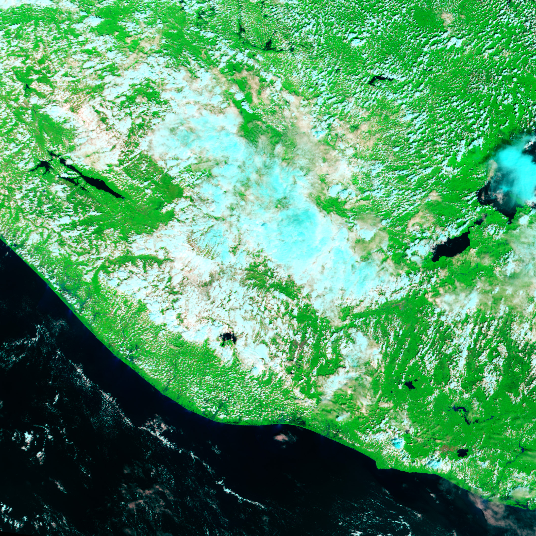
- October 12, 2005 (2.5 MB)
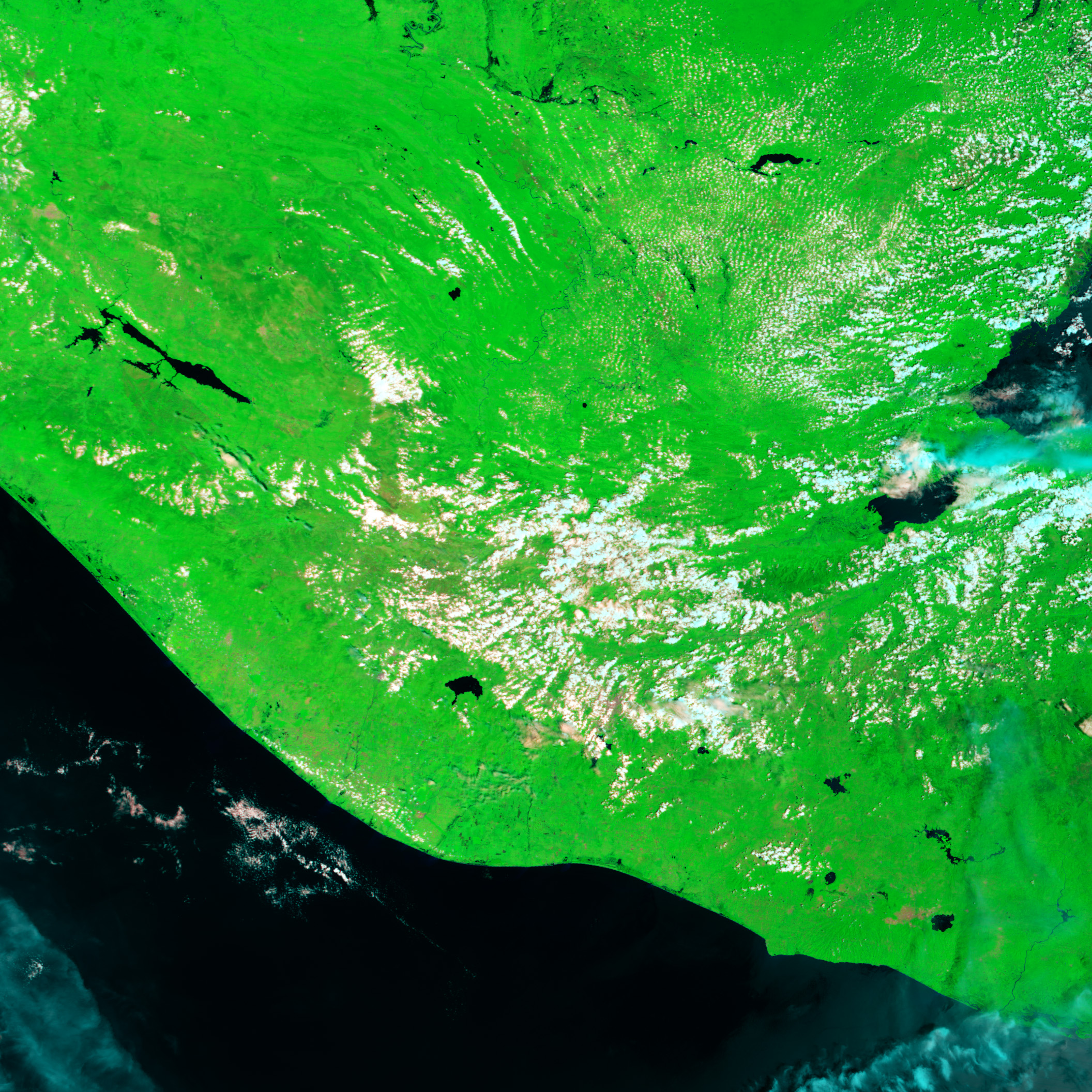
- September 10, 2005 (2.1 MB)
Devastating floods swept across Guatemala in early October 2005. Stan, a tropical cyclone that wavered between hurricane and tropical storm, showered the country with heavy rain for several days starting on October 1. When the Moderate Resolution Imaging Spectroradiometer (MODIS) on NASA’s Terra satellite captured the top image on October 12, all of the rivers draining from the Sierra Madre into the Pacific Ocean were brimming with flood water. Water, black and dark blue in the false-color image, widens the rivers and smudges the surrounding landscape with dark colors.
Terra MODIS acquired the lower image on September 10, 2005. The scene is clear enough to show Lake Atitlan, the location of massive mudslides which buried thousands in the Mayan town of Panabaj. Destructive mudslides, though none so large, plagued communities throughout Guatemala, El Salvador, Nicaragua, Honduras, and Mexico.
References & Resources
NASA images courtesy Jesse Allen, based on data from the MODIS Rapid Response Team at NASA GSFC


