- Animations:
- web (2.8 MB QuickTime)
- broadcast (8.6 MB H.264 QuickTime)
- high-definition (23.6 MB H.264 QuickTime)
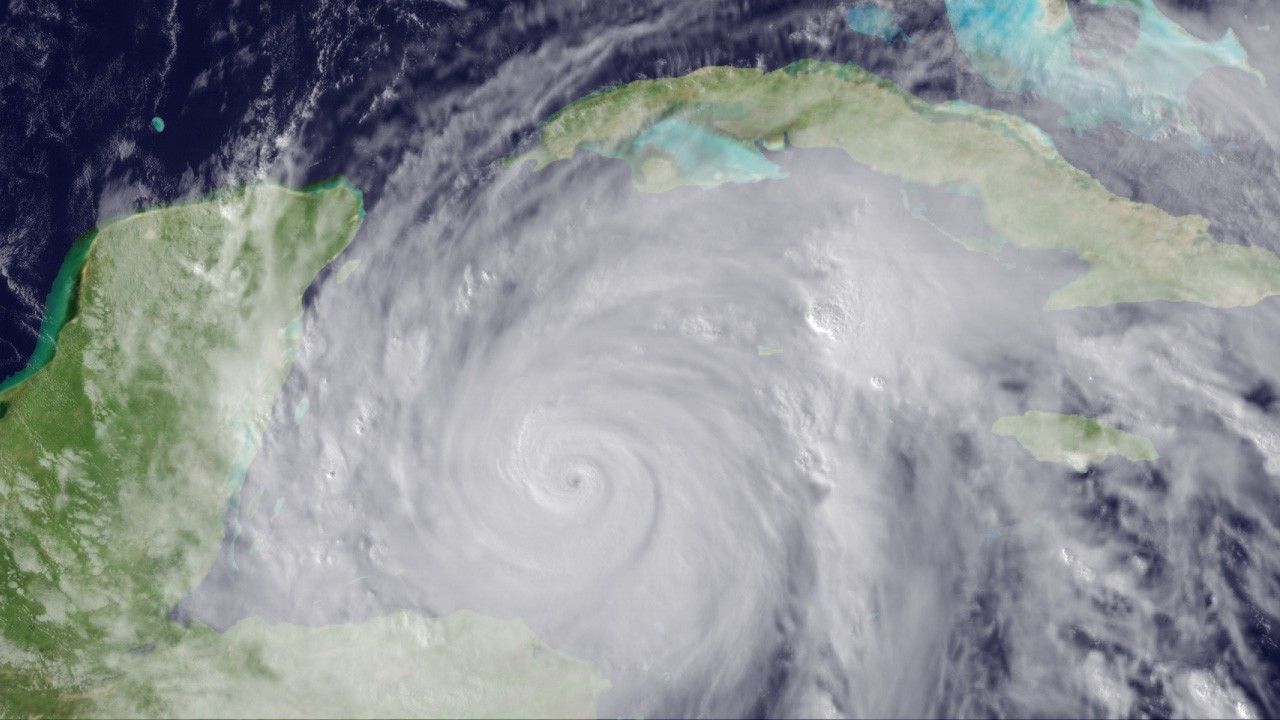
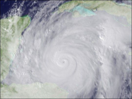
On the morning of October 19, 2005, National Oceanographic and Atmospheric Administration (NOAA) aircraft measured a pressure of 882 millibars in the center of Hurricane Wilma—the lowest pressure ever measured in an Atlantic hurricane. This low pressure earned Wilma the status of the strongest hurricane ever recorded in the Atlantic. As of October 20, the storm was moving northward through the western Caribbean Sea and toward the Yucatan Channel, which separates Mexico from Cuba. Predictions at that time were that once Wilma moved into the Gulf of Mexico, westerly winds would begin steering the storm toward Florida.
In this image, Wilma is sprawled across the entire western Caribbean Sea, with bands of clouds reaching from the Yucatan Peninsula and Honduras (left and lower left, respectively) all the way to Cuba and Jamaica (upper right and center right edge). The image is one frame of an animation that shows the development of the storm between 8:15 p.m. (Eastern Daylight Time) on October 18 and 4:45 p.m. on October 19 (00:15 to 20:45 UTC on October 19). At the beginning of the animation, the core of the storm is a smaller, bright disk of clouds off the coast of Honduras. Over the course of the animation, Wilma grows larger and spins and wobbles its way west-northwest. Thunderstorms embedded in the hurricane’s spiraling cloud bands explode and then subside over the course of the animation.
This image shows visible data collected by NOAA’s Geostationary Operational Environmental Satellite (GOES), combined with land surface data collected by NASA’s Moderate Resolution Imaging Spectroradiometer instrument. The animation uses GOES infrared data during the nighttime part of the animation (up until about 11:45 UTC on October 19) and visible data in the daytime portion.
References & Resources
NASA animation by Marit Jentoft-Nilsen