![Request for Information – Potential [Placeholder for Prize]](https://assets.science.nasa.gov/dynamicimage/assets/science/psd/solar/2023/09/s/solarsystem_0.jpg?w=1024)


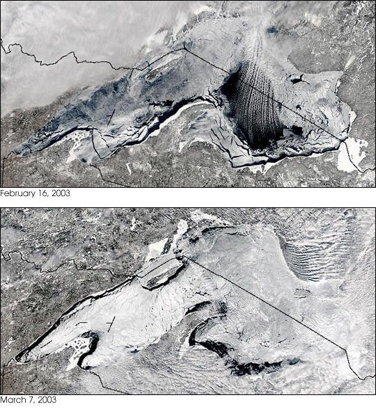
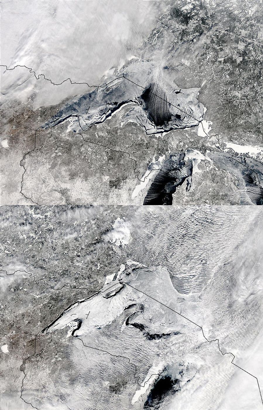
February 16, 2003
These Moderate Resolution Imaging Spectroradiometer (MODIS) images show the ice in Lake Superior on February 16, 2003, and again on March 7, 2003. It is very rare for Lake Superior to freeze over completely due to its large size and great depth, both of which inhibit freezing.
The high-resolution image provided above is 1 kilometer per pixel. The MODIS Rapid Response System provides these images at MODIS? maximum spatial resolution of 250 meters. (Links below.)
References & Resources
Image courtesy Jacques Descloitres, MODIS Rapid Response Team at NASA GSFC