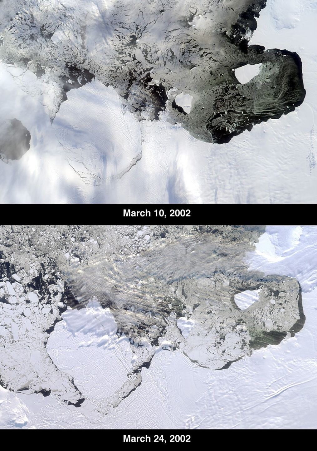
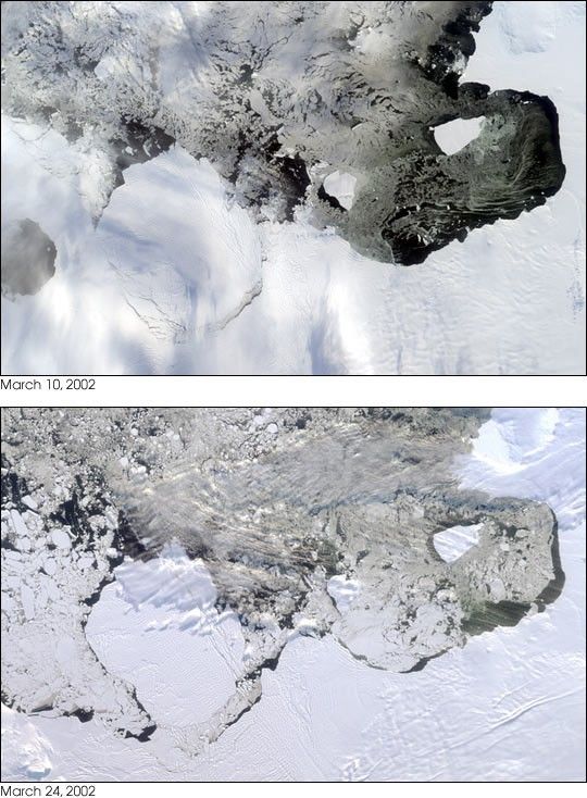
The Thwaites Ice Tongue is a large sheet of glacial ice extending from the WestAntarctic mainland into the southern Amundsen Sea. A large crack in the ThwaitesTongue was discovered in imagery from Terra’s Moderate Resolution ImagingSpectroradiometer (MODIS). Subsequent widening of the crack led to the calvingof a large iceberg. The development of this berg, designated B-22 by theNational Ice Center, can be observed in these images from the Multi-angleImaging SpectroRadiometer, also aboard Terra. The two views were acquired byMISR’s nadir (vertical-viewing) camera on March 10 and 24, 2002.
The B-22 iceberg, located below and to the left of image center, measuresapproximately 82 kilometers long x 62 kilometers wide. Comparison of the twoimages shows the berg to have drifted away from the ice shelf edge. The breakupof ice near the shelf edge, in the area surrounding B-22, is also visible in thelater image.
These natural-color images were acquired during Terra orbits 11843 and 12047,respectively. At the right-hand edge is Pine Island Bay, where the calving ofanother large iceberg (B-21) occurred in November 2001. B-21 subsequently splitinto two smaller bergs, both of which are visible to the right of B-22.
Antarctic researchers have reported an increase in the frequency of icebergcalvings in recent years. Whether this is the result of a regional climatevariation, or connected to the global warming trend, has not yet beenestablished.
References & Resources
Image courtesy NASA/GSFC/LaRC/JPL, MISR Team.