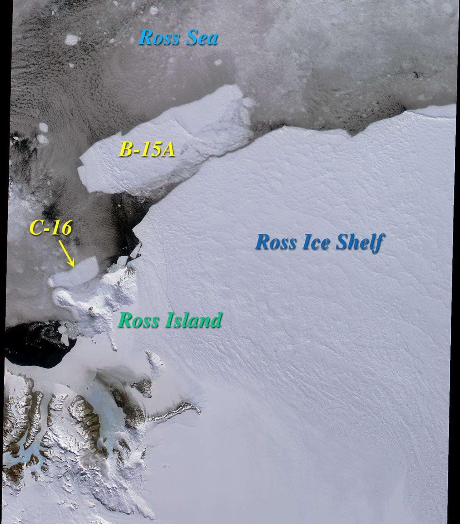


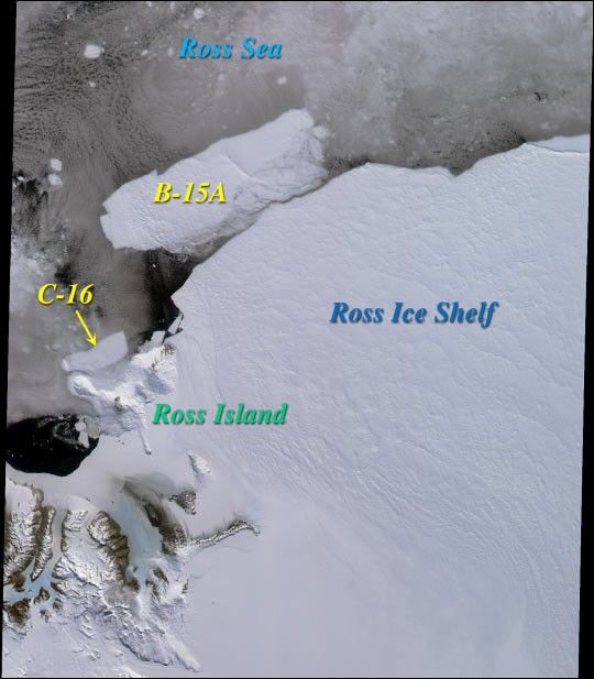
Two large icebergs, designated B-15A and C-16, are captured in thisMulti-angle Imaging Spectroradiometer (MISR)nadir camera view of the Ross Ice Shelf and Ross Sea in Antarctica. Theimage was acquired on December 10, 2000.
Iceberg C-16 calved off the ice shelf in late September and is nearly 50kilometers in length. It is seen here having migrated to the vicinity ofCape Bird on Ross Island. The initial letter designation in an iceberg'sname denotes the longitudinal quadrant in which it is first seen, andnew icebergs sighted in that quadrant are sequentially numbered. B-15divided from the ice shelf last March, and initially was nearly as largeas the state of Connecticut. It has since broken up into several pieces,hence the final letter designation in the berg shown in this image.
Ross Island lies between 77 and 78 degrees south latitude, and consistsof several volcanic peaks, of which the still active Mt. Erebus is thetallest (3794 meters). It overlooks McMurdo Station, a U.S. researchfacility located near the tip of the island's Hut Point Peninsula.
References & Resources
Image courtesy NASA/GSFC/JPL, MISR Team.