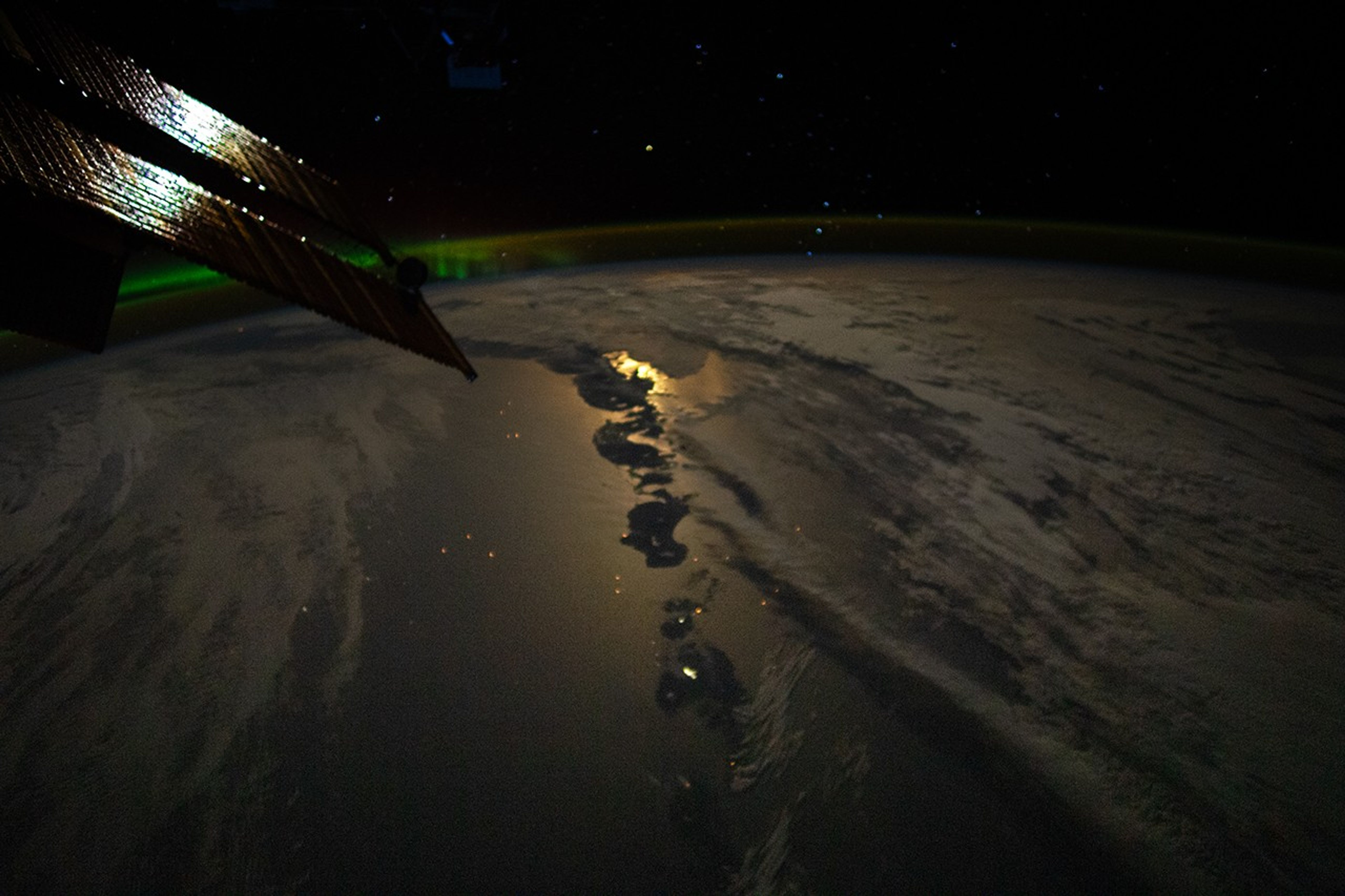
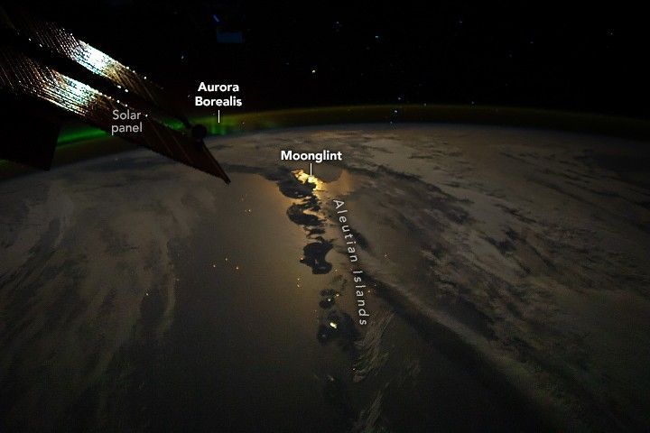
An astronaut aboard the International Space Station captured this photo of the Aleutian Islands off the coast of mainland Alaska. The archipelago is illuminated by moonglint—a phenomenon similar to sunglint that occurs only when the Moon’s light reflects from the water at a particular angle. Capturing moonglint is uncommon in astronaut photography.
While some archipelagos form from processes such as erosion and rising sea level, most island chains, including the Aleutians, are the result of volcanic eruptions. Occupying an area of about 6,800 square miles (17,611 square kilometers), the islands arc southwest then northwest for about 1,100 miles (1,800 kilometers) from the Alaskan Peninsula to Attu Island (not pictured). The Aleutian chain forms the boundary between the main body of the Pacific Ocean to the south and the Bering Sea to the north.
Notice the green light high in Earth’s atmosphere. This phenomenon is called the aurora borealis, also known as the northern lights. Massive bursts of energy from the Sun, such as solar flares and coronal mass ejections, can speed through space and sometimes impact Earth’s magnetic field. The interaction between the magnetic field and solar radiation causes the color display shown in the image. Auroras appear in different hues, from green and yellow to shades of purple and red. Auroras can also occur over the southern hemisphere, where they are known as the aurora australis (southern lights).
References & Resources
Astronaut photograph ISS067-E-363431 was acquired on September 17, 2022, with a Nikon D5 digital camera using a focal length of 28 millimeters. It is provided by the ISS Crew Earth Observations Facility and the Earth Science and Remote Sensing Unit, Johnson Space Center. The image was taken by a member of the Expedition 67 crew. The image has been cropped and enhanced to improve contrast, and lens artifacts have been removed. The International Space Station Program supports the laboratory as part of the ISS National Lab to help astronauts take pictures of Earth that will be of the greatest value to scientists and the public, and to make those images freely available on the Internet. Additional images taken by astronauts and cosmonauts can be viewed at the NASA/JSC Gateway to Astronaut Photography of Earth. Caption by Minna Adel Rubio, GeoControl Systems, JETS Contract at NASA-JSC.