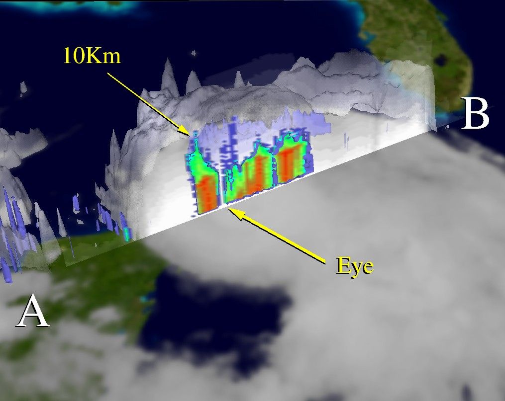

This image captures the formation of Hurricane Isidore, the first major storm of the 2002 Atlantic hurricane season. Isidore first developed from a tropical disturbance north of Venezuela on September 14. The image shows the vertical structure of precipitation within Isidore’s clouds, taken through the center of the storm at 7 a.m. local time on September 21, 2002. In this scene, the rain cross section is oriented from southwest to northeast and is labeled “AB.” The larger cloud and rainband structure is shown in white, while rainfall intensity is indicated by the different colors. Blue represents light rain and red shows the heaviest rain.
At the time this image was acquired, Isidore was passing through the narrow Yucatan Strait and was beginning to grow in intensity. Winds were 85 knots and the central pressure was 969 millibars. TRMM captured these data at a point when a slender eye was beginning to develop and intense thunderstorms were erupting in the storm’s core. Maximum cloud top heights of 10 km are shown adjacent to the eye. Isidore later became a major Category 3 hurricane before making landfall over the Yucatan Peninsula. As of the evening of Sept. 24, Isidore was being watched for possible landfall along the U.S. Gulf Coast.
References & Resources
Image courtesy Hal Pierce, NASA GSFC Mesoscale Atmospheric Processes Branch (Code 912). For more information and other examples of TRMM data, visit the TRMM Web site.