

February 2, 2014
Kilauea Lava Chews Through More Forest
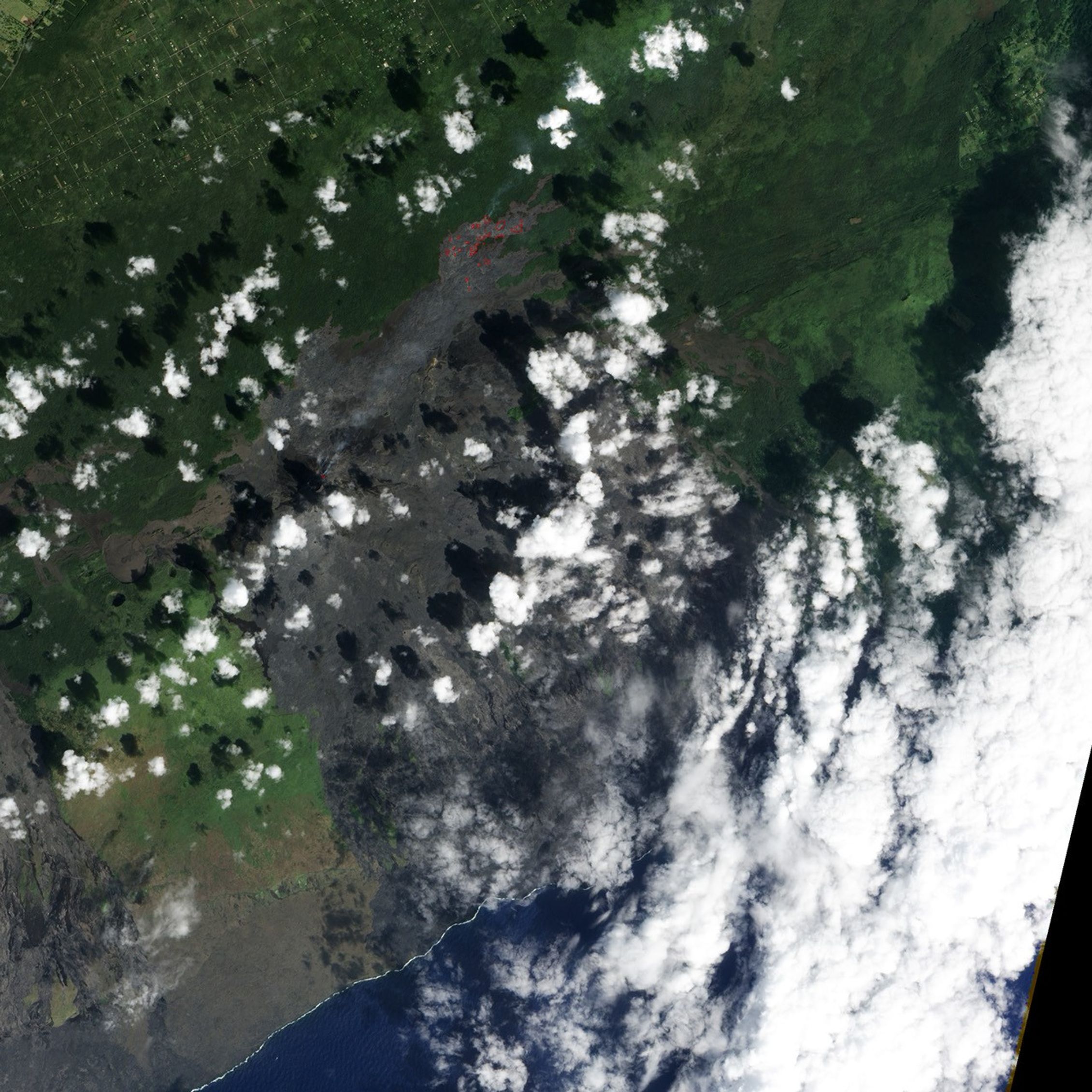
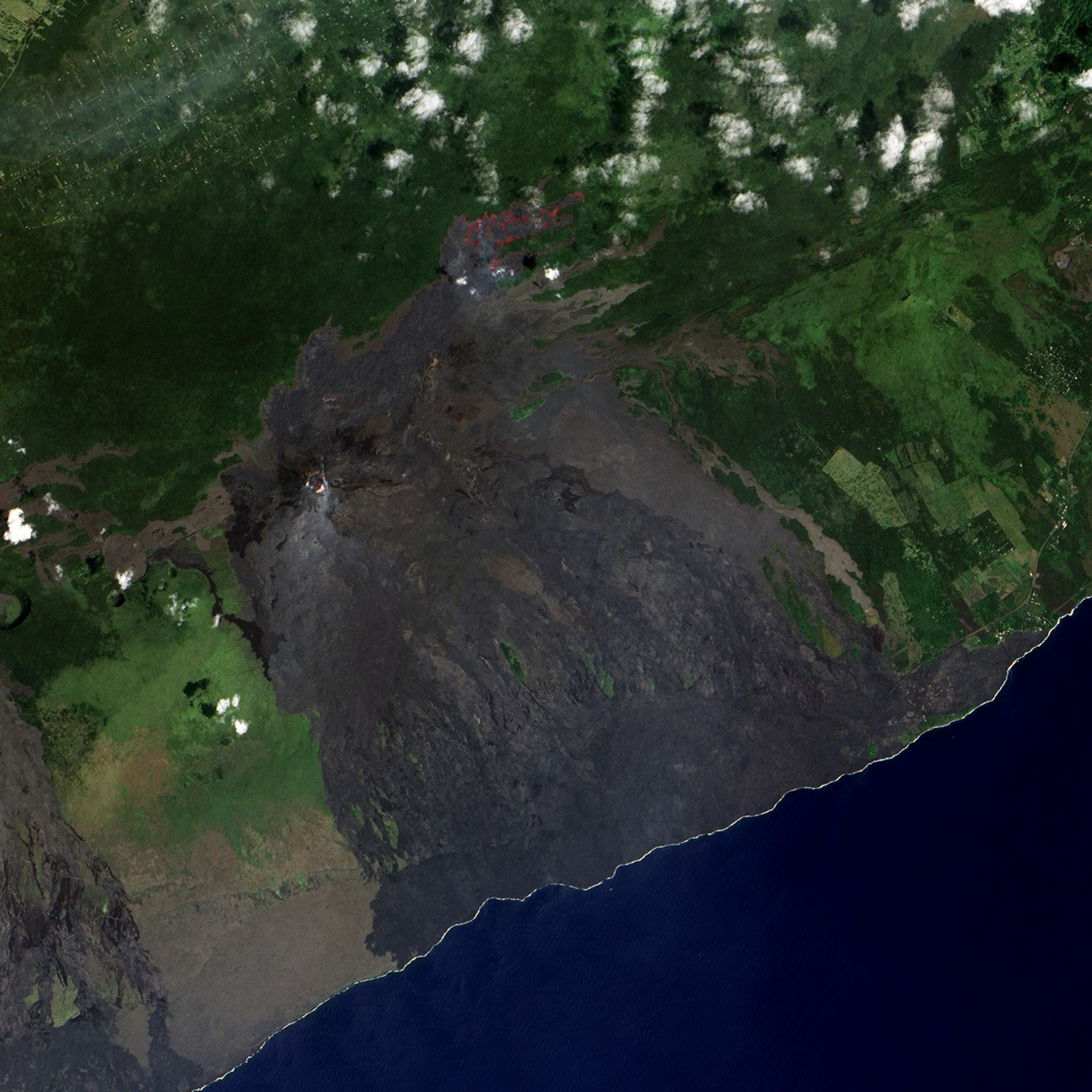
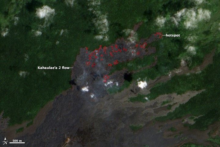
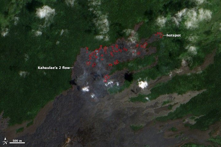
While most lava from the Pu’u ’O’o crater on Kilauea has flowed south towards the coast over the years, the most recent flow—Kahauale’a 2—is pushing northeast into ohia lehua forests in Hawaii’s interior. The Advanced Land Imager (ALI) on NASA’s Earth-Observing 1 (EO-1) captured these images of Kahauale’a 2 on February 2 and March 11, 2014.
Turn on the image comparison tool to see where the lava has advanced. The red outlines represent hotspots ALI detected by observing shortwave infrared light. Active flow features known as breakouts are present in many of the hotspots. Rocky lava flows appear black. Clouds are white. The reddish-brown areas along the edges of the lava flow are scorched forests.
Kahauale’a 2 is moving slowly, having only advanced by about 600 meters (2,000 feet) since November 2013. The halting advance is the result of cyclical changes in pressure about one kilometer beneath the surface that cause Kilauea’s summit and the Pu’u ’O’o’s vent to suddenly deflate and inflate over periods of a few days. When the summit deflates, the volume of lava flowing from Pu’u ’O’o decreases and the flow front stops moving forward. When the summit inflates, lava surges from Pu’u ’O’o, forming breakouts. However, the breakouts often appear well behind the stalled flow front, and it can take some time before they begin pushing the front forward.
While Kahauale’a 2 poses no immediate risk to human settlements, it could eventually encroach on communities to the northeast if it continues on its current path. In the past, lava from Pu’u ’O’o destroyed several communities, including the Royal Gardens subdivision, along the south coast of Hawaii.
References & Resources
- Big Island Video News Tracking Kahauale‘a 2 lava flow on Hawaii Island. Accessed April 9, 2014.
- Hawaii 24/7 Latest volcano and Kahauale‘a 2 lava flow update, Tuesday (April 8). Accessed April 9, 2014.
- National Museum of Natural History Global Volcanism Program Këlauea. Accessed April 9, 2014.
- USGS Hawaiian Volcano Observatory Këlauea—Perhaps the World’s Most Active Volcano. Accessed April 9, 2014.
- USGS Hawaiian Volcano Observatory Recent Kilauea Status Reports, Updates, and Information Releases. Accessed April 9, 2014.
- USGS Hawaiian Volcano Observatory Photo and Video. Accessed April 9, 2014.
NASA Earth Observatory image by Robert Simmon, using EO-1 ALI data from the NASA EO-1 team. Caption by Adam Voiland.