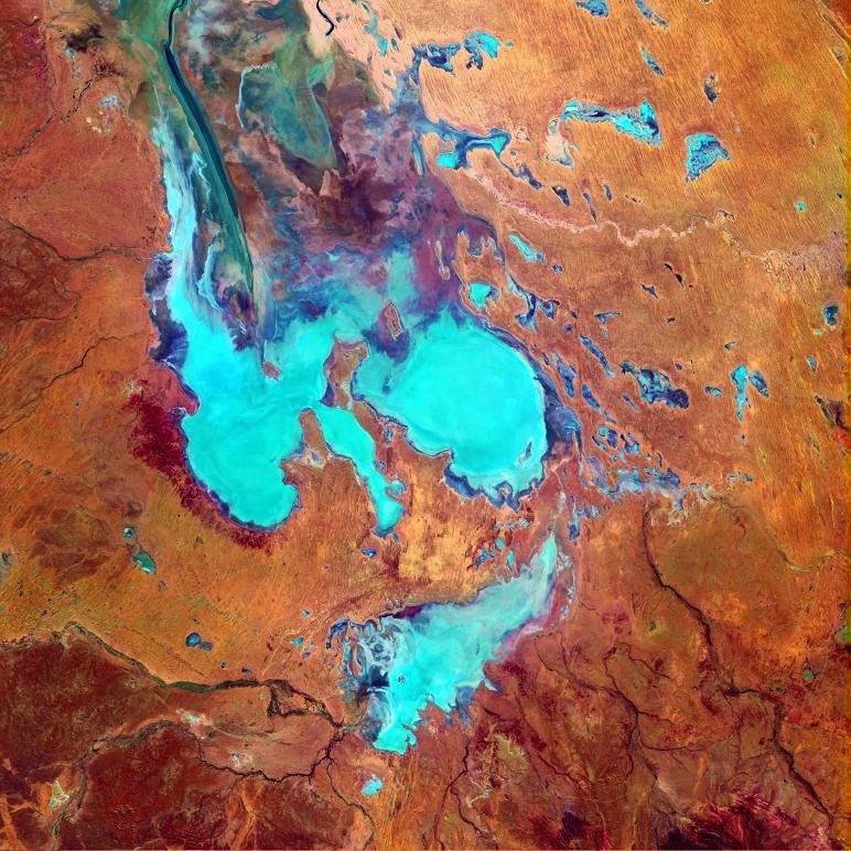

Lake Eyre in South Australia is the terminal point for drainage in the Lake Eyre Basin, one of theworld’s largest internally draining systems. It sits 15 meters below sea level and is the largestsalt pan in the world. Spanning 9,300 square kilometers, the Lake Eyre salt pan fills with water a few times each century when the rivers of Queensland’s channel country in the northeast receive enough water to push through the dry maze of channels on the edge of the Simpson Desert.
This image was acquired byLandsat 7’s Enhanced Thematic Mapper plus (ETM+) sensor on July 29, 1999. This is a false-color composite image made using shortwaveinfrared, near-infrared, and blue wavelengths (ETM+ bands 7, 4, & 1).
References & Resources
Image provided by the Goddard Space Flight Center’s Landsat Team and the Australian ground receiving station teams.