Suggested Searches

1 min read

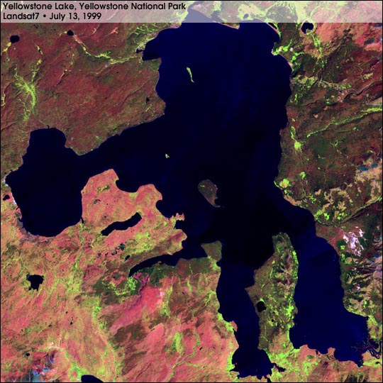
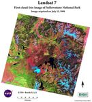
Landsat 7 – First Cloud-free Image of Yellowstone National Park

Instruments:
Topics:
 

This image of Yellowstone Lake, in the center of Yellowstone National Park, was taken by Landsat 7 on July 13, 1999. Bands 5 (1.65µm),4 (.825µm), and 2 (.565µm) were used for red, green, and blue, respectively. Water appears blue/black, snow light blue, mature forest red/green, young forest pink, and grass and fields appear light green.

Southwest of the lake is young forest that is growing in the wake of the widespread fires of 1988.

For more information, see:
Landsat 7 Fact Sheet

References & Resources

Image by Rich Irish, NASA GSFC
You may also be interested in:

Stay up-to-date with the latest content from NASA as we explore the universe and discover more about our home planet.

Examining Algal Blooms in Blue Mesa
5 min read

Using satellite data, researchers connected harmful algal blooms with warm water and low water levels at one of Colorado's largest…

Article
Painting the Growing Season in the Maize Triangle
3 min read

Radar data from an agricultural area in South Africa, shown in a vivid color palette, reveal crop types and how…

Article
Rising Waters Swamp Lake Naivasha
6 min read

Relentless rains are threatening a lake in Kenya's Great Rift Valley that has become a key hub in the global…

Article